
Highway 90 to Highway 90, 20.5 miles
I arrive in Lordsburg after midnight. The bus driver is aghast I walk alone – and without a gun. He wishes me godspeed but doesn’t offer to drop me at the motel.
The Econo Lodge is a hiker hangout, but I am way to early to partake of any hiker box leftovers, like tasty treats from someone who overpacked. All I want is to sleep and I knock out fast on my cozy King bed, not caring when I get up.
There’s a reasonable breakfast and I drink as much orange juice as I can keep down. Water is going to be a big problem on this stretch of trail, so I carry four liters and plan to walk 20 miles to a known water source – well, reasonably known. As of a week ago, there were 6 1/2 gallons left.
It’s all a compromise. I can’t risk running out in this parched, hot landscape but there haven’t been enough hikers out yet to get a report on cow tanks and cisterns.
So I pack those four liters, eight pounds of water, in addition to my first day food bag. I am very weighted down, heavy and slow, and you know what? There is no way I’m walking three miles of road.
A bit disoriented, I start walking the wrong way out of town. Good thing no one picked me up as I make an about face and plod down the sidewalk.
Angie, my friend I stayed with in Tucson, asked about hitching if it’s safe and had I ever encountered problems. I think it’s safe and I have never had any scary experiences.
That might bd because I hitch near trail where people are used to seeing hikers. Still, several pass me until about five minutes in, a couple with a pekingese stop for me.
The dog growls and yaps, protective of its mommy. We try to hold a conversation over the din, but it’s a short ride to a turnout on Highway 90.
I thank them and throw on my heavy pack only to take it off immediately and shove it under barbed wire, then shove myself under, and I’m off.
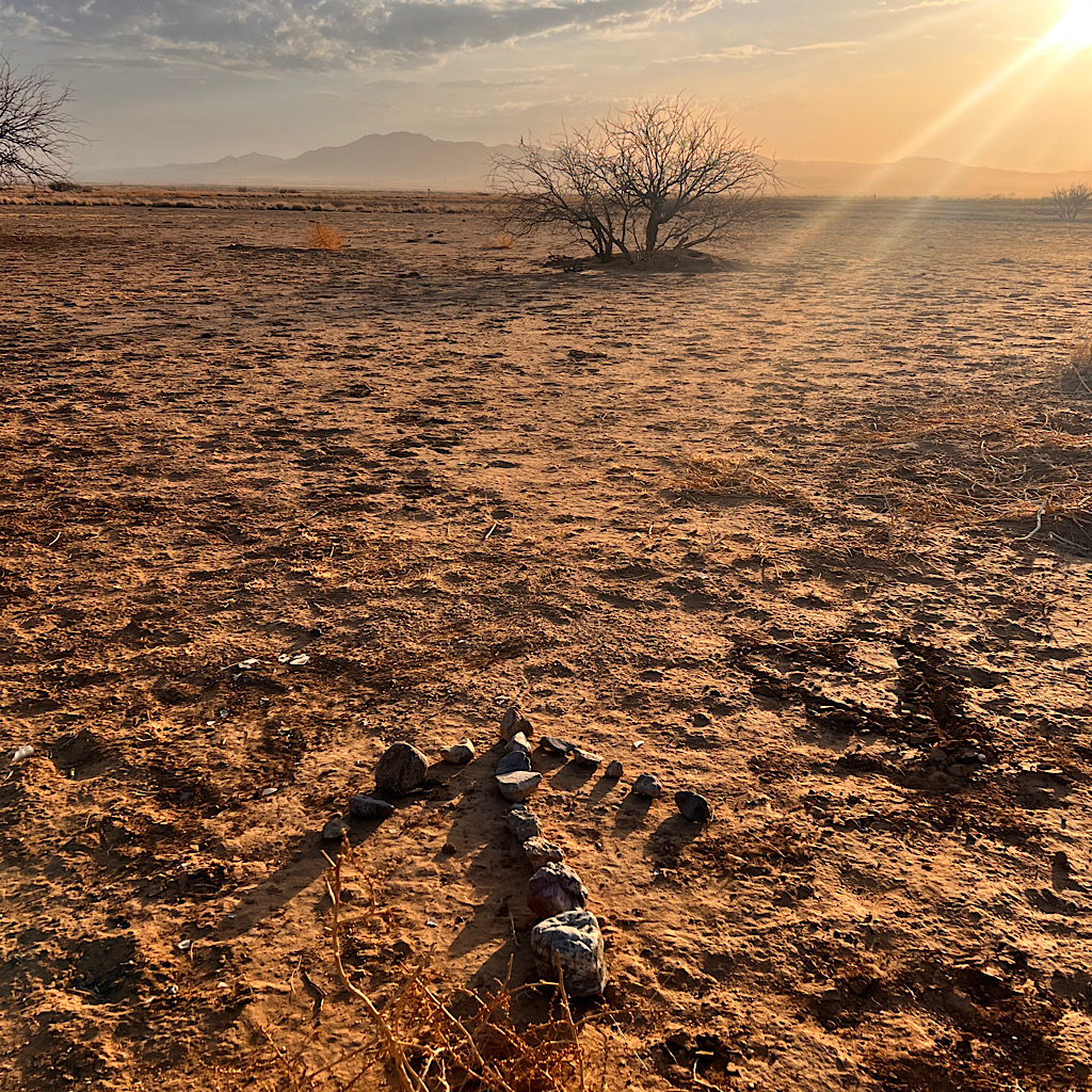
The morning is still relatively cool though the sun is up and I walk towards it on sand studded with cactus and brown grass. It will be a long walk on this terrain with absolutely no shade most of the morning.
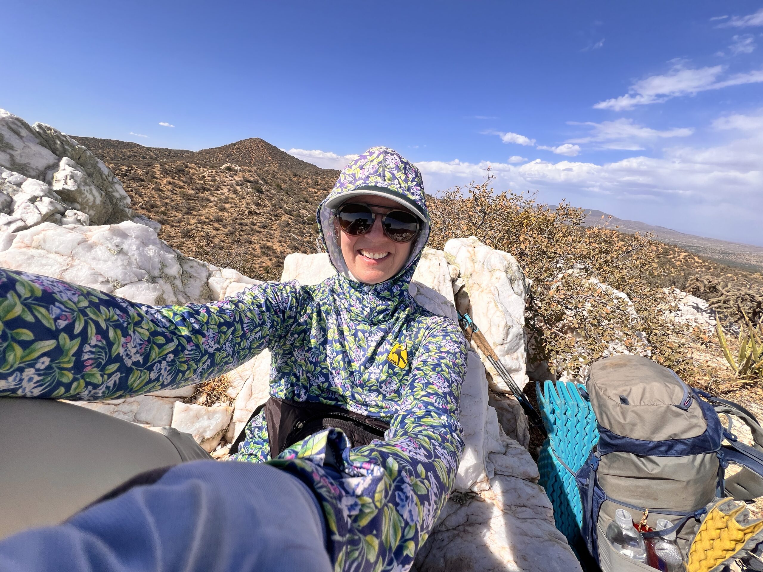
I am covered head to toe, long pants, long sleeved shirt with a hood plus gloves and a wide brimmed cap. I slather sunscreen on my nose and now I’m ready to face the sun.
The Big Burro Mountains rise up in the distance, but I don’t walk straight to them, rather I move parallel for over ten miles.
The ground appears to have been saturated recently and I see many different foot prints, though no clear trail. I just need to aim myself in the right direction and look far ahead for sporadically placed CDT signs.


I wouldn’t say it’s boring. Mostly it’s flat in a gigantic space, the sky open from horizon to horizon. A few black throated sparrows sing lovely songs, but mostly it’s quiet except for a light cooling breeze.
I forgot to mention that I saw another hiker at breakfast. He was polite, but must have assumed I am not a hiker. I’m way too clean and neat!
I thought for sure he’d overtake me, but I don’t see a soul out here, not all day as a matter of fact. This is a popular trail, but I am starting a bit early and there just are not the numbers like the PCT or AT.
But this is just fine, because I brought work. I’m memorizing the keynote I’ll give in early May to the Minnesota City and County Managers Association. It’s about cultivating resilience, and I share some stories from trail, science, exercises and inspiration. It’s a good talk!
But I feel best on stage when I know the talk inside out, and there’s no better place to practice then while walking.
Since no one is around, I play a section of the talk that I have recorded and say it back just a second or two later. It’s an actor’s trick and it works fast.
Soon, I ditch the recording and just say the speech as I move, adding today’s bit to the other bits I’ve already learned. It helps me tighten things up, add a few ideas and sound totally natural.
And I’ll be thinking of this expansive desert when I give the talk – and the resilience I need to keep moving forward in the heat and relentlessness.
I find a tiny patch of shade where a scrubby tree hangs over a wash. Here I drink up the first liter and rest my feet.
It’s really not hard hiking, though I begin to go in and out of dry washes, losing the trail and trying to locate the next CDT sign in all this expanse.
Finally, I turn towards the mountains and begin climbing into them. I’m out of breath weighted down, but I keep plodding forward, meeting larger trees, one mesquite growing right out of a wash and providing a shady spot for lunch.
Ten miles it is, so time to drink and eat. I have a variety of foods – apple chips I dehydrated from extra thin slices Richard cut, a vacuum-sealed bag of olives, cheese and almond butter plus a yummy replacement meal that uses up my entire liter.
I rest here a good long time, but still no hikers pass. Eventually, it’s time to press on and I climb more into the mountains, a rainstorm building in the distance. Rain is fine since it will fill up the water supply. But it looks far in the distance, the rain might not even be reaching the ground.
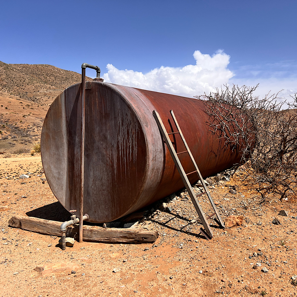
I pass dry tanks, cisterns and a few busted windmills along the way, there’s a farm tucked into a valley that the trail skips. One cow tank just off trail called Engineers is full to the brim. I skip it but make a note in the shared app for hikers behind me. I probably could have avoided such a massive water carry, but what’s done is done.
The trail loops around, following the contours of the land, though irritatingly losing a lot of altitude in the process. The view back to the dusty desert is incredible from here, that world below so far away now.
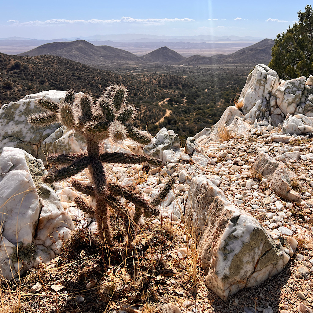
Up ahead, I see the pass that will take me over the mountains, though I still wind this way and that. There’s a small peak just next to the trail covered in exposed quartz as white as snow.
Around and around I go, until reaching a turnoff for the summit and taking myself to a quartz “throne.” The views are beautiful all around and I hang in my seat sipping the third liter, getting tired now but wanting to stick with my plan.
From here, I drop down sharply into jack pines and mesquite. I’m following a forest road, but cut off abruptly on a thin wisp of trail as if a balcony looking out to more mountains ahead.
There are so many camp-spots here, but I stick with my plan, the trail looping this way and that down into forest.
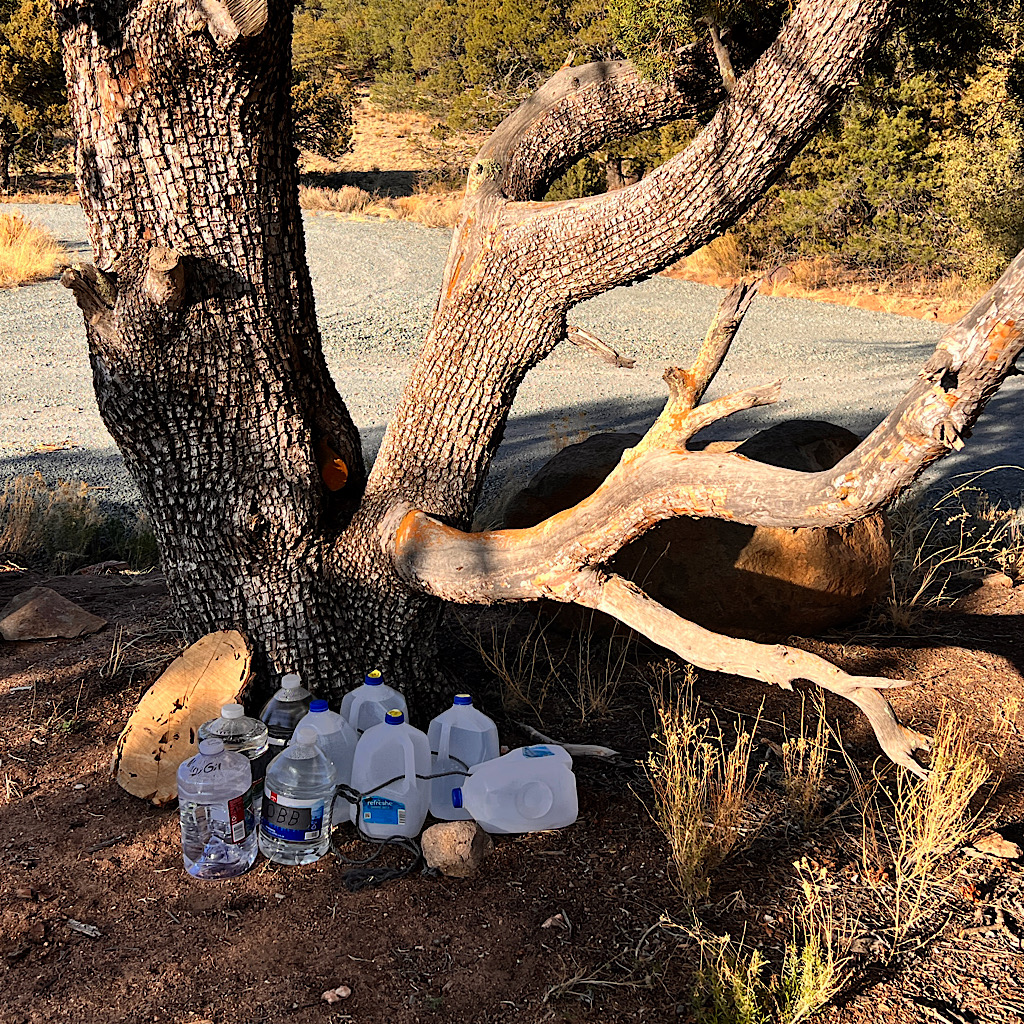
There’s a water source from a cow tank, “Gold Hill” and the aptly named “Cow Camp” tucked into trees, but I move on and eventually reach the cache, which after my share is down to just 2 1/2 gallons.
The trail angel who maintains this assures me he’ll come over the weekend to replenish it. Several hikers have stashed their own jugs of water too and I plan next time to do the same.
But for now it’s time to find a campsite. The trail heads straight up after crossing 90 and I break off onto a hillside where a find a nice flat spot to set. As much as I look forward to cowgirl camping, I am so tired, I set the alicoop so I can crawl in and crash out.
But not until after I make beans and rice with cheese and one packet of olive oil (yay, did not leak!)
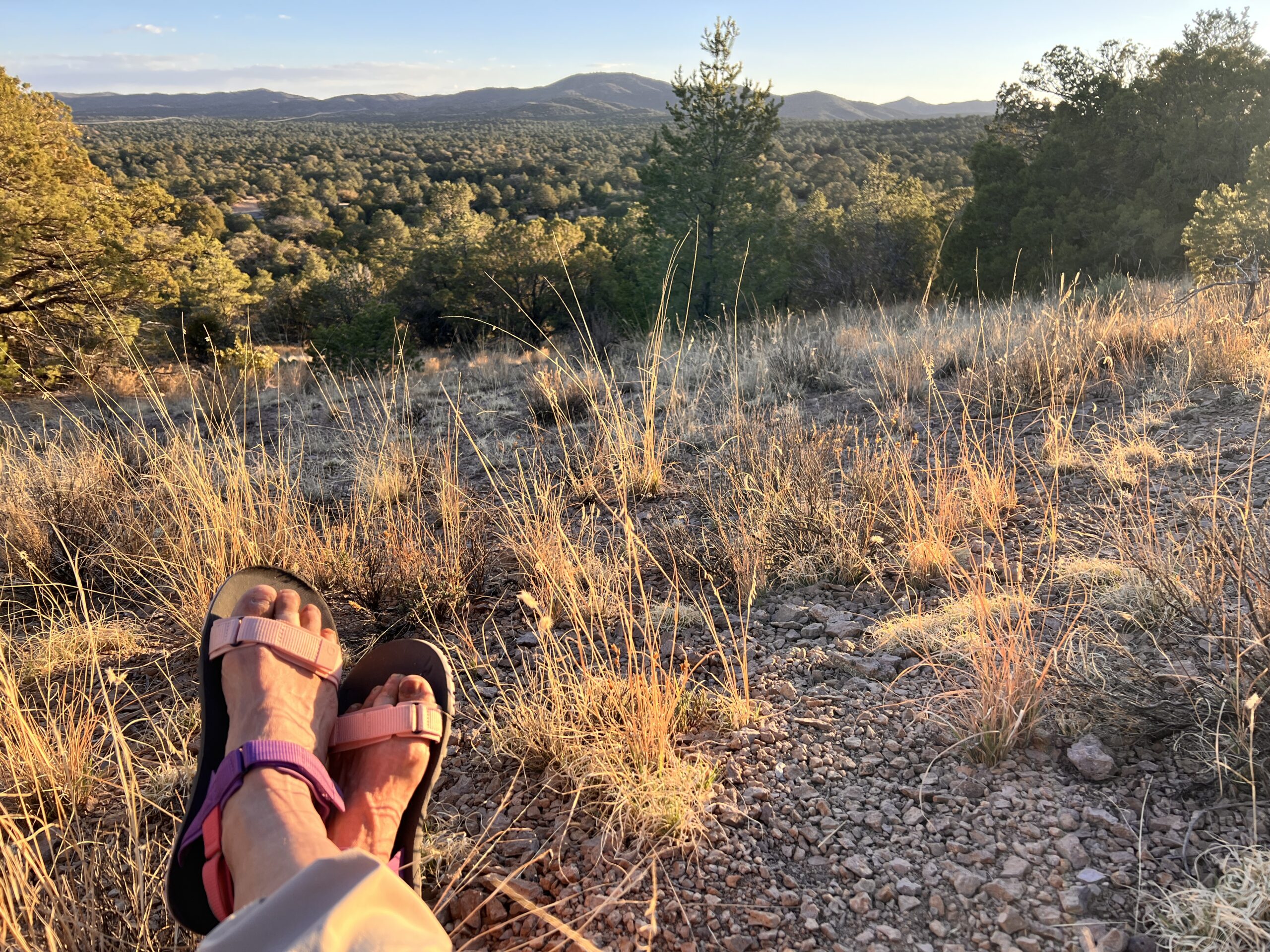
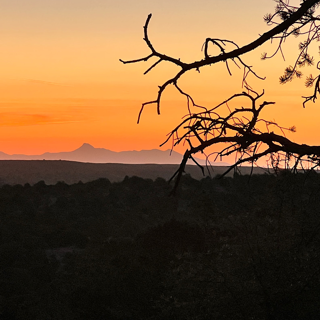
I find a little seat and cook looking out to the mountains I crossed as the sun turns the sky orange, then pink. I’m cuddled in now as coyotes rev up their evening song. I am so ready to rest, especially after such a fine day where my water calculations worked out, and my timing was just right for the sunset show.
Now, it’s a sky filled with stars.

4 Responses
Alison, you are such an inspiration, even for those of us who have trouble walking a mile with two walking sticks.
thank you Tom! I definitely feel all of you rooting for me while I am out there!
Great observations. Remind me of my summer in Acton, CA, in 1959 I remember the glorious sunsets and the desert flowers and animals, even scorpions and black- widow spiders. II loved that summer. Thanks for this.
That sounds like a wonderful time! It was very cold so I only saw a few gnats and one very pink caterpillar. Lots of birds and mammals too.