
I like being near the top of a mountain. One can’t get lost here.
Wislawa Szymborska
I broke two cardinal rules today: I didn’t check the map as I came around a difficult section of the trail and I followed two people I thought were going my way. Never do these things. Why? Because you get yourself good and lost.
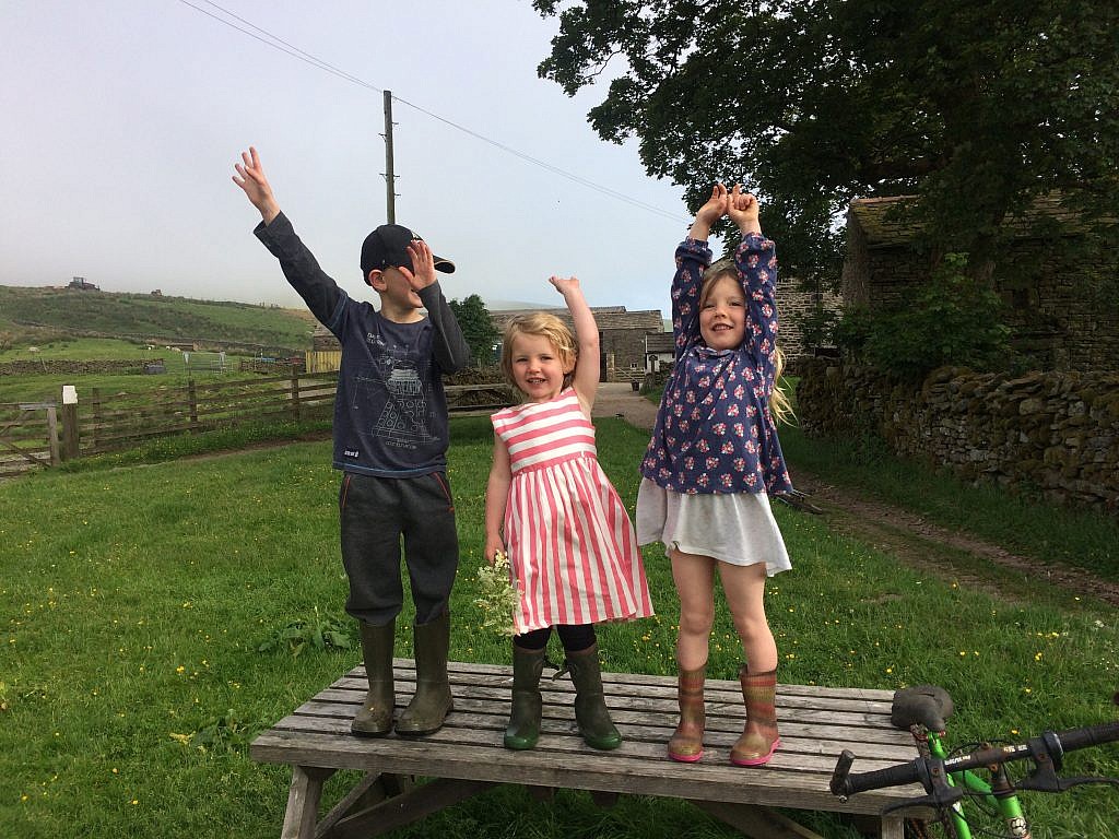
I’m in the lovely village of Reeth tonight. A reasonable pull of 14 miles or so, if I hadn’t made a long and arduous detour. The day started at Ravenseat Farm, right at the end of the trail coming off the moors. The farmer’s wife greeted me with scones and jam and had me set the alicoop right at the foot of the stone bridge, the bubbling beck singing me to sleep. When I awoke, it was all in mist and chilly, though the sun peaked out promising a good days walk.
Soon the children came out one by one to see who was camping in their yard. This is a big family of nine children spanning a few decades. First it was the second oldest riding over in a motorbike he was fixing up himself. He was dressed to kill in real biker duds, though likely his dad’s or older brothers as the pants were rolled up. He showed off a little, waiting for me to ask more about the bike.
Then the farmer himself sauntered to my the picnic table where I was organizing breakfast. He gave me the facts about sheep farming, then plunged right into politics. Brexit – bad; Trump – not so much.
Later the little ones came by. “What’s this for-uh?”asked the littlest one, Clemmy, about all my gear. “What’s this for-uh?” This is a compass. “What’s this for-uh?” My gps…”What’s this for-uh?” These are my trekking poles…The smallest of the brood has no guile whatsoever and I could have stayed the day playing and explaining.
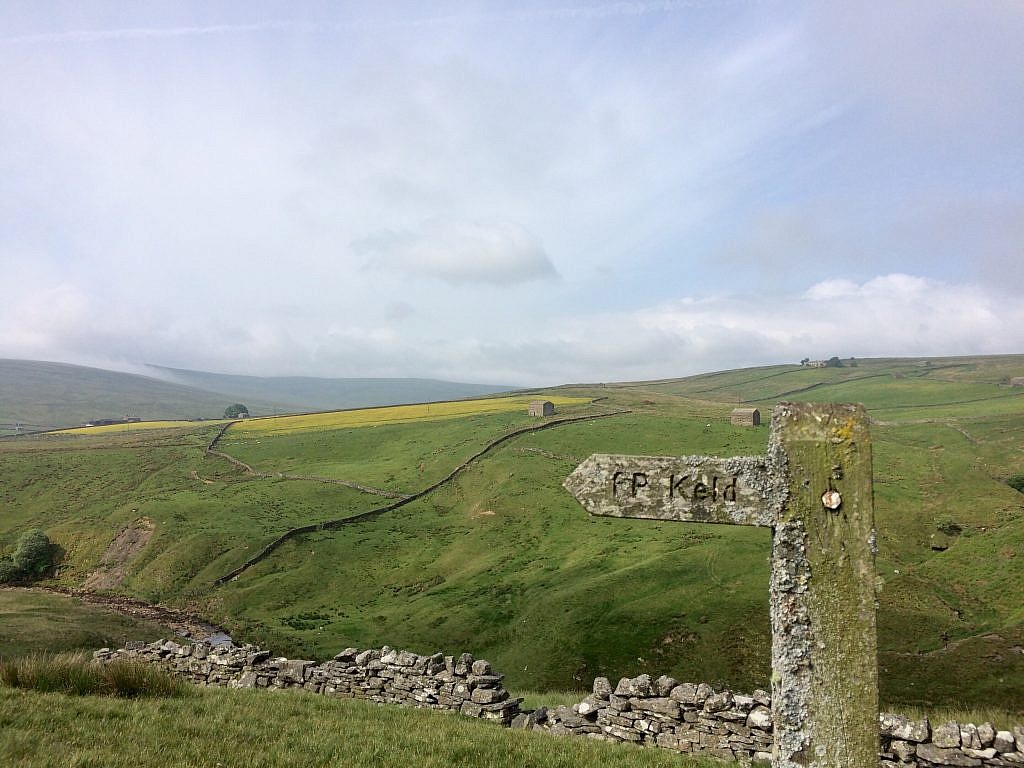
But it was time to push off, out on the moor high above gulleys rushing with water and “forces” or waterfalls. This area is called Swaledale and rolls along in gentle curves dotted with laithes or stone barns standing solitary in million-dollar views.
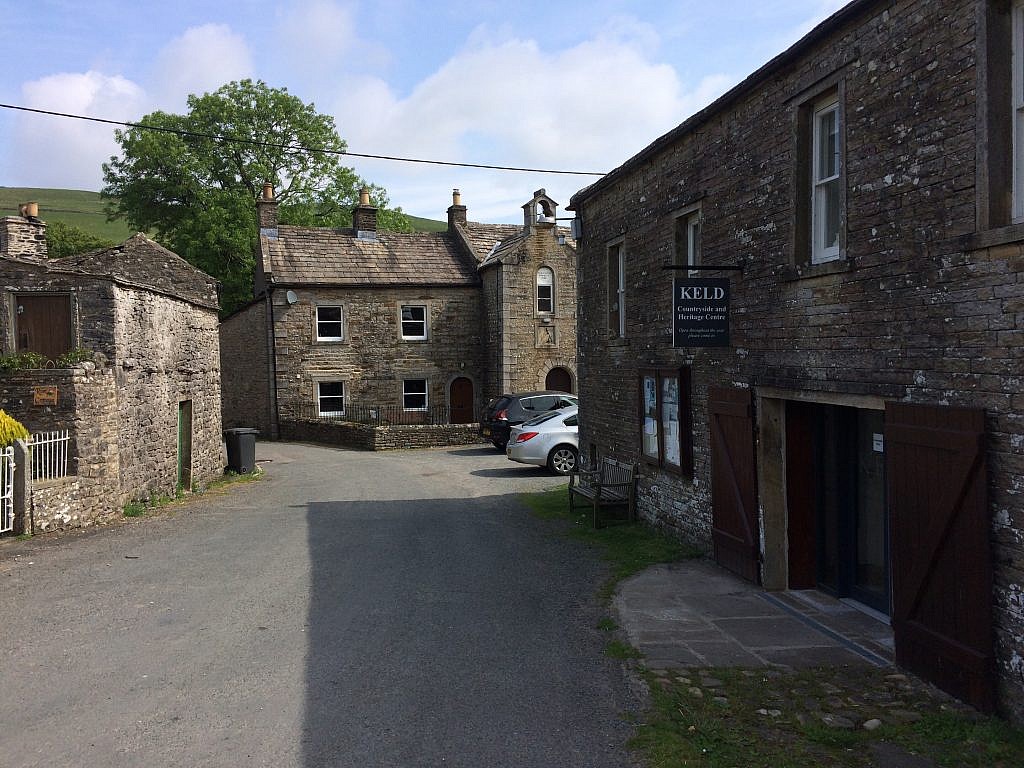
Soon, I approached Keld, more of a bend in the road than a village of stone houses. I picked up a bacon bap at the camping store, but was a bit put out by the notices filled with rules, regulations and a cost for everything including charging the phone.
Perhaps it was the funk I got into leaving a lovely green in Keld with massive signs saying no camping, so by the time I neared the high route leading to Reeth, I was distracted and enervated by the increasing heat and lost my way. The book warned that the trail was not easy to find, and of course, I landed myself directly on the wrong trail, only two boots wide and hanging right over the cliff above the river. But I found it an adventure and soldiered on towards Crackpot Hall, crackpot simply referring to the depth of the chasm, one only a crow could love.
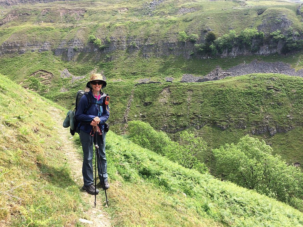
Two intrepid women marched ahead of me and I circled around the old lead mining ruins with them, snapping a few pix then following them up the other side of the chasm. A big mistake. From here, the trail came right back out, onto the edge of the moor, essentially in the opposite direction I needed to go. Once I realized my mistake, I discovered an easy exit straight down to the lower route to Reeth, where most hikers were slowly meandering along in bunches.
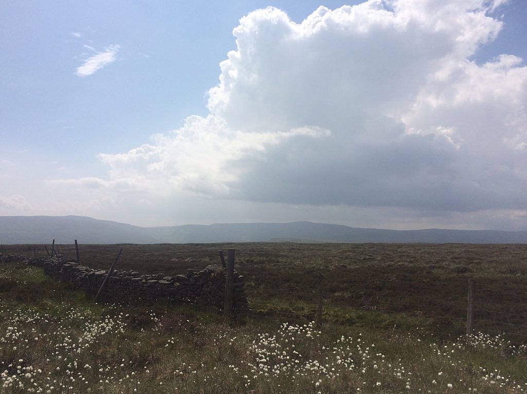
But that kind of walking was not for me. I was up for a challenge and thought I might simply take a beating and meet the main high route trail by making a kind of triangle. Theoretically, it’s doable. But it required crossing over two miles of open moor, much of it uphill.
And that’s what I did, ignoring all of my English lit classes warning of the dangers on the open moor, how one can get thoroughly lost, disoriented, or sucked into the mire. Luckily the mire was well in hand with so little rain. It was the heather that nearly did me in, sharp, scratchy, grabby, clumpy, tussocky heather for miles on end.
But once I got going, there was no stopping me and I plodded onwards and upwards, finally following a stone wall that eventually led to a stile. A stile meant only one thing: people walked here. And just as I felt completely idiotic adding many miles to what was supposed be a reasonably easy day, two other women hikers appeared. We shared the map and advice and I found a way down and down, backtracking to a bridal path and finally to the C2C.
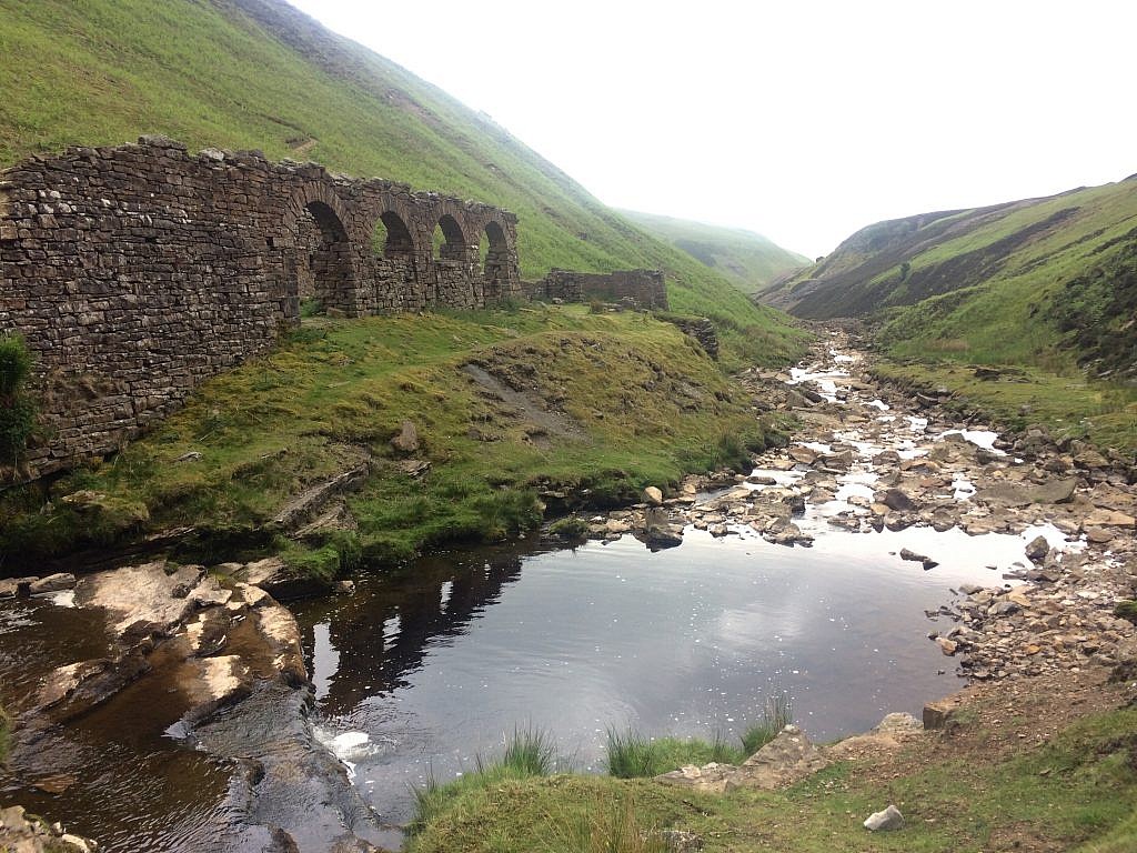
And this just as the thunder started rumbling. It was quite a sight at that junction, ruins from one of the smelters built during the Industrial Revolution, a lovely brook falling over mossy stones. But at this point I needed to go up to go down, right into the path of the storm.
In a previous post, I mentioned the English seem less panicky about thunderstorms which tend to be less catastrophic. None-the-less, loud booms echoing in the hills had me moving as fast as I could up onto Melbecks Moor as the rain began lashing down. The site at the top seemed fitting, an industrial wasteland of tailings and moved earth, a few ruins scattered about for dramatic effect.

The hike from here, had I not made such a costly error, was mostly boring. But I was knackered through and through, it seems an endless six miles or so. I missed yet another turn and ended up in a tiny group of houses on the road a mile from Reeth. A sign promised a walk through the fields, but came to nothing and I cursed as I made my way back to the road and walked all the way into this lovely town, wide open to the fells and wide open in embracing my tired self.
Now I must go and study up carefully for tomorrow’s hike which I hope will prove uneventful. Though to be honest looking back, what an adventure to have such a stunning view up the Swale Dale over Gunnerside and Mucker and to experience for myself the first – and hopefully only – time crashing straight through moorland, no trail, no path, just me an the compass. I’ve had my share of thunderstorms in the hills, but this time I really was out in it and far from comfortable. So I just put on the raincoat and kept moving. Not so bad an adventure after all, and certainly different from the masses.
Yay for this #blissfulhiker.
