Patricia Sampson
Self-reliance is the only road to true freedom, and being one’s own person is its ultimate reward.
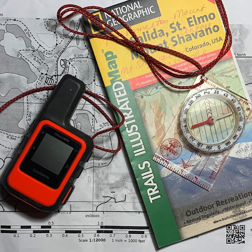
To navigate, head for the sun
With first aid and knife on the run
Bring fire and shelter
Extra food is a helper
But water and clothes weigh a ton
That’s the Mountaineers Ten Essentials limerick.
The ten essentials are navigation, headlamp, sun protection, first aid, knife and repair kit, the ability to make fire, shelter or a bivvy, extra food, a way to purify water and extra clothes.
Super important for day hikers who should always ask themselves the question if they could spend the night out here if something goes wrong like they get lost or hurt. Now a backpacker has all this stuff, but the thinking on navigation is to take five tools with us – including printed maps.
The Continental Divide Trail does have an official route, but, unlike most other long-distance trails, nearly every thru-hiker chooses alternates. Why? Because in some cases they’re more beautiful or more interesting or more challenging than the actual divide. The CDT Trail Coalition does make maps available – as does a very generous thru-hiker named Jonathan Ley, who marks the most used alternates – but there’s a couple that are not on maps, exactly.
And for those, I need to make my own. So I took a class.
I admit that on my last two thru-hikes I only had maps on my phone. Yes, it was risky because phones fail, they get crunched, lost, they die. I made it, but what bothered the most was a feeling like I was just following a line and not aware of the larger picture, or my options.
In the GPS Navigation class I learned a lot including navigational workflow, situational awareness and the ethic of self-reliance. Those are some big concepts and I’ll admit, I’m quite literally taking baby steps – and the class is for people like me who gotta start somewhere – and that’s with creating a map – a physical map with a route and waypoints customized to my needs – like, where I want to go, where I might want to stop and issues I may encounter along the way, like water sources or resupply options.
And that begins with learning to use software called Cal Topo. The story goes that founder and Wilderness EMT Matt Jacobs was sick of buying maps for every outing and 10 years ago, he set up mapping tools for search and rescue. He now has ten people on staff for this incredibly sophisticated tool.
With time running out before I head to Montana, I still thought cramming in all the material I’d need for class, including six hours of pre-work, reading and studying, practicing in the field and taking two quizzes (which I passed) – was worth the effort, even if by no means would I master navigation.
Read ‘Don’t shun (-tion) the “Ten Essentials”’
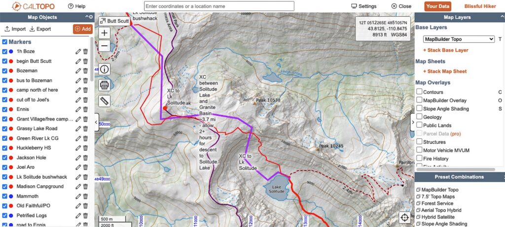
In addition to making a physical map, I’d also learn about the phone app Gaia GPS, which works in conjunction with the map software – you basically make your map, print it and then import to Gaia so you can follow it via GPS. But the key to success in the backcountry is to keep you nose out of your phone. And that’s because, well, you want to see the scenery, but also you are more aware of weather, how many hours left to daylight, if there’s a rattle snake in the middle of the trail. You want to NOT rely on these tools singularly, but rather as a whole.
And that’s when the magic occurs, when we combine the map making and gps with the lowly handheld compass. After our three-hour Zoom class, our next activity was in the field. I printed a map with a route and marked waypoints and went out and walked it. It’s at Lake Elmo again with clearly marked trails and a place very familiar to me using my compass to follow the bearing from the map I made now in my phone. One of the first things I learn, even after all those times walking here, I never has any idea which direction I was going. I also learn that heading towards something “as the crow flies’ is not always possible, and I can take intermediate bearings. The GPS gives me the distance, kind of like someone telling you, “walk fifty paces then turn right.”
And maybe the biggest miracle, is if I stay on my bearing, I don’t get lost.
Now back to why I took the course, to make that map for my big alternate on the CDT. It’s loosely called the Super Butte/Big Sky Cut Off – or the “Butte Scoot” – followed by Yellowstone and finally the Grand Teton Crest Trail. The good news is other people have walked it and have made their GPX data available online which I import directly onto my map. Still, I need to vary the route somewhat and create waypoints for water and possible camping. The greatest tool of all is a snap to OSM or open street map. No there aren’t streets in the wilderness, but there are trails and I can snap my route to them. It takes a bit of trying, but it saves so much time.
There are a couple of cross-country sections without trail, and here I can change the map layer from Map Builder to aerial or aerial topo hybrid, which allows me to see the terrain. I can see from the profile that there’s a 1,400 foot cliff over Lake Solitude, but there’s a section that looks doable and I know it’s doable because other people have done it. So I drop in waypoints to the easier part so I can navigate to when I get there.
I am no expert, but I am incredibly empowered. The ethic of self-reliance is founded on the principles of experience, preparation, skill and judgment. This is just one more arrow in my quiver that will help me when I move along the trail to make good decisions and be responsible for myself.
Listen to Blissful Hiker podcast, ep. 56 “CDT prep: maps ‘n food”
You want to get overwhelmed fast? Try making food for a thru-hike.
To be honest, the only recipe that’s mine is for my magic vegetarian pemmican bars. That’s a calorie bomb of cashews, almonds, pecans, walnuts, wheat germ, flax flour, figs, dates and honey. Fortunately, I have about four pounds in the freezer ready to be packed.
For all the other recipes, I am using Backcountry Foodie. It’s a member-based backpacking meal planning site created by a dietician backpacker. Ultralight recipes packed with nutrition and high in calories and most importantly, gridded into meal plans, so you don’t have to think too much. You just have to prepare.
I watched friends on the PCT manage all 2600-plus miles without carrying a stove and I was jealous. I don’t like cooking on trail, and it’s not necessary. Backcountry set me up with a “No-cook 7-day meal plan” and I got to work.
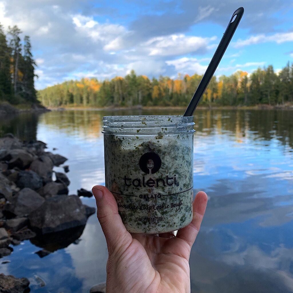
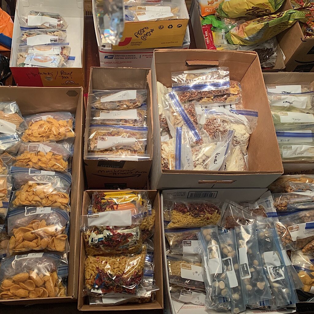
The most fun to make was pasta. Sure you could live off of ramen for 7 days in a row on repeat, but I wanted to try others. You have to cook the pasta first, then dehydrate it. This enables it to rehydrate in about 30 minutes for a pasta salad. It does seem a bit ridiculous to pull out the water just to put it back in. And oddly, the pasta looks exactly the same. But it’s not. What works really well is penne and elbow macaroni. Not so crazy about orzo and definitely unwieldy is angel hair, which glued itself to the dehydrator. Still, for no cook meals, pasta works great because you make salads. Sun dried tomato pesto, spicy peanut, buffalo salad. And just how do you make these tasty? The trick is using mayonnaise and peanut butter packets and lots and lots of shelf stable parmesan cheese as well as olive oil.
I was kinda tuned off to the mess of it, but oils pack a massive nutritional punch per ounce and I know my body is desperate for it on the trail. Does it go bad? I haven’t had any problems, but I’ll let my nose be the tester. You do have to pack it carefully in a leak-proof Nalgene bottle and its own baggie, but it’s worth it.
I made about ten or so of each main meal, packing the herbs and spices and pine nuts separately in their own tiny baggie. It’s just a glorified assembly line, but it still takes me the better part of two days.
Read “Backcountry Foodie review”
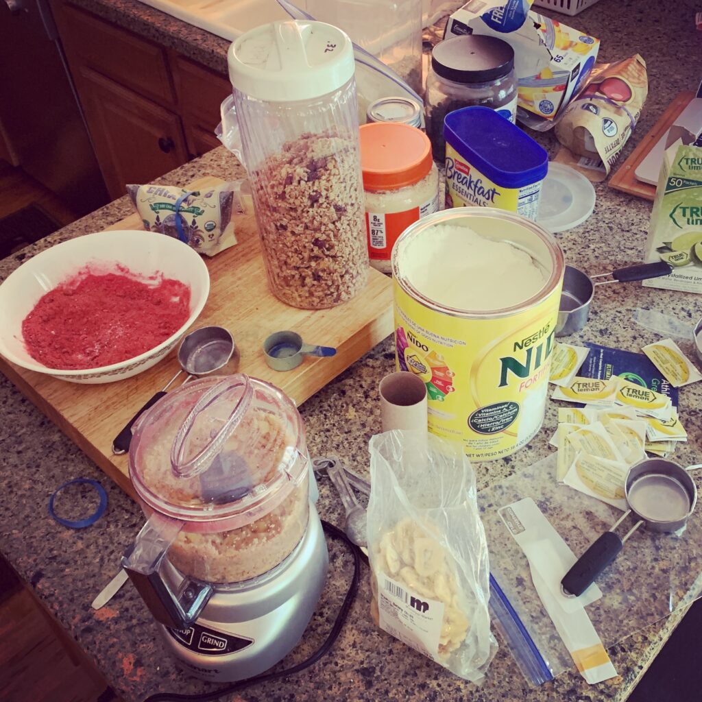
I have no idea why I was so opposed to cereal in the past on my thru-hikes. Maybe because it was always porridge over a stove, slowing down my morning. This time around, I make packages of granola and kashi with whole milk powder, berries dehydrated at home and nuts. I actually end up eating out the bag. I must look like a sorry little person, but wait until you hear about the dozens of shakes I created and also drink out of the bag – berry, chocolate, peanut butter – and a real cool trick of grinding up coconut and oats to a powder. I just might have the most flushed colon on trail!
For lunches, I have dips and spreads with chips and crackers. Have I gone completely off the deep end if I’m counting each cracker, measuring each pile of pita chips? Maybe the most complex of all my dips is a salsa. Lots of ingredients including a new discovery for me of True Lime powder, like one slice of squeezed lime juice and a miracle of flavor popping. In between meals are my magic bars, a truckload of Honey Stinger waffles sent to me by a follower, plantain chips, Pepperidge Farm goldfish and of course, gummy bears.
I am less a cooking show star and more a Swedish chef disaster of spoons, bowls, knives, cutting boards, food processor and baggie explosion – but I only had to go to the store twice for extra items.
Everything is assembled in quart-sized freezer bags and nestled into boxes ready to roll. Some I’ll send to my first resupply at mile 236 at Benchmark Wilderness Ranch. I need to send that this week so it gets there in time. Another box I’ll leave in east Glacier, and then there’s what I’ll pack in my new Ursack to take on day one.
And all the rest, my trail angel here in Saint Paul Richard will send as I move along, to Yellowstone, Atlantic City and Encampment, WY and Pie Town, NM – and maybe points in between. I’ve tried all the recipes and didn’t gag or die, but not cooking might pose its own issues. Let’s just hope Richard doesn’t have to send me an emergency resupply half way through Glacier with my stove.


9 Responses
Thank you so much, Lois! It is slightly crazy what I’m about to do, but I am feeling strong and ready – there’s really no time like the present! I hope some photos inspire your watercolor talent again. 💜alison
Hi Alison,
You always find ways to amaze me. This time 3 ways: no stove, your own maps and hiking the CDT with a titanium hip. Proceed with your usual confidence and gusto.
I love maps and food, so I found these two articles very interesting and informative! I bet you’re going to very happy without your stove. It’s just a matter of a few days of adjustment. And if by chance someone along the way offers you a hot cup of X, you’ll appreciate it more than ever! When you stop here, there will be MEAT and fresh PRODUCE . . . .and alcohol😁
for that offer alone, nothing’s impeding my journey to CO!! 🥳
Wondered what you might be up to and how you navigated the pandemic. It looks like you did just fine! As of about 3 years ago, I also have a new hip. I’m very interested to see how things go for you! Good luck, stay safe, don’t let the mountain goats bite!
Hi Dave! That’s awesome about your new titanium; how’s it working out for you? Thanks for the props. I feel strong and ready to roll. Sending my very first resupply box today!! (and just learned a trick which might seem obvious but took me forever to figure out – include goodies to eat right away in the box. That might be really important since it will be held at a remote ranch that could be deserted when I arrive except for a bear-proof hiker box!)