In the spring, at the end of the day, you should smell like dirt.
Margaret Atwood
This past weekend, I packed up my new pack, slung it over my shoulder and headed out on the Superior Hiking Trail for a twenty-something mile section to test my new titanium hips doing the real thing. It was absolute bliss.
I started by visiting my friend Karen in Grand Marais, a follower who I had only met online. She’s the one to thank for helping me get to Isle Royale, The Kekekabic and up Quandary Peak since each time I used one of her homes as a base and her feisty spirit as motivation. We had a grand time talking, running the dogs and finally bounding up to the cliffs at Section 13 where she saw me off for my southern walk.
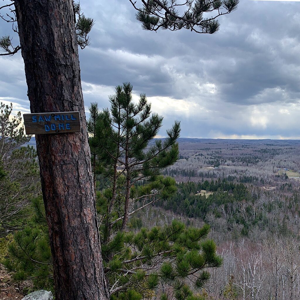
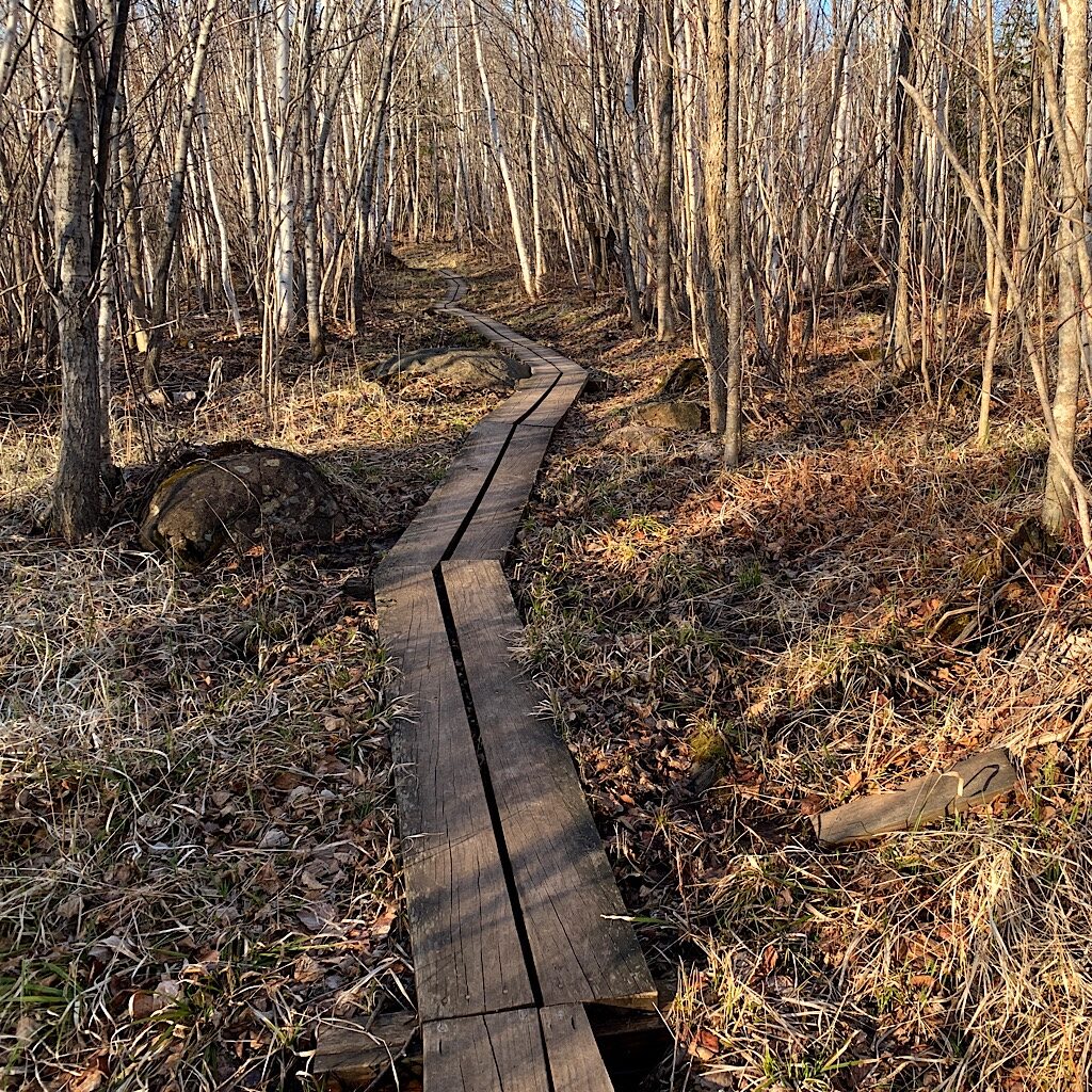
I had forgotten how steep the trail is on the Superior Hiking Trail, taking the hiker from one ridge to the next with exposed cliffs and balds and giving the out-of-breath climber spectacular panoramic vistas. At the top of Sawmill Dome, my perfect, sunny and warm day with a gusty, cooling breeze disappeared into a threatening thunderstorm over the Boundary Waters Wilderness and appeared headed my way. Happily, I was well-supplied with rain gear and a tent, though a few drops pattered on my cap.
The trail wends its way from Canada to Jay Cooke State Park just south of Duluth mostly through the Superior National Forest and one state park after another. The geology boasts some of the oldest rock on the earth’s surface. Granites of the Laurentian shield, basalts and rhyolites laid down 1.1 billion years ago plus 2 billion year old iron ore, fossil mounds and breccias formed after a cataclysmic meteor strike. For the hiker – and rock climber – it’s heavenly out here to push yourself up steep sides or use technical gear to climb vertical slabs. From my perspective, it was a chance to see if I could pull together both muscle and pulmonary strength in the kind of symbiosis I was used to in my long distance hiking.
As glorious as the views were deep into Northern Minnesota and across the vast expanse of the “Big Lake,” Lake Superior, I was astonished by the quiet yet expectant woods. Just at the edge of the so-called “boreal forest” the flora is made up of balsam fir, white spruce, paper birch, and mountain ash, though entire pockets are home to mountain maple, which turn a brilliant red in the fall and can be viewed in a sea of color from the ridges. In early May, the forest floor is covered with their leaves, completely bleached to an almost iridescent egg-shell white, as if the forest glowed.
Peepers take over the tiny ponds, loud and insistent while black capped chickadees flute, and red bellied woodpeckers pound into still standing dead logs, their tops and branches gone. Mostly the walk is quiet and totally alone, not a soul sharing this gorgeous section. Maybe it’s too long or too far from the closest town or state park. I love having it all to myself.
A seasonal spring crosses the trail, so I stop to filter water and have some food. My new pack is built with a sit pad, so it has to be removed from the back strapping to use. I don’t like faffing with gear, so I stand up to clean water and eat. I hope that won’t become a hassle on the CDT. Later, I come to Kennedy Creek with a bridge to cross, but I have plenty of water for the night and it’s time to look for a place to sleep. There is a campsite deep in the woods, but I’m alone and don’t plan to make a fire, so stealth camping is just fine.
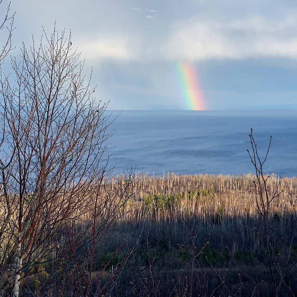
High above again on the cliff, I see deep Wolf Lake below, steep sides of rock rising sharply above. I browse around here, but nothing is flat and there are too many branches and bushes. Sure, in a pinch I’d be fine, but I still have time until dark. The trail continues up, heading straight out towards the lake and suddenly I see a rainbow, bright and colorful. As if leading me on, I come out on the high ridge to get the best picture.
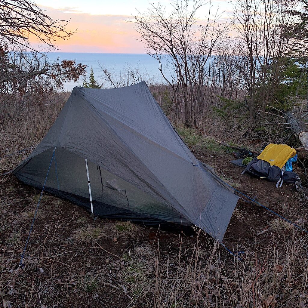
And that best picture spot is right at a flat area above the trail. I pop into a wee spot where I set up the new tent, needing to find a few stones to hold down the stakes on this rocky soil. Bed is set, gear is out and now food. I find a little log to sit on to begin dinner, a cold soak of marinated chickpeas which has become one of my favorites – savory, filling and easy to make. The sun goes down fast and with the evening comes a chill. I crawl in and open the entire front of the tent so I can look out.
All night the wind howls, shaking the tent but never knocking it down. OK, gold star right there. I snuggle deeper into the bag as a magenta moon emerges over the horizon, producing a pathway of light all the way to my shore. I leave the bug next off to see it better and one mosquito finds me. Where did you come from?!?
I’m up just as the sun rises and a man walks by. Later, he walks back and apologizes if he woke me, telling me he was just out for the sunrise. I am not too far from the highway to Ely, though I never hear it and as I pass a side trail to an overlook, I wonder why this man passed the overlook and instead opted for my spot. The day warms up and I look around for a suitable place to dig a cat hole. Up and down and steep and bushy, nothing appears for some time.
By the time I really need to answer nature’s call, I scramble to pull my pants down – a cute pair of zip-offs made by PrAna that I found for five bucks at Goodwill. And right there at my waist is an itsy bitsy tick. He’s crawling and hasn’t latched on, but where the heck did he come from?!? I pick him off and proceed to check the rest of my mostly naked flesh pretty sure he’s a harmless wood tick, then head on down – and up – and down again, a roller coaster to Tettegouche State Park and its massive waterfalls.
It’s a long day of walking, more up to spectacular balds like Mount Trudy the very first place I hiked to on the SHT when I first relocated here 13 years ago. That day I forgot my tent poles and ended up swaddled in my tent to stay dry. When a group of deer browsed too close, I heard them sneezing wildly unable to figure out who or what was in front of them on the cliff’s edge.
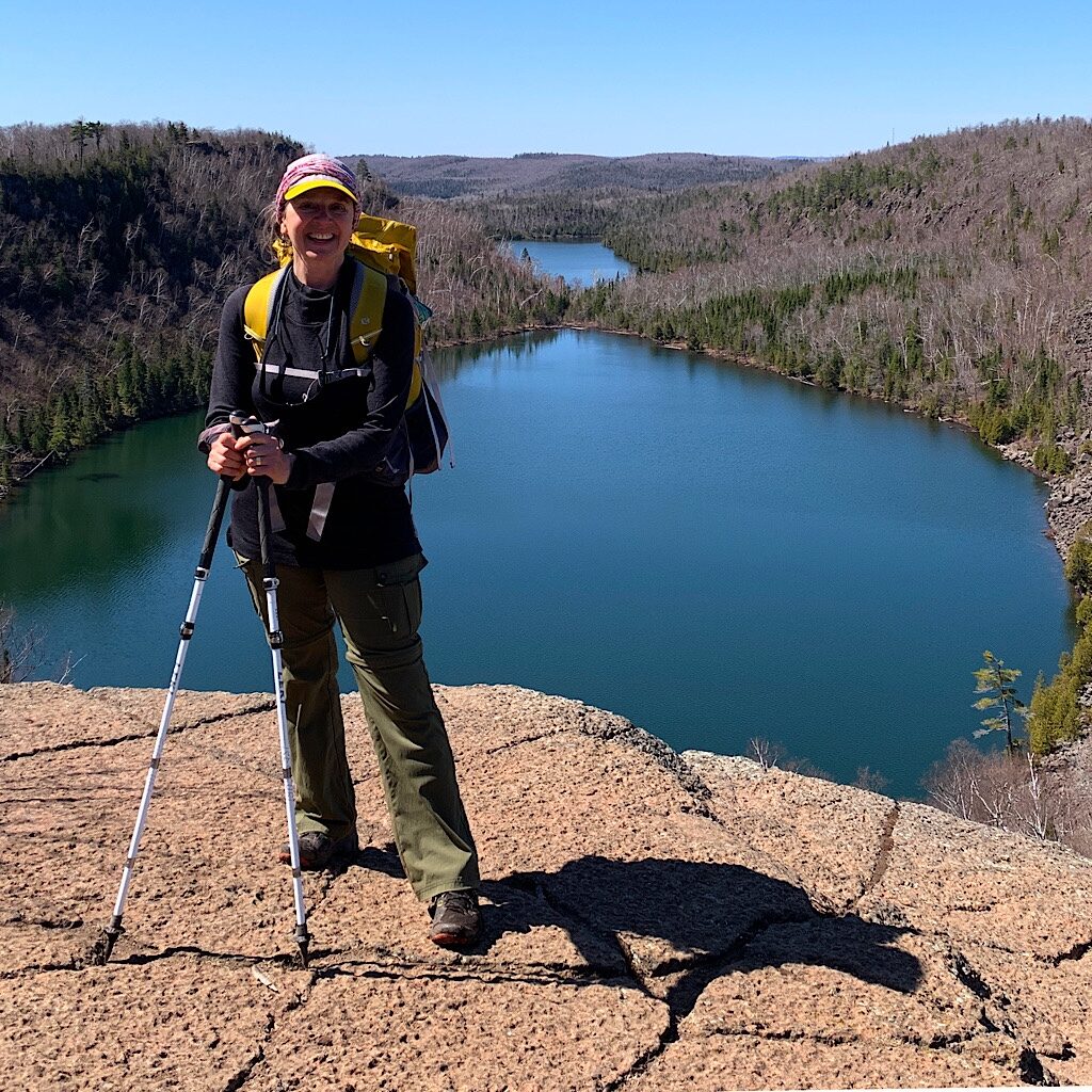
Wetlands, beaver houses and lakes appear below before I cut out onto a slab of granite above Bear and Bean Lakes. I see the first person of my trip here seemingly waiting to take my picture,. I tell her about camping below, once in deep snow where I had the place to myself except for a lone wolf, who’s tracks I see inside my snow shoe tracks; the other, after I buried Sasha, my beloved cat, when the sky lit up with wild lightning as I said goodbye to my furry friend.
Beyond I cross swollen and rushing Beaver Creek, one of thousands of waterfalls and rapids that empty the 10,000 lakes of the glacially formed Boundary Waters above. I see way more people now with massive backpacks all hoping to get the perfect site at the lakes or near the rapids. But I head on, more up and down, more spectacular views, and more deep forest along beautifully built boardwalks over wetlands until I meet another friend, Courtney, at Split Rock State Park. She immediately hands me a beer.
I’m tired but my body didn’t betray me, carrying me up and down on this perfect spring weekend. Am I ready for a long distance thru-hike? I think so. After all, thru-hiking is really just a whole lot of section hiking strung together. I learn that I need to go slow – at least for starters – and make sure I get plenty to drink, which became obvious after I slammed down two beers all at once. My pack is pretty small and most backpackers I met had no idea I slept out at all, but keeping it small helps me. Massage and stretching also help, loosening the muscles, though that tingly neuropathy in my left left still nags. Maybe it’ll be gone by the end of the CDT.
Maybe there will be me at the end of the CDT, having walked from Canada to Mexico.
Let’s hope!


4 Responses
I very much enjoyed and appreciate your blog post. Beautifully written descriptions! The photo of the rainbow over Lake Superior is a keeper! I was wondering if you had done the Lake Superior Trail and now I know. The Lake holds a special place for me, having grown up in Washburn, WI on Chequamegon Bay, living in Duluth for over ten years, and now Minneapolis.
Glad the “shake down cruise” with the new hips went well. I’m still listening to the New Zealand podcasts and enjoying the journey.
Thanks so much, John! Isn’t that an amazing rainbow – or rain “bar?!” That was such an exquisite night on alone on the ridge with big wind. Only a few drops of rain and one itsy-bitsy tick I pulled off before he dug in.
Thanks for following along. It’s going to be something podcasting while on trail. ~alison
Good luck, Alison.