
Day One, Gorham to Imp Shelter via Carter-Moriah Trail, 7 miles
When I called a couple of shuttle drivers recommended to me to take me the five miles from the motel to the trailhead, I got all sorts of bids, the lowest $30.
Now I fully believe in supporting the local economy, but that’s edging towards extortion.
I had a really nice conversation with one guy via text and in the gaps, discovered another route straight to the top of the 4,000-footer Mount Moriah.
It shaves a few miles on the 3,300 feet of climb, but most important, the trail starts from town.
Wispy fog hangs on the mountains tinged in pink as I cross the road and try to hitch the mile+ to the beginning. A spunky young woman named Jordan stops telling me she runs a hiking company that gets kids out on trail.
She drops me at the Peabody River and I take the cool swing bridge across, up a residential street, then hit the trail – which, of course, goes straight up.


The first mile or so is steep, but it’s on lovely dirt, soft on the feet and such a contrast to what I’ve mostly walked for days on end. For a moment, I can look away from my feet!
I rise quickly and soon join granite slabs that look as if poured wax. They’re dry now and knobby, so it’s easy to just cling on like a bug and walk straight up them.
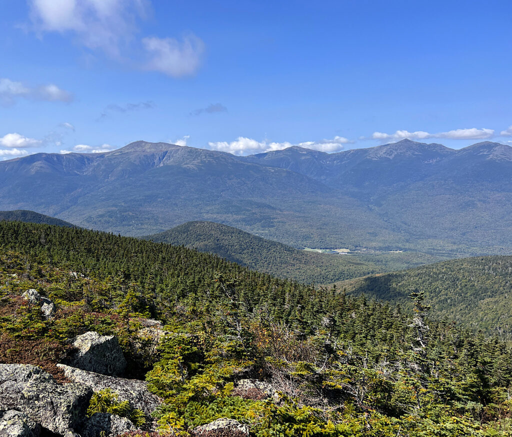
At Mount Surprise, a little over 2,000 feet, views open up to Gorham, the Androscoggin River and waves of mountains to the north where I walked, the oddly shaped ones like Saddleback in successive humps and maybe even the two pointed horns of the Bigelows.
Yes, it seems inconceivable my feet took me this far.
I squeal with delight as sun fills the valley and I can make out rows of trees on nearer mountains. But when I continue up, I enter a fog belt.
The Appalachian Trail may very well be the most work I’ve put into advancing my body forward with the least amount of reward.
Today did call for part sun and that’s accurate. No rain either, which I feel deeply grateful about.
Jordan was certain the trails were dry by now and I see she’s been spending far too much time in the office. As soon as I enter fog, I encounter streams pouring down my rock trail. It’s so fresh, I even collect some to filter.
A posse of golden-crowned kinglets sizzle at me in the dark forest. To me, all of this is monotony and so much the same, but without rain, these guys are delighted to be out.
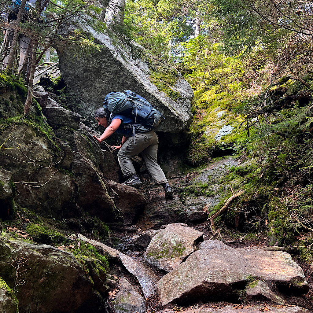
I pass an enormous boulder. An erratic moved by glacier? Or did it break away from a cliff. It appears like a painting by the surrealist Rene Magritte, incongruous all on its own.
I have made the decision today to go much slower and not as far. This trail is beating my body up and I’m tired. Now, without sunshine, my mood takes a beating.
I’ll target my days to the two shelters along the way, evenly spaced apart, and during what’s promised to be a set of sunny days.
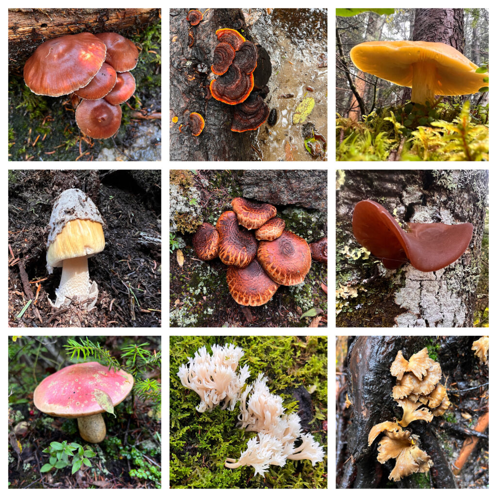
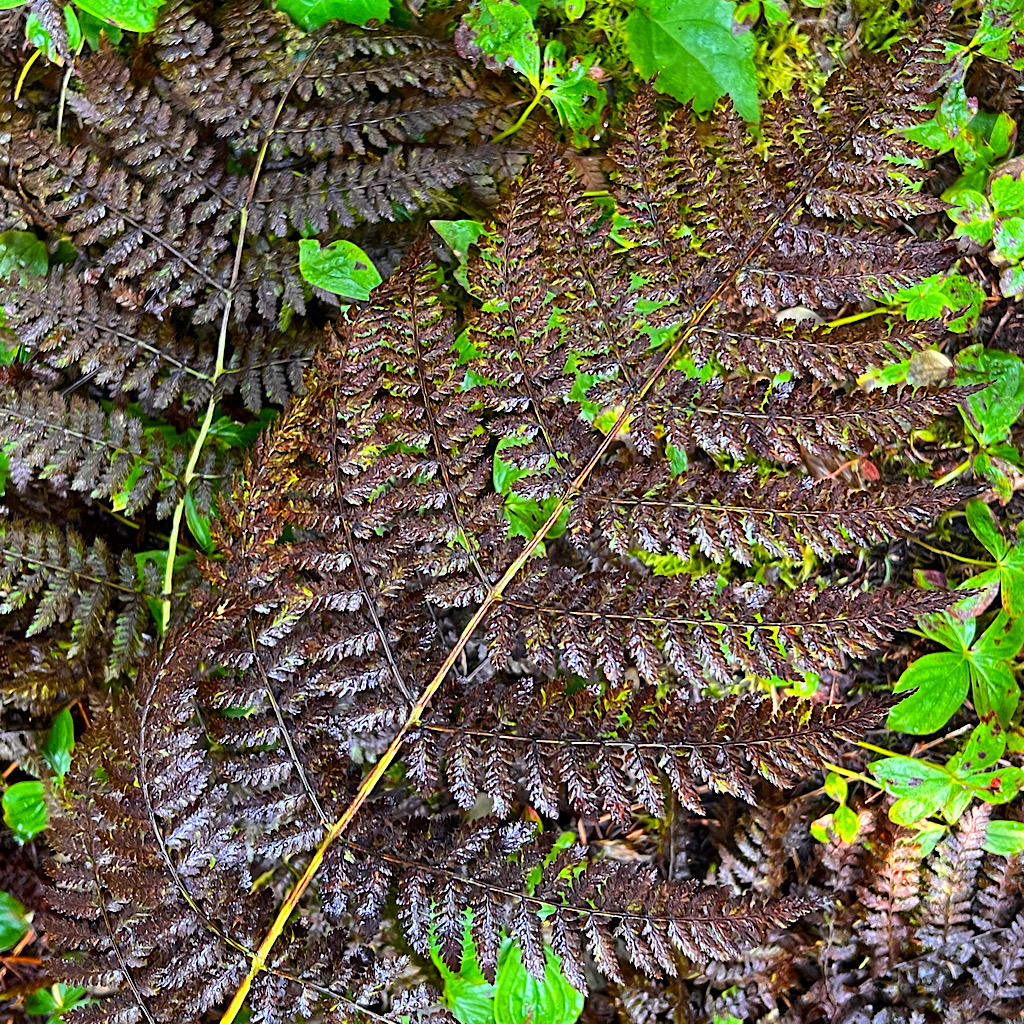
It’s good thinking as there is a relentless sameness to these forests, yet with more time, I can snap photos of my fungus friends along the way.
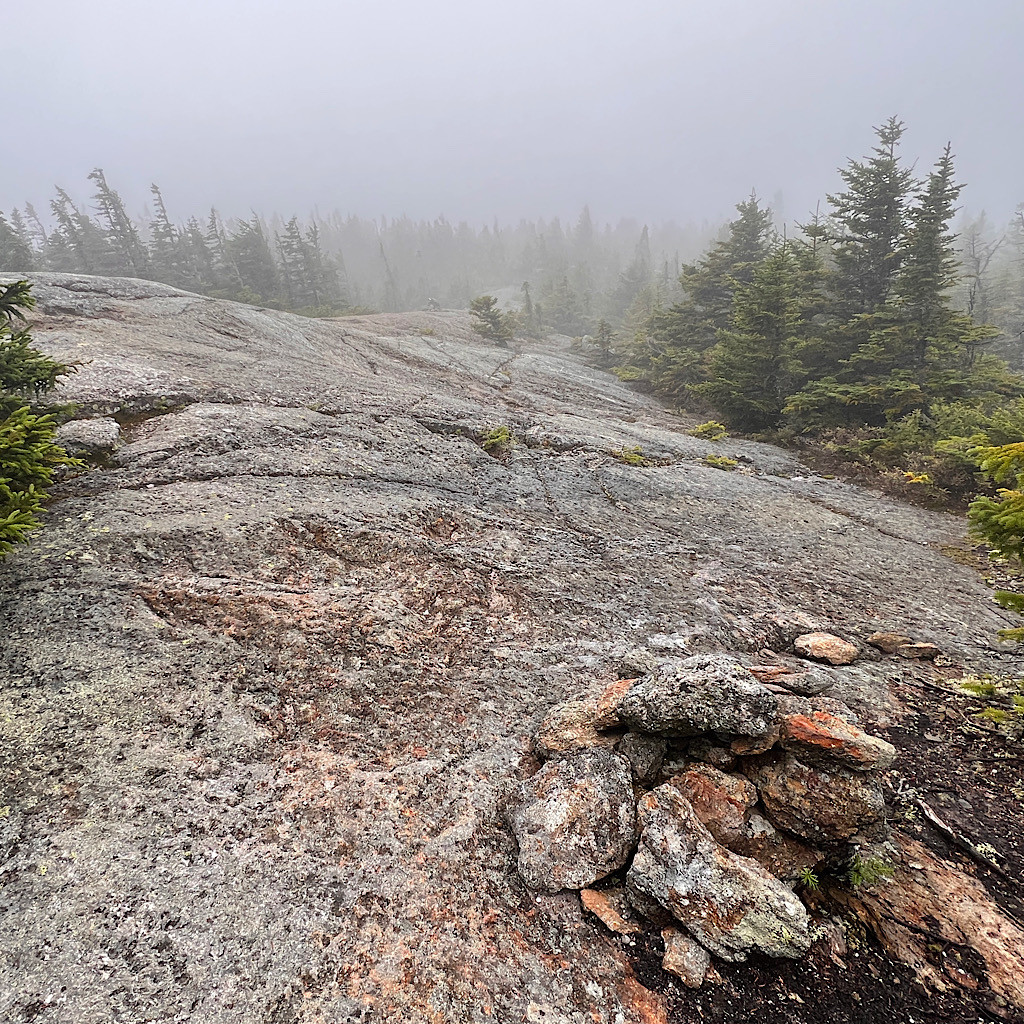
I surprise myself reaching Mt. Moriah. I climb up onto its dome for a view of fog.
Two days ago when Rock Hound and the German NOBO and I sheltered out of the relentless rain, the German told us he could care less about views. At this point, the trail was something to be broken down into miles and days and it didn’t matter where he ended up in fog or rain or brilliant sunshine.
I can feel that mentality gripping me as I pushed through Maine, an urgency to ‘get there’ and to keep moving forward.

Perhaps now that the air is chilling and my body is tired, I can pull back the stick and try to walk in the best weather only.
Still, it would have been nice to time today better. It’s a long range and surely tomorrow will improve.
As I come down and meet the AT, I run into another hiker and scare her when I say hi. Her name is SJ and she’s using an easier trail to get her to the ridge, then touching each side over a few days.
That seems far more logical then my thru-hike which will have me exiting on a long, steep, leg-busting, butt-sliding descent.
SJ is friendly and positive taking in the fog as just one step closer to sunshine. She warns me about puddle and bog boards coming up, then disappears up the rock slabs.
It’s slow going through deep wet, up to rocky knobs marked by piled rock cairns, then back into mud. I need to use my hands at times, but mostly all of this is familiar.
Chickadees swish at me and I call back, urging one to land close by on a branch to study me. Their constant commotion sounds like each has his own coach’s whistle and bleats its high frequency at odd intervals. All of this in a three-dimensional stereo.
Two more 4,000-footers, North and Middle Carter, loom straight up above me as I begin to rise steeply again, gratefully on more manageable lunchbox-sized rocks.
Another woman passes with a sour look and barely burping a hello. She’s moving fast and I wonder if she is attempting all of this in one go. It’s doable, but a bit of a death march, especially with no views.
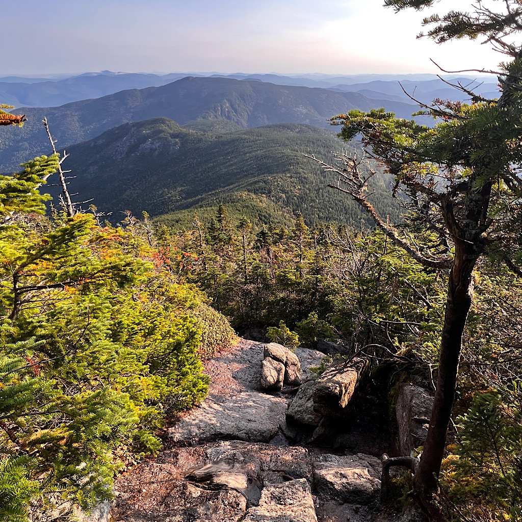
But wait, what is this? I must have dropped below the fog as I can now see mountains. It’s only a portion through a V in this wee notch, but I finally receive some reward.
It’s not long before I arrive at Imp Campsite. The large caretaker’s canvas tent is empty, as in the site. I had in mind to set my tent, the alicoop, on one of the cool wooden platforms, but it’s cold and windy and the double-decker shelter is brand new.
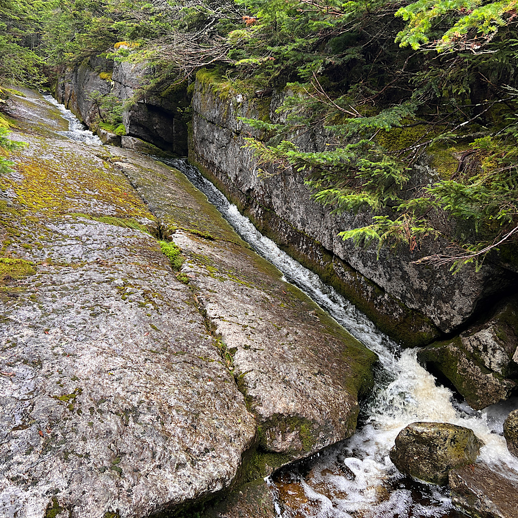
I take a corner of the second floor, then collect water at a falls funneled down a tight chute of rock. Two chairs are set for sunset views looking down to Gorham and Maine. A series of windmills spin at a col.
One man drops by telling me he hasn’t been up here in thirty years. He carries a pack and I imagine he’ll move on tonight. I cuddle in for a nap as the wind makes a hushing sound through trees.


Another kinglet chips as I sit up to read in this beautiful new shelter. I can see mountains beyond the trees, shimmying ever so slightly in the wind. It’s after 5 and I’m still alone.
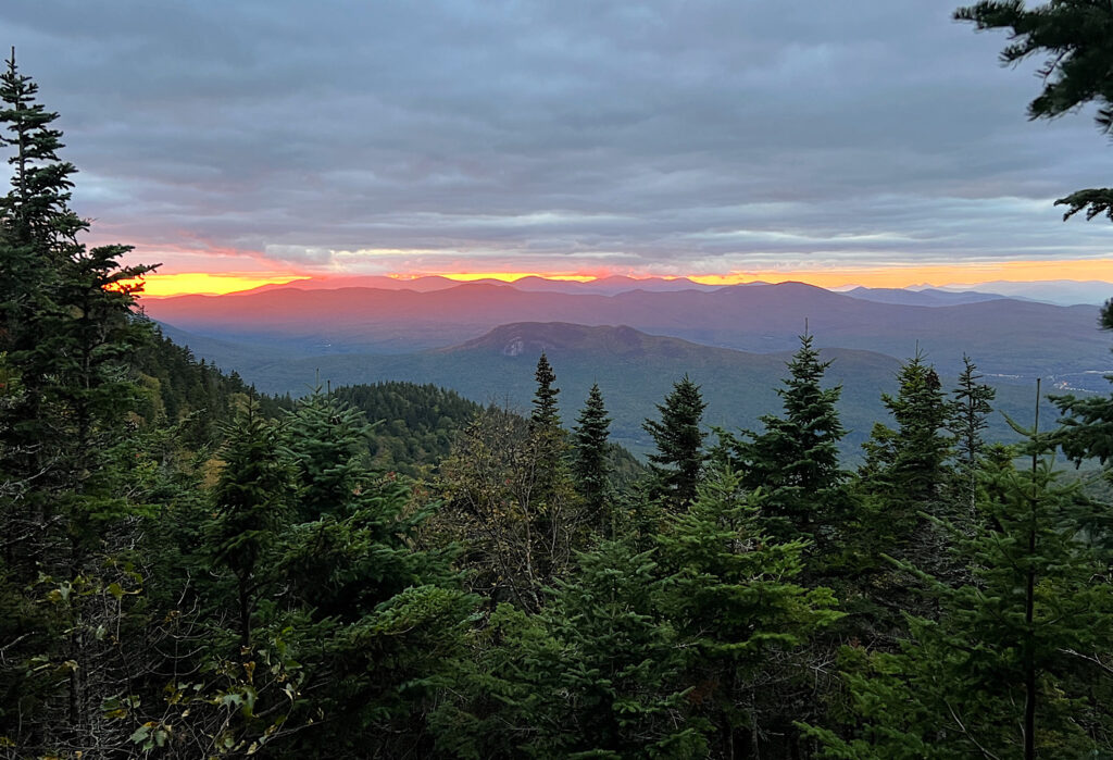
Soon, the sky turns a peach sherbet, delicately painting the blue and gray clouds just grazing the summits. I watch in awe for a solid hour as one cone of light reaches a distant forest, then shifts to a misty blue.
This is my gift at last for all the work to fogged in views. It requires stillness as the temperature drops but I’m patient and still surprisingly alone.
I never see the sun as it sets behind a mountain, but this far north, the sharp angle keeps a layer of pink seemingly forever.
As the show ends, four hikers show up. Ah well, it’s safer, I guess. I hope they’re polite. I’ll bid this beauty good night in hopes that a pink sky means full sun tomorrow.
And just like that, all the mountains turn pink in one last coda of gloriousness.

Day Two, Imp Shelter to Carter Notch Hut, 7 miles
I sleep well in the lovely shelter. It’s just me and the two women on the upper deck. I do tend to faff about during the night, so when I woke, I found I’d turned diagonally to the ledge. Thank goodness I didn’t roll off.
I’m the first out to use the privy. Still ‘mouldering’ but not as clean and effective as Maine privies.
Way back on that rainy night in the shelter on Mount Bemis, the men were complaining bitterly about shelters in The White Mountains.
Each has a caretaker and requests nominal payment for use. They felt this was unfair, robbery, not how campsites should be run.
Of course, they’re welcome to stay for free in the woods and I saw plenty of very flat ‘stealth’ spots, but this never seemed to be part of their calculation.
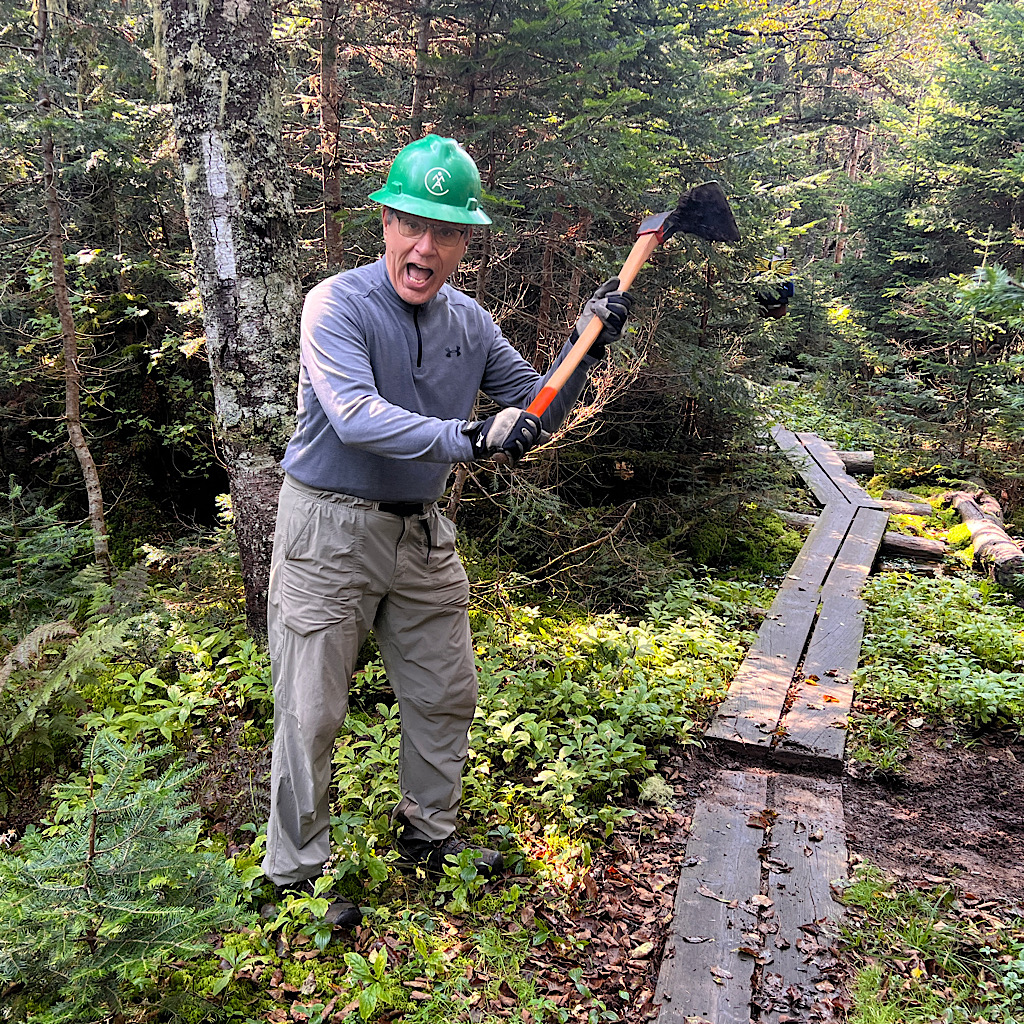
So I laugh when I do my business and see a comic strip address this precise issue. Stick figure caretaker explaining to stick figure angry hiker how their $10 helps keeps the place from becoming an overused, animal-habituated, used TP flowers nightmare.
Still, some jerk leaves his garbage in the bear box hoping to get $10 worth of service perhaps.


Finally, it’s a day which begins clear and in full sun. It’s cold and damp, but I’ll have views for all my work.
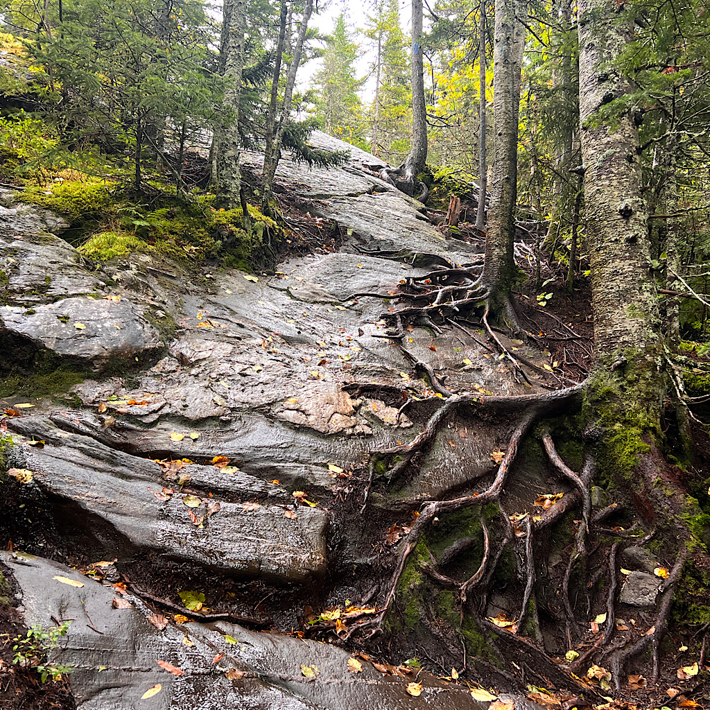
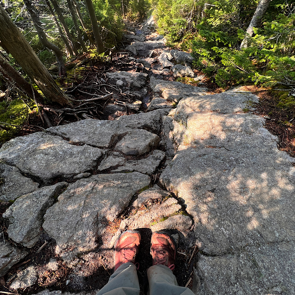
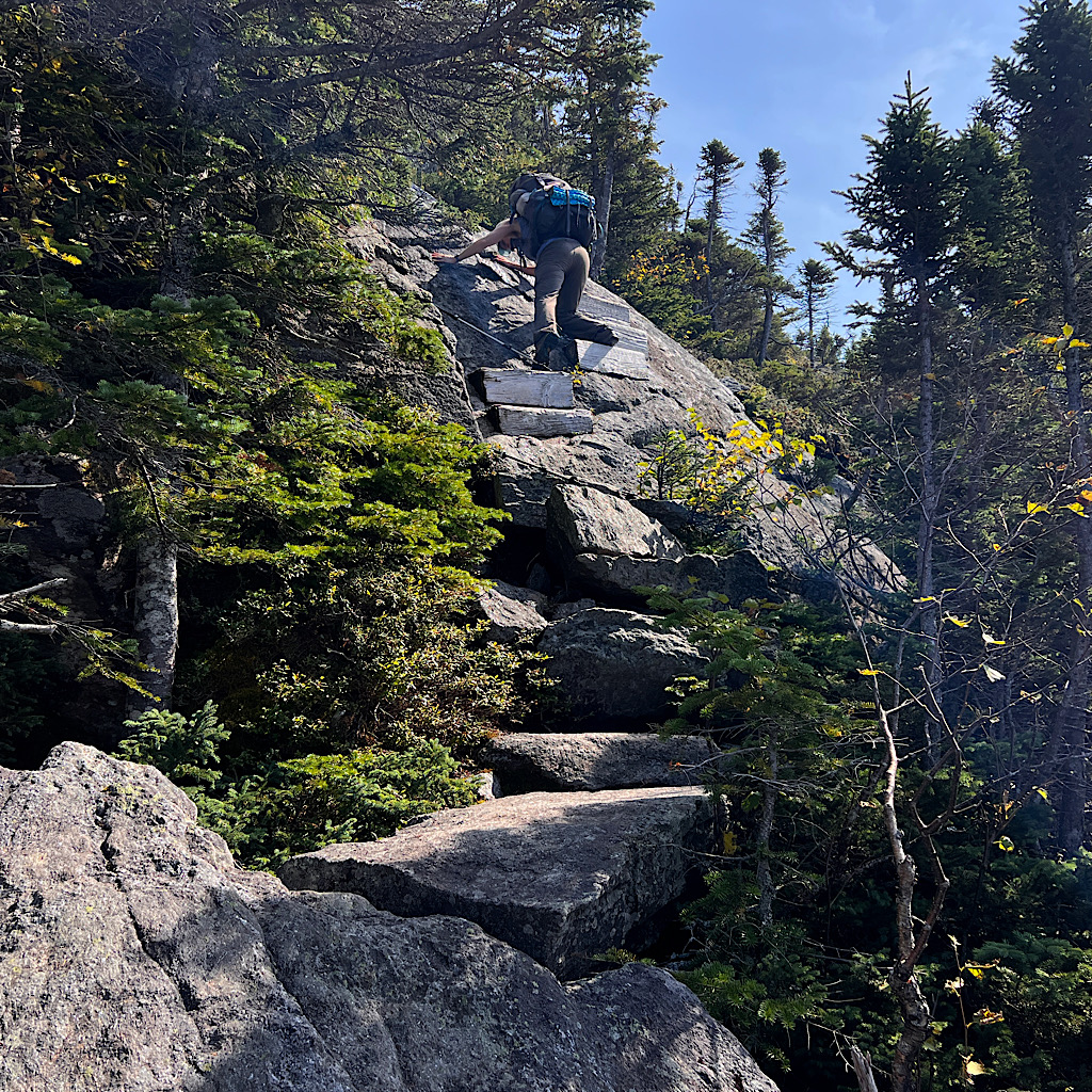
I enter the forest on stone stairs moving up steeply towards the series of Carter Mountains. A Bicknells thrush tweets a good morning as I push up from rock stairs to rock climbs.
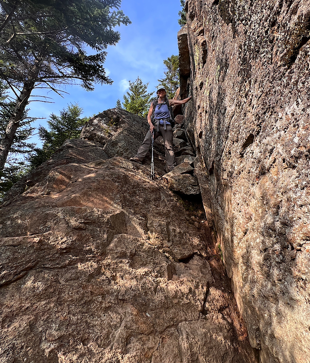
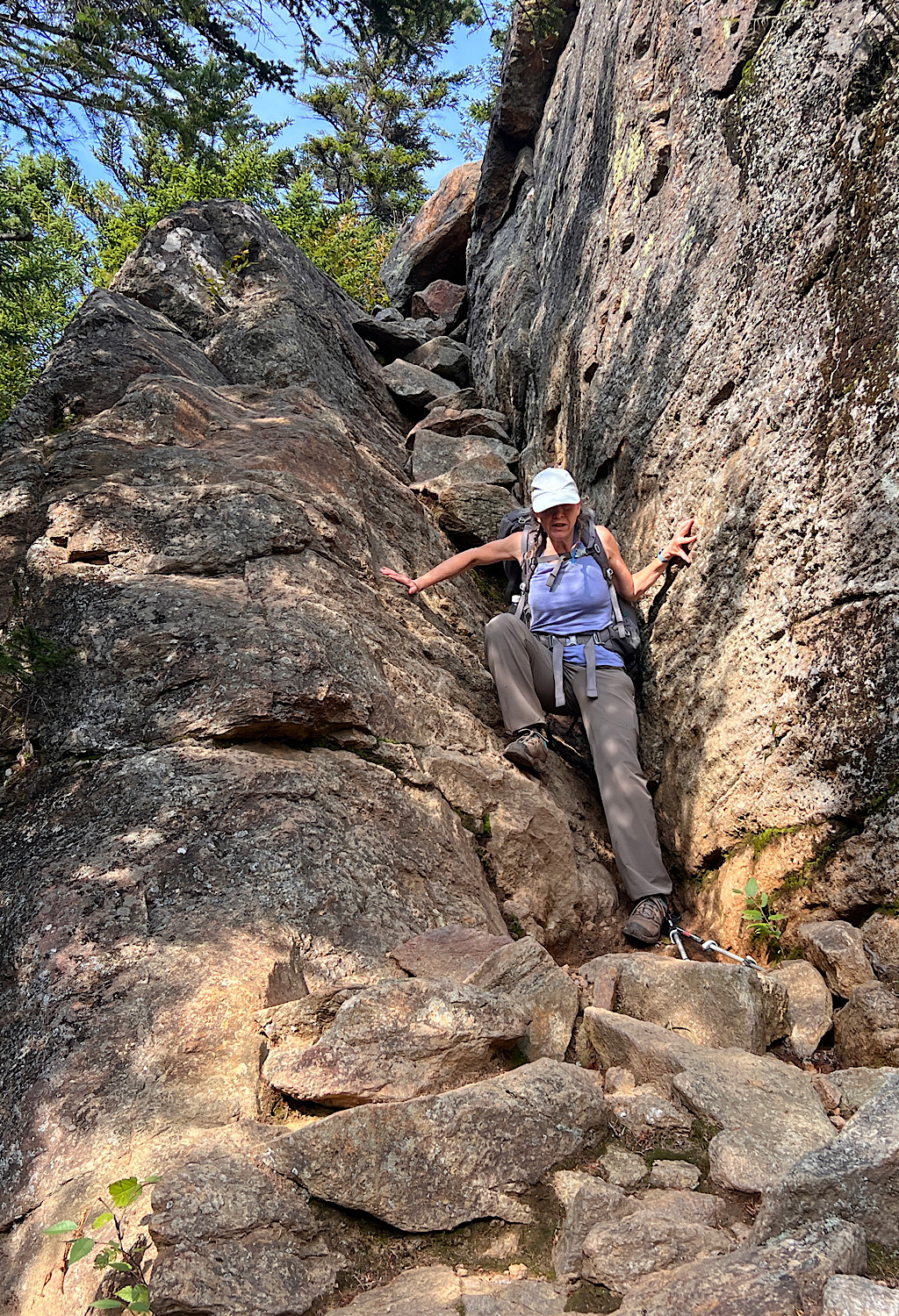
These are rock scrambles on steroids. I don’t mind trying to figure out my way, but when I meet exposed ledges with a fall chance, the stakes get higher.
At one point as I carefully cross, a limb grabs something on my pack and I feel a gentle shove off. Definitely the scariest mile of climbing yet, but it parks me on North Carter, a 4,000 footer, and a spectacular view back to Imp and Mount Moriah.
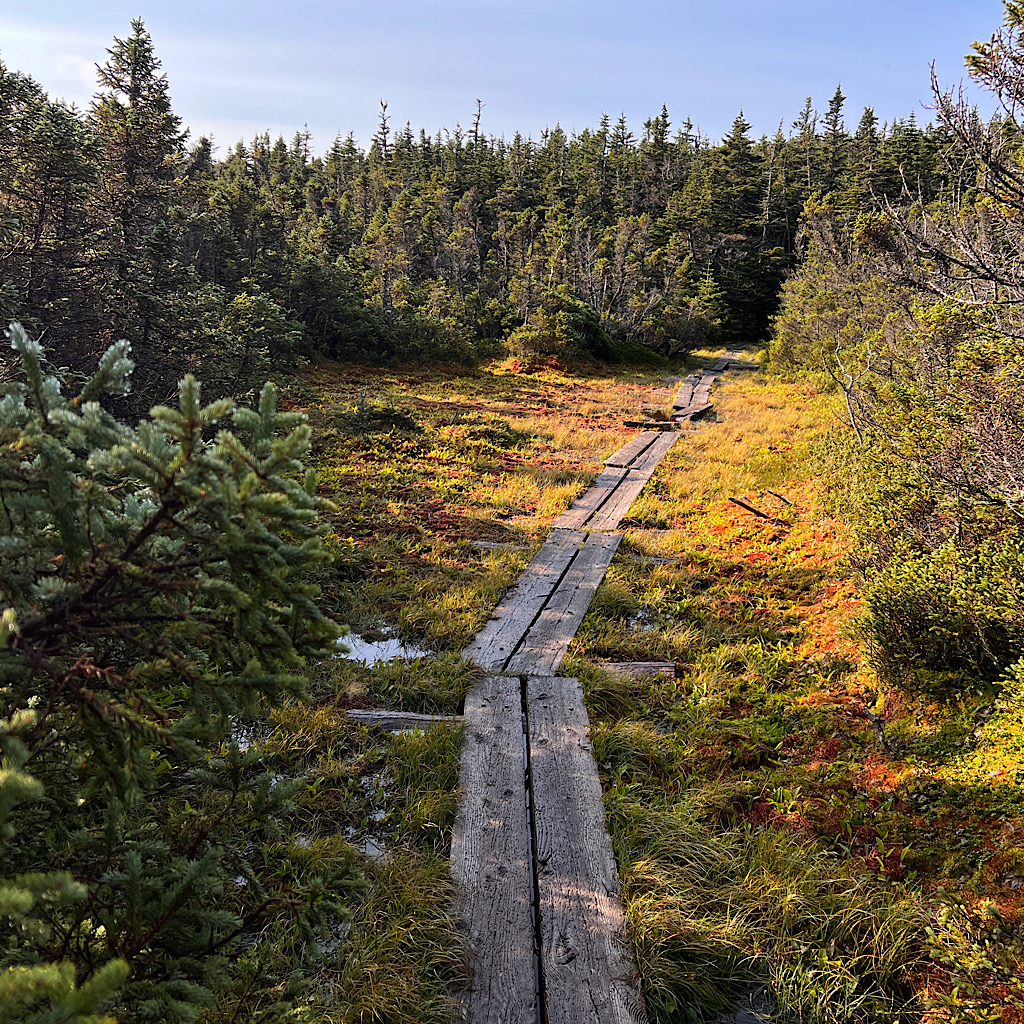
Apparently this peak is not officially counted since Middle Carter is so close. In between is a beautiful bog with a superbly cared for boardwalk.
It’s always interesting to me the life high up in the mountains seemingly protected enough from the worst elements to produce the sort of ecosystem of a much lower altitude.
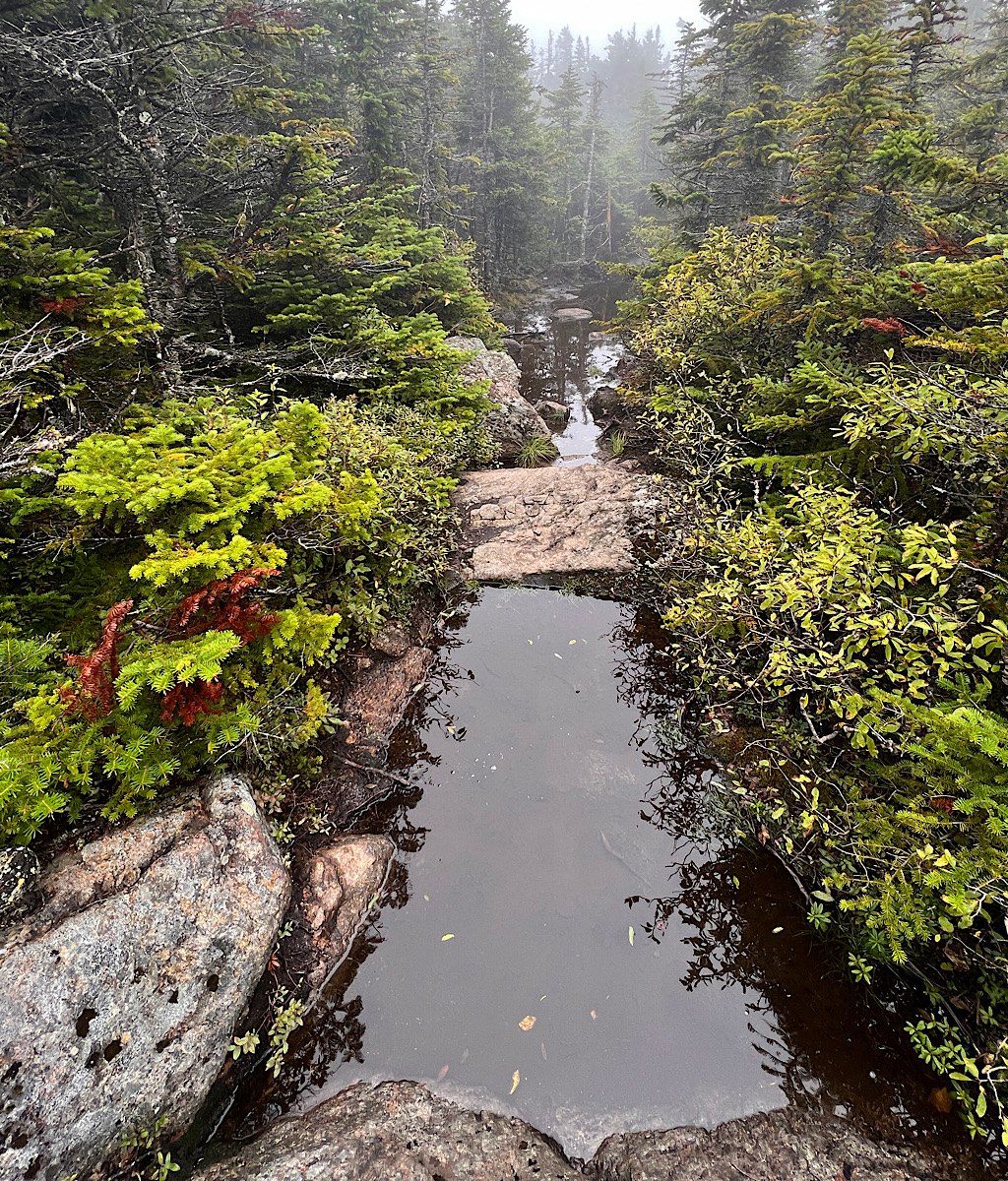
I mention the boards because the level of rain this year has made most muddy sections even muddier and deeper and I encounter plenty to slosh through. One board seesaws as I climb over it.
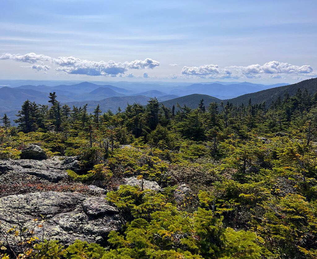
The air is spicy with balsam and I can see my breath. I begin to see views towards the massive Presidential Range and pointy Mount Washington through the trees, though no real open area exists at Middle Carter.
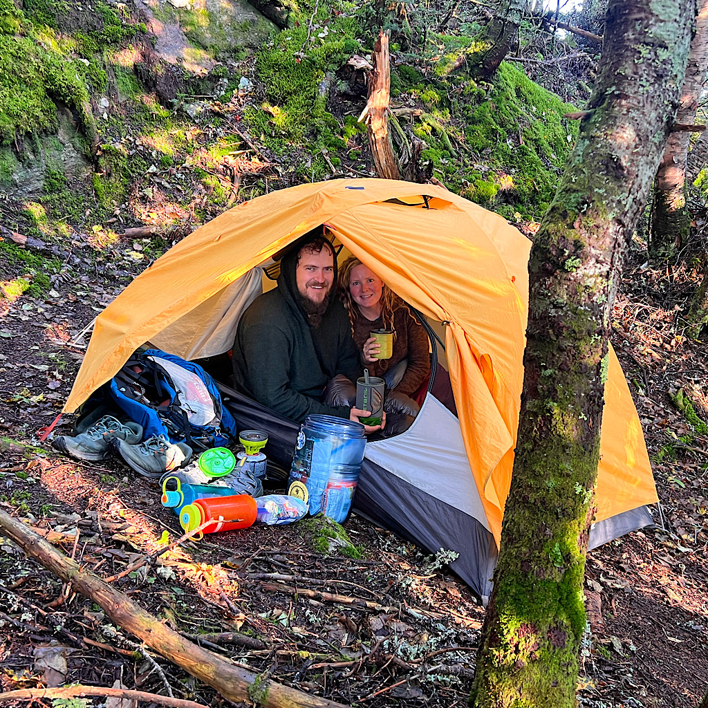
It’s down now and some Canada Jays, fluffy with Disneyesque faces, peep at me. Aha, a camp spot! These guys will steal your breakfast if you turn your back for a second.
They have no fear and land close by hoping cute equals handouts. Close by, a couple sips coffee in the vestibule of their tent and I snap their picture.
The Appalachian Trail is so hard, especially in the north. Some people slackpack this entire range and I wilt just considering the idea.
I start singing songs about this place.
Hooray for mud, hoooorayyyy!
On the AT it’s just another day!
Then think of all the orthopedic surgeons and physical therapists lining their pockets from busted up bodies marching through this killer landscape.
At least the sun’s out as I enter a mossy forest beautifully lit, magical, sensual.
I hear a noise behind me and it’s the man I met at Imp yesterday afternoon. Mike doesn’t recognize me with my hair pulled back – and I hadn’t realized he tent camped at the site.
He’s a local – obvious when he says Concord as “Cahcahd” – and is only hiking for the two days. We easily walk together and chat up and over South Carter.
He tells me three more people showed up last night to tent camp, arriving in the dark. I can’t imagine taking on this challenge by way of headlamp. Even local Mike, a veteran White Mountains tramper said no way.

He tells me he hadn’t hiked this particular stretch in thirty years and had planned to take a bypass around Mount Hight.
I admit, I am so tired and busted up, I may have followed him, but the goddess placed a couple with two big dogs right at the junction. They told us the view is stupendous and not to miss it.
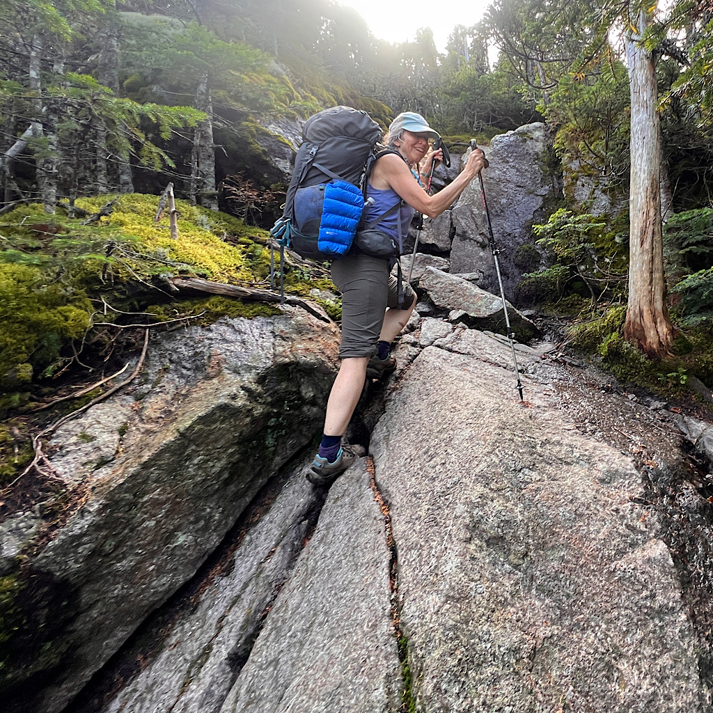
It’s less than a mile and very, very, steeply up, but this time on manageable rock, not stairs but more like a trail out west, minus the heart-attack preventing switchbacks.
Here’s where I excel, putting myself in granny gear and powering forward. I even pass Mike – though his super power is descending, veritably bouncing down the rocks while I use my hands and butt.
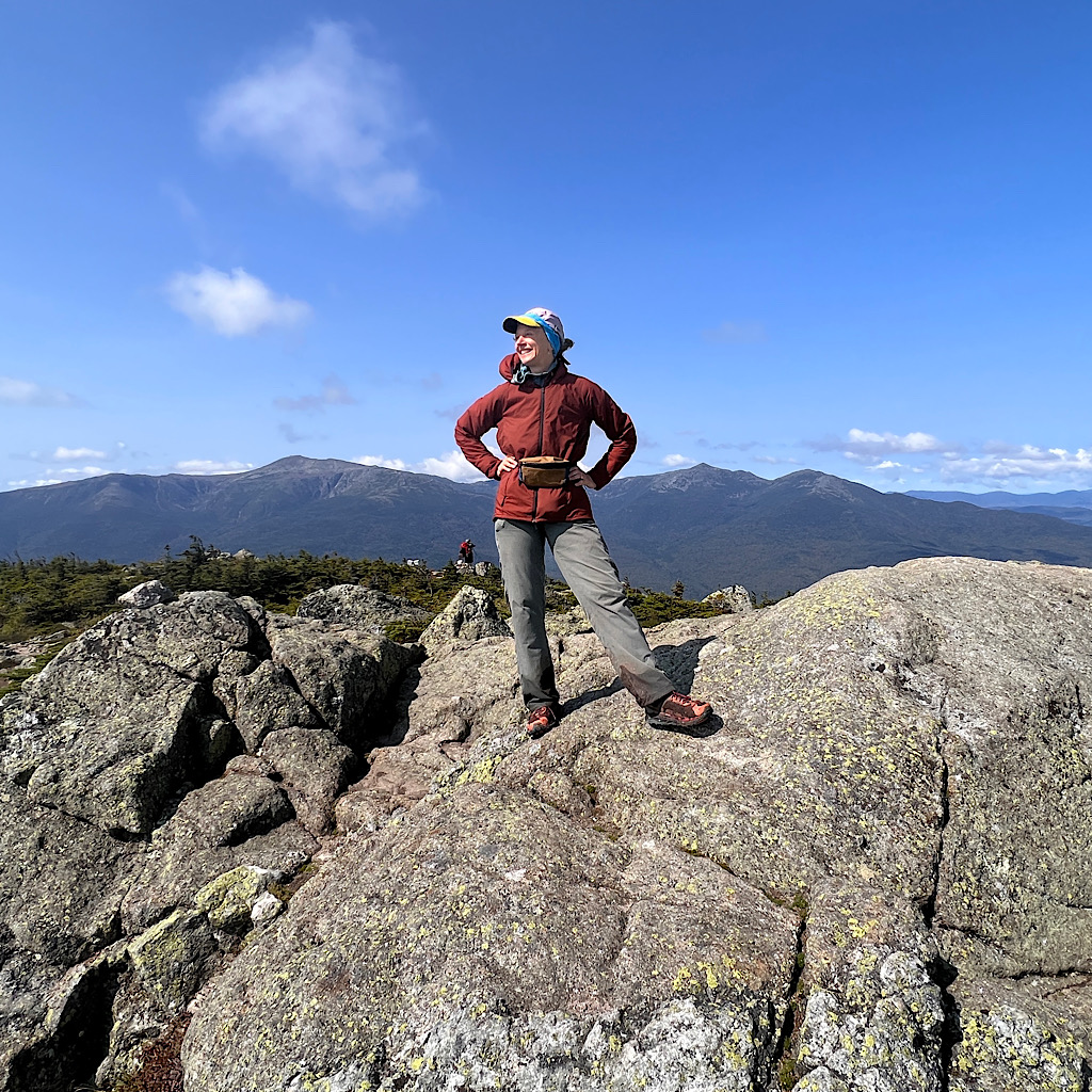
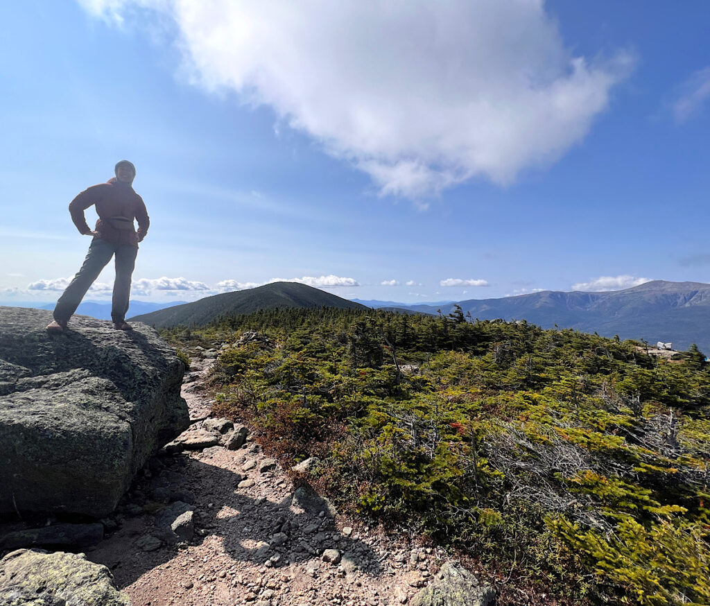
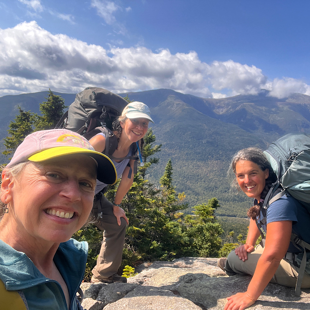
Hight is truly amazing. A large open alpine area looking directly at the Presidential Traverse.
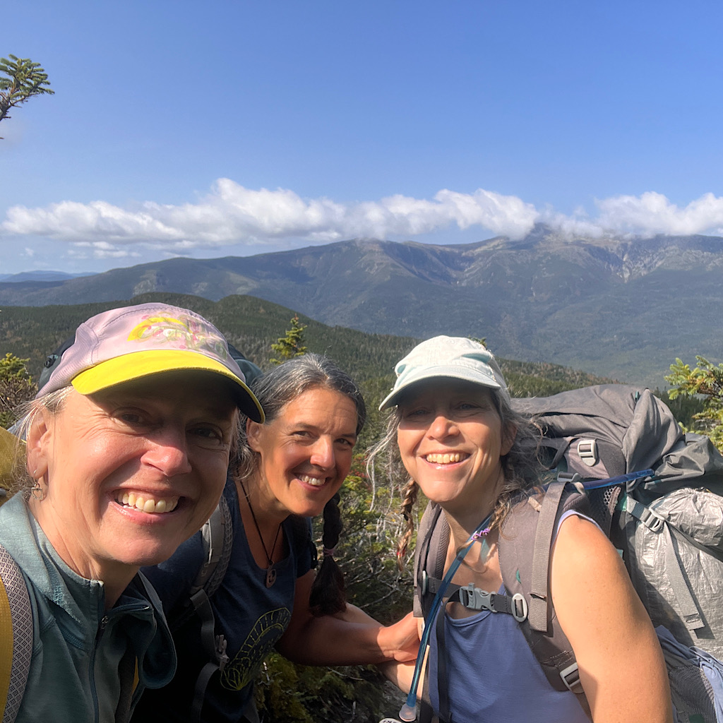
And SJ is up here! So glad we bumped into each other again!
We put on warm clothes as the wind is high and cold, then snap pictures trying to capture this surreal moment of joy in rare sunshine.
Have I mentioned weather really matters a lot?
There are stealth sites in the krumholz and I imagine this place is a dream at night, but it will be very cold tonight and I am aiming for an AMC (Appalachian Mountain Club) hut in Carter Notch.


So I soak it in, commit it to memory for my dreams, then head through a green tunnel to totally treed in Carter Dome. Good grief! I feel extra happy the couple with dogs was right where they needed to be to send me to the fabulous summit of Hight.
From here, it’s a mile and a half of steep down. Mostly like stairs, but I am so destroyed now I move slowly on tender feet, every step jangling my bones.
But Mike waits up and we take a short spur to an exposed ledge. It looks straight down on the deep notch (or pass) where beautiful ponds sparkle and I see the roofs of the hut and bunkhouses.
Next to us is a massive boulder shaped like a hammer and fanning out below are thousands of house-sized boulders called “The Ramparts.”
We hang here to eat and take in this incredible view. Trees are beginning to turn red and yellow and the sky is a deep blue with only a few clouds sprinkled about for interest.
It’s still a long way down, and just as lovely when I reach the ponds covered in lily pads as if painted by Monet. Of course, I sing a little Debussy as I walk past.
It’s still rocky and tricky trying to access the hut. I have no plan at this point, but know they sometimes allow AT hikers to stay in exchange for work.
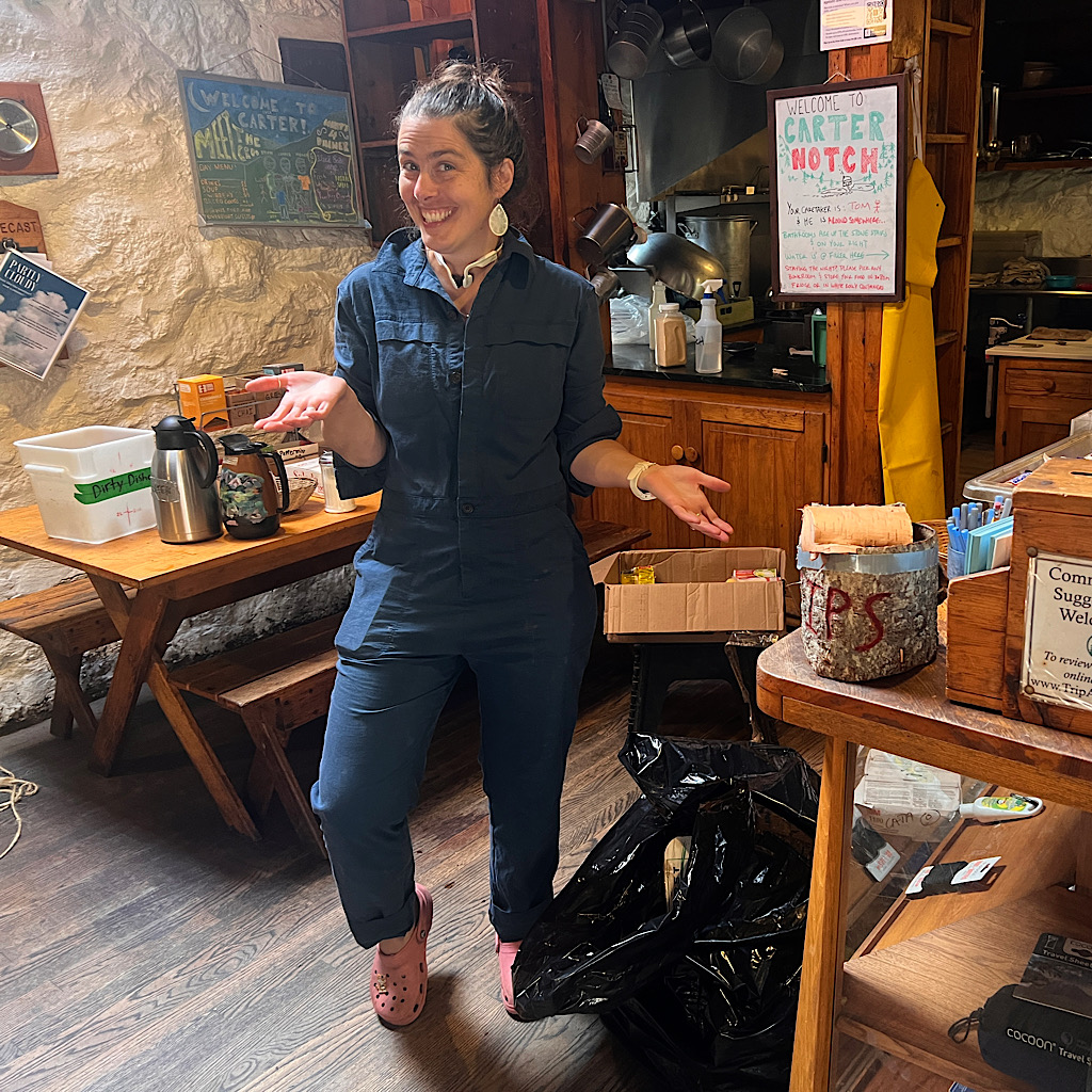
Right away I meet Bethany. She’s the manager of the entire AMC hut system and tells me today is a transition day as they move out of summer management into fall.
She and Tom are cleaning the place from top to bottom, so there’s no food to be had, but would I be willing to work for an hour to stay?
At this gorgeous place, you bet I will.


She takes me up to a bunkhouse and asks if I’ll transport all the pillows, now in plastic bags, to a storage space.
“Like Rumpelstiltskin, move these out and this bunk is yours.”
I happily dig into my job which is tiring as I carry each bag down rock stairs, then return to fetch more. But in this fresh mountain air with views of towering mountains above me, I feel incredibly lucky to have made such a trade.
I eat dinner, then walk out to the ramparts looking up now on Carter Dome and where it’s ejected all these boulders. The sun warms the rock and shines for a long time on me and my surroundings before it disappears behind the Wildcats I’ll climb tomorrow.
And just as I start to fall asleep, Janet and Gretchen from Vermont (and last night’s second story sleep) arrive. Such lovely gals and also planning the Wildcat.
Can I come with you?!
They say of course, but they are on vacation and in no hurry. This sounds perfect to me – and I’ll have friends to share the scary bits with, friends who shrug and accept that the White Mountains are just as they are – hard, challenging, steep, sketchy scary, exhausting.
I am ever so lucky.

Day Three, Carter Notch to Pinkham Notch, 7 miles
It is a grand sleep in the wee buck house. Mine sleeps four, but I have it all to myself in this in-between moment.
Condensation drips on the windows and I think how wet and cold I might have been in my tent had I “stealth” camped. Am I just getting too old for so much discomfort?
I work my way down to the main hut where water is on for tea and a thru-hiking gentlemen with a thick crop of white hair and full white beard is organizing his morning. He eats cheerios from a former Frosted Flakes disposable bowl.
There’s something slightly Benny Hill-esque about this man, his shorts belted up to his chest and various items tied to the sides of his backpack. He hardly looks hearty enough to follow the rocky path around the pond back to the main trail, and yet he tells us – to our astonishment – that he’s a beginning backpacker and has walked all of the Appalachian Trail to this spot.
I can see it. Determination, advancing slowly, taking rest days. A person can walk this thing end-to-end.
For me, it’s a matter of finding my way down what the fear-mongers of our crowd-sourced trail app are saying accounts for the most broken legs of the trail.

My body is really beat up and I am thoroughly burning out on rain and damp and the harsh trail that eventually reveals views after much work.
I’m hoping a walk today with the girls will change all that. It’s sunny and warm already, the weather being read over a walkie-talkie reminding us that there will be 12 hours and 20 minutes of daylight. They also add a tropical cyclone is hitting the Eastern seaboard and to be prepared for rain and wind.
This begins to spark conversation amongst the small group that has gathered – a sullen man looking for rolling papers, a gabby woman who suffers from neuropathy and walks on what feel like “stumps,” plus the girls and Old Man Thru Hiker.
No one seems to know what a cyclone is. I venture that a cyclone is essentially a hurricane, with the name suggesting where it originated. But this does not seem to satisfy anyone. Truly all that matters is will we get more rain and when.
The subject is quickly dropped once Tom and Bethany pop out of their quarters and tell us they have a large cache of bacon that needs to get eaten up. If you want to get a hiker’s attention, just say “free food.”
We load up then slowly disperse, each going different directions. Weather makes a monumental difference when hiking. The sky is Robin’s Egg blue and the trees are on fire on the verge of putting on their autumn finery.
I’m told the red berries are Mountain Ash, bright and magnificent this morning as we pass the magical ponds. Gretchen has already gone swimming in one. I love to swim, but I don’t love to be cold, so only take photos.
It’s a steep climb right out of the gate, but on easy, lunchbox-sized rocks. Janet takes the lead and skips right up. She promises me that Gretchen’s talent is not on the ups, but the downs, and I can easily slot in between them as we tackle today’s challenges.
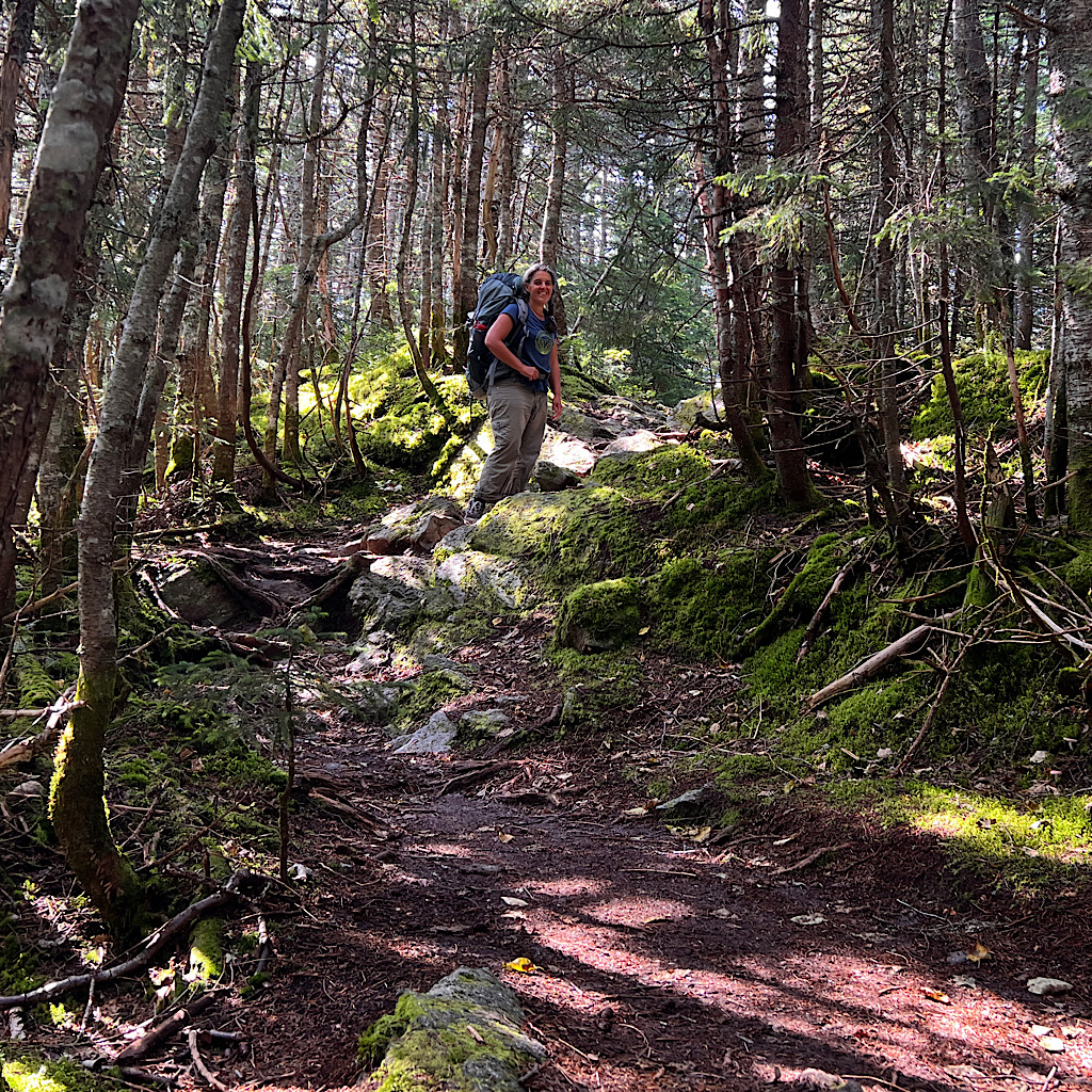
Yesterday, Mike mentioned to me how much he loves new Hampshire’s mossy forests. It startled me since I expected a more macho response to these mountains involving the words “peak” and “bagging.”
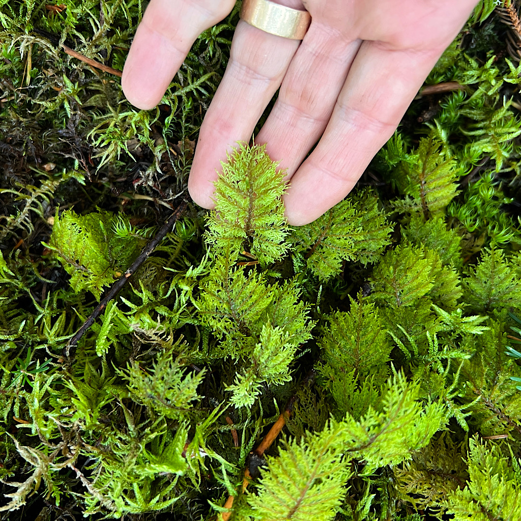
Instead, there was a sort of soft and nostalgic quality to his voice when he spoke of returning high up into these crags for the fairyland of green enveloping a walker. Imagine how it is in these grottos – the perfumed aroma of balsam filling your nostrils as you pass five different types of moss, electric green lit by filtered light.
If the rain did anything good, it gave us humps and humps of mosses, fat and healthy.
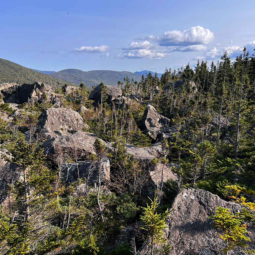
At the summit of Wildcat Mountain, a 4,000-footer mostly in trees, we find a ledge to sit on and take in the view. This is my kind of hiking! Slow and savoring.
We’re on a sharp ridge closed in by trees and accessed by steep rocky faces. I’ve become an expert at this type of walking now. Tossing sticks down or placing them above me so I can use my hands to move safely. Gretchen indeed does take the lead and moves like a cat without using sticks.
They told me that they had been scolded for carrying big packs, even told they’d “never make it” hiking like that. I don’t try to pick up their packs to test them, but whatever luxury they’ve carried to make this a more enjoyable endeavor does not seem to slow them down in the least.

We’ll do these short bursts of powering up and carefully lowering over the entire ridge, meeting high points with the creative names of Wildcat B, C, D and E, all above 4,000 feet and looking straight over a massive valley to the Presidential Range.
We reach a large deck with a weather monitoring system and bask in the sun, which now has gotten quite hot. I eat the last of my food, then wander down to the ski lift where two workers eat at a picnic table.
We talk about the weather and how nice it is to finally have a lovely day. They remark this truly is the best job around and ski season will start soon enough. I ask if winds are as bad here as in Washington and they say not so much, though the snow can get very icy. From our perch, the two main roots down are black diamond with one wee escape route for the likes of me.
Then the gal tells me how dangerous the wind is and how a woman was caught in it a few years back and froze up there. Yes, it was my friend Kate. She wanted to traverse the Presidential Range in winter and headed up intending to travel light with just a down suit and provisions on her back.
No one knows what caused her to keep heading out of the trees when it was obvious the wind was gusting to unmanageable levels. She got trapped in that wind, unable to turn around. When she set off her SOS beacon, it bounced off the mountains and didn’t give an accurate location. Still, the weather was so fierce, there was no way to get to her in time.
I hiked here the summer after her death to pay homage. It was such a spectacular trip of serene beauty followed by wild and dangerous thunderstorms. I look over at the mountains I walked and decide right then that it’s time to leave that bit of mountain in my memory.
So today will be my last day this season on the Appalachian Trail as I meet where I left off last time. I’ll ending on a high note and it’s enough.
Still, there is a long way to go – 2,000 feet of elevation loss in two miles. It ain’t over ’til it’s over.
So much information out there about this descent is a good thing and a bad thing. On one hand, you know what you’re in for, that your pace will slow to a crawl, that the rock is unforgiving and at the steepest angle it can be before considered “technical,” that is would be best not to try to do this in the pouring rain.
On the other hand, you can lose sleep with worry that this is the place you will fall and break something, or at the very least, freeze up and be unable to continue.
For me, the worst is the continual sliding on the seat of my pants which has now completely shredded into strips.
Right away, we hit a beautiful ledge, warmed by the sun with a view straight over to Mount Washington, clouds alighting atop it gently like whipped cream. The girls sit close to the edge and gab while eating.
I take a look at how high we are. Maybe not two miles straight up, but pretty darn close. There’s no such thing as switchbacks out here. Perhaps there’s no way to carve up these mountains the way one can out west.
When we finally decide to give it a go, our first move is to walk along the ledge. It’s wide (enough) and you’d probably have to be a klutz to fall, but the rock arcs straight down to our right with catastrophic consequences should you misstep.
Needless-to-say, none of us missteps.
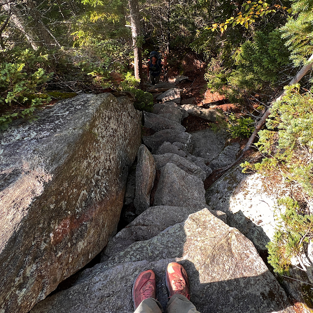
We need to get ourselves to a wide bowl in the large granite slab. Here, trail builders affixed wooden steps. There’s nowhere to really hang on except by friction and leaning, but we each need to turn around and take the steps backwards, like a ladder. The turning around is dizzying, but when done slowly with care, I don’t knock my pack and throw myself off-balance before lowering myself to more rocks in a jumbly staircase.
It’s the exposed moves which get the heart rate pumping – and after all the warnings, I assume it’s this type of down-climb the entire 2,000 feet.
Not at all. Of course, that’s not to say it’s easy, rather the steep sections are in forest, so often offer root and branch handholds. Still, I end up throwing my poles ahead, sitting on my butt, and gently scooting down using both hands.
It’s not elegant. It’s not fast. It’s definitely not pretty. But it works.
It surprises us when we hit a momentary flat section with helpful streams for campsites along the way. This is not one long slog, rather scary and vertiginous precipices followed by astounding views and laughs.
With girls, I talk. Really talk about all things – our families and friends, movies and music, the hikes still to do and this entire quest of coming out here to hike as far as I felt like going and how it transforms me. Both are a decade younger. They’re fit and game, but happy to “be on vacation” and enjoying all of it.
I count the four ledges we’ll reach, none quite as scary as the first, until the last which again pushes us on a catwalk of concentration. There’s a mud slide around and below this boulder that apparently several hikers had taken only to find themselves ledge-bound and scared out of their minds.
Thankfully, this warning is a useful one and we stay on the ledge to meet rock piles, somewhat like stairs. Janet mentions speaking with a trail builder who helped put some of these rocks in place as a staircase. It’s tremendously difficult work to get the rocks to where they need to be, place them and ensure they don’t move.
After all that work, the life expectancy is just twelve years before they move out of place. Flat rocks do make our lives easier, but placing them serves the purpose of erosion prevention. No one cares how hard we have to work.

It’s not long before we can hear the highway below and see the huge Appalachian Mountain Club Center along with the fancy Joe Dodge Lodge. Our scramble continues with eyes glued to each step as we wind down to the flats along Lost Pond, still clamoring up and around moss covered boulders.
Beautiful Ellis River is crisp and clear, a deep pool lined with smoothed rocks. Gretchen jumps in and I throw myself against a tree fully embracing a rock in its long rooty arms. My shoes are drying, but the mud leaves sparkly bits of mica behind.
The girls change quickly into “car clothes” planning to head back to Vermont tonight but not before taking me back to Gorham to sleep and make my next plan. On the way, we get caught in local Homecoming Parade, a motley crew of one drummer, one cymbal, handmade floats and kids marching haphazardly while the entire town looks on.
Everything is sold out except for a bunk at a hostel where I am the only guest. I eat at a Chinese buffet and meet a writer and his wife who help me find my way home.
Maybe it’s too soon to leave just as fall starts to settle in. My body is really beat up and I caught a cold from Rock Hound who hacked all night long way back at Gentian Shelter. Whatever I decide to do, I know I’ll need to take time off to recover and it will be far more comfortable in my own space.
Besides, I accomplished what I set out to do: to come right back to where I left off, finish Maine and join with the trail I’d walked before. It was challenging in such nasty weather and unforgiving terrain, but also hard on the spirit to work so much for only intermittent views.
Setting all that aside, I’ve been given a tremendous gift in being able to return. My brother compares this odyssey to taking a test where you have time at the end to go back and review your answers. I’m a changed person since cancer and this afforded me the opportunity to take measure of who I am in the place I was just before I got sick.
Most of us never have the chance for a do-over, or, I guess in this case, more of a picking-up-where-I-left-off. By grace, I was able to pull back the lens and walk without pressure for any outcome except to just be.
I busted my ass – as quite literally demonstrated by the holes in my seat beyond repair – but I also got to see who I am in relation to this trail, the people I met and the experiences I had and then make decisions based on how my new self fit in.
I loved much of it including who I was through the challenges as well as the laughs. And I consider myself supremely lucky to possess enough physical strength so soon after the crisis of cancer in my body.
One might think after such a shock, I’d cling more tightly to experiences in fear of time running out and opportunities dwindling. The funny thing is that I know it’s time to say enough for now, and to believe there’s more to come.
Looking up at the Presidentials, I recall my incredible hike with Randy as if it was yesterday and feel absolutely no need to try and top it. All the new trail I walked this time fills my heart and the memories will stay with me just like the memories from that hike a half dozen years ago.
Leaving now having seen so much beauty, pushed (almost) to my limit, and taken in this wondrous place with all my senses, leaves me full and satisfied.
And you know, just as the girls said when we parted, “There will always be more hikes.”

6 Responses
Well done, Allison! Welcome home!
thank you!!
Alison, These pictures are beautiful-and just what I need right now as I recover from an emotionally challenging week. I recall a family vacation in the White Mountains area of New Hampshire-my parents trying the cabin thing . There were boulders all over the place to climb on-orange day lilies and goldenrod.My brothers and I loved the rock-which I have learned since is referred to as an “erratic”. My friend Wally, a flute playing friend, sent me a picture of himself sitting on this big rock and titled it “An Eccentric sitting on an Erratic”. Now I get it having read the term again! It must fill your heart being around so much beauty and color.
HA! That is such a great story. I recall a silly dad joke.
Q: What’s a sexy glacier boulder?
A: An erotic
It is a magical place!
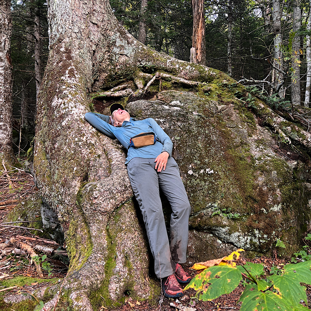
I’m happy for your success to finish this task. Love the final flop back photo. It says it all!
Go rest and relax!
thank you! my feet just might maybe perhaps be on another trail soon, totally and utterly different…