

Day Ten, 20 miles
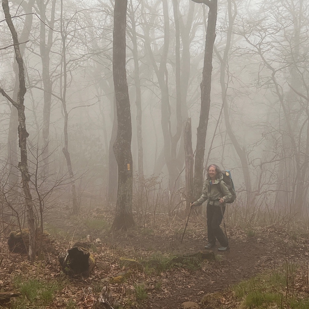
It’s foggy the morning I need to head back. Janet tells me this region is referred to as “The Land of the Noon-Day Sun.”
It should clear later, but right now I’m pleased I hauled my butt up here the other day when it was clear and glorious because now it feels like ghosts are active.
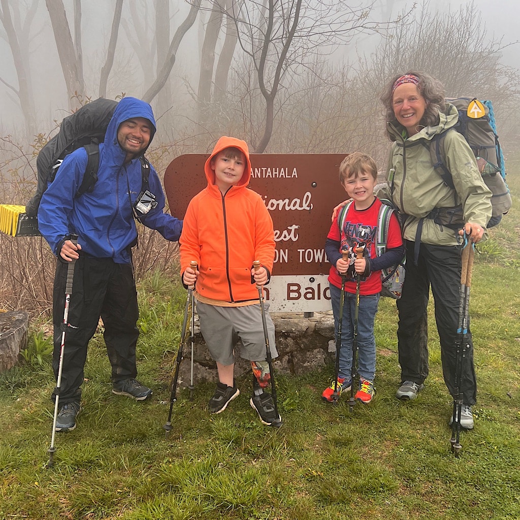
The boys walk us up to the tower with their brand new Lekis, just like professional walkers. They hug us goodbye, then start to cry. It really was a special visit and we all bonded.
Off we go into the mist, down at first, then steeply up to Cold Spring Shelter where I take a break for food and run into Number One! He’s lost the whole group of girls and has decided to call his hike quits (he walked it all ten years ago)
Another hiker named “Frosty the Slow Man” appears and makes me laugh with his laid back attitude to this cold mist. He’ll finish in Virginia and seems to care less about speed – or views.
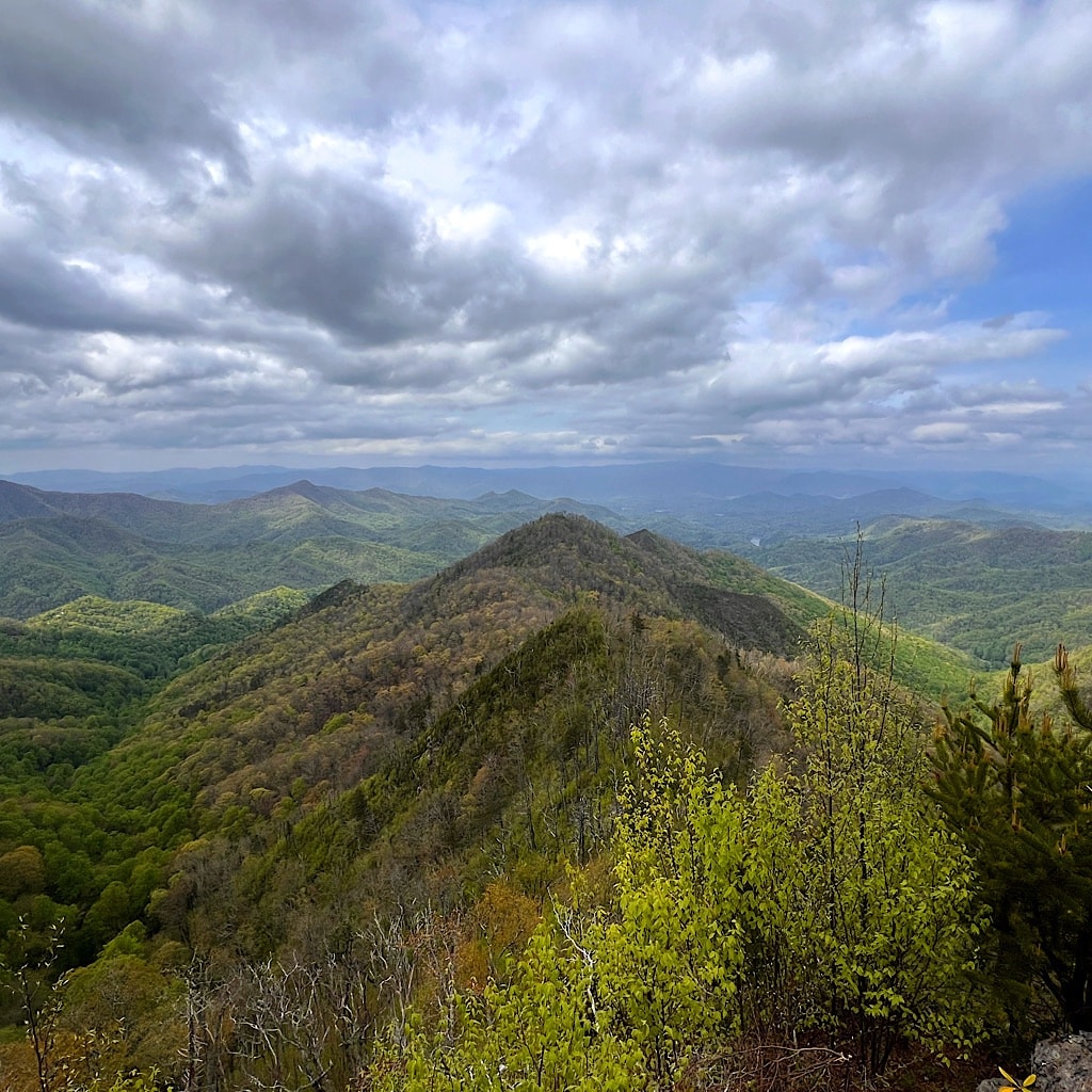
Number One and I take off and talk politics and gun rights and all kinds of topics he seems far too progressive about for a Tennessean. I like talking with him as we march right past Rocky Bald with zero visibility and launch ourselves down then up to Wesser Bald, just as the skies clear.
Up here I meet Charlie and Cheryl from Florida who ask me if we camp along the way. Wouldn’t it be nice if we didn’t have to?!
I’m the first one up and we snap pictures of each other, then Yoshi and Number come up to finally see all the mountains we’ve been climbing up and down.
I’m not sure if it’s the effects of a rest day, but I am tired today just as Yoshi suggests we go down past a camp spot and to the NOC (Natahala Outdoor Center) where we can get our Smoky Mountains permit. It appears there’s a site near water just past the center, and it’s only six miles.
I stop at the last water source until near the bottom at some ruins of a cistern where someone placed a piece of pipe to aim the water.


I feel good and ready for a long descent. But it’s up and down still on the ridge. The landscape is beautiful, but I am really wearing out.
At the edge, there’s a spectacular view followed by tricky footing on steep rocks to get me off the steep mountainside. It not only slows me down, but is tougher on my body.
I crawl along carefully, willing myself not to fall. The sky is gloomy and gray, but the view is clear until I enter forest and begin to follow a more reasonable trail.
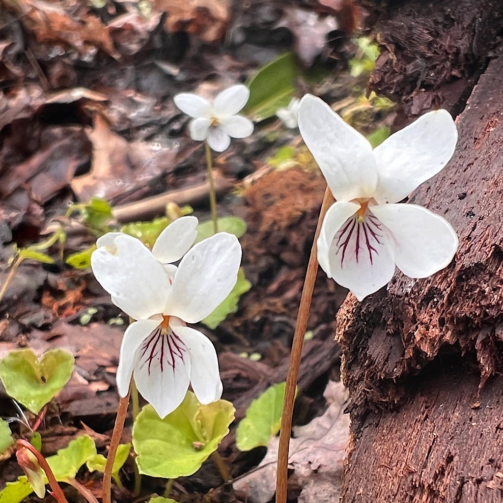
In here, the air is thickly perfumed by flowers and pine. Rhododendron are beginning to bud in bubble gum pink.
I plan to pass the campsite by a stream and go to the NOC because my hiker app tells me it’s open until 7. I should easily reach it by 6.
The campsite looks pretty full anyway and I’m tired but happy to keep moving. The Natahala is a river which is dammed to create the lake where Aunt Janet lives. Below, though, are rapids with many grades and the Center was developed for tourists as well as to train experts.


I arrive at a collection of buildings – liquor store, restaurant, bar – and tons of people milling about. I make beeline for the outdoor retail shop and the door is locked. Yoshi comes out and a young woman tells me they’re closed.
It is 6:05.
I lose it. I know, I know. I’m tired and thirsty and their closing an hour earlier is the last straw. I tell her all I need is the Smoky Mountains permit for AT hikers.
She tells me it’s very, very complicated.
Really?! Why??
The good news is Yoshi just got his and knows the drill. So she decides to have me fill out the application, pay for it, then email her the permit to print.
Though, I see what she means. In the day and age of iPhones why on god’s earth would some bureaucrat require printing a permit?
Good grief.
First I have to get online and that requires filling out a form – fortunately not requiring printing.
Yoshi sends me the links I need to click and speeds things along. I enter my credit card for a $40 fee to walk about 70 miles in the Smoky Mountains.
I then forward my confirmation to the store, the young woman gets my email, prints it up and hands it to me and that is that.
What a moment of trail magic. Gratitude all around.
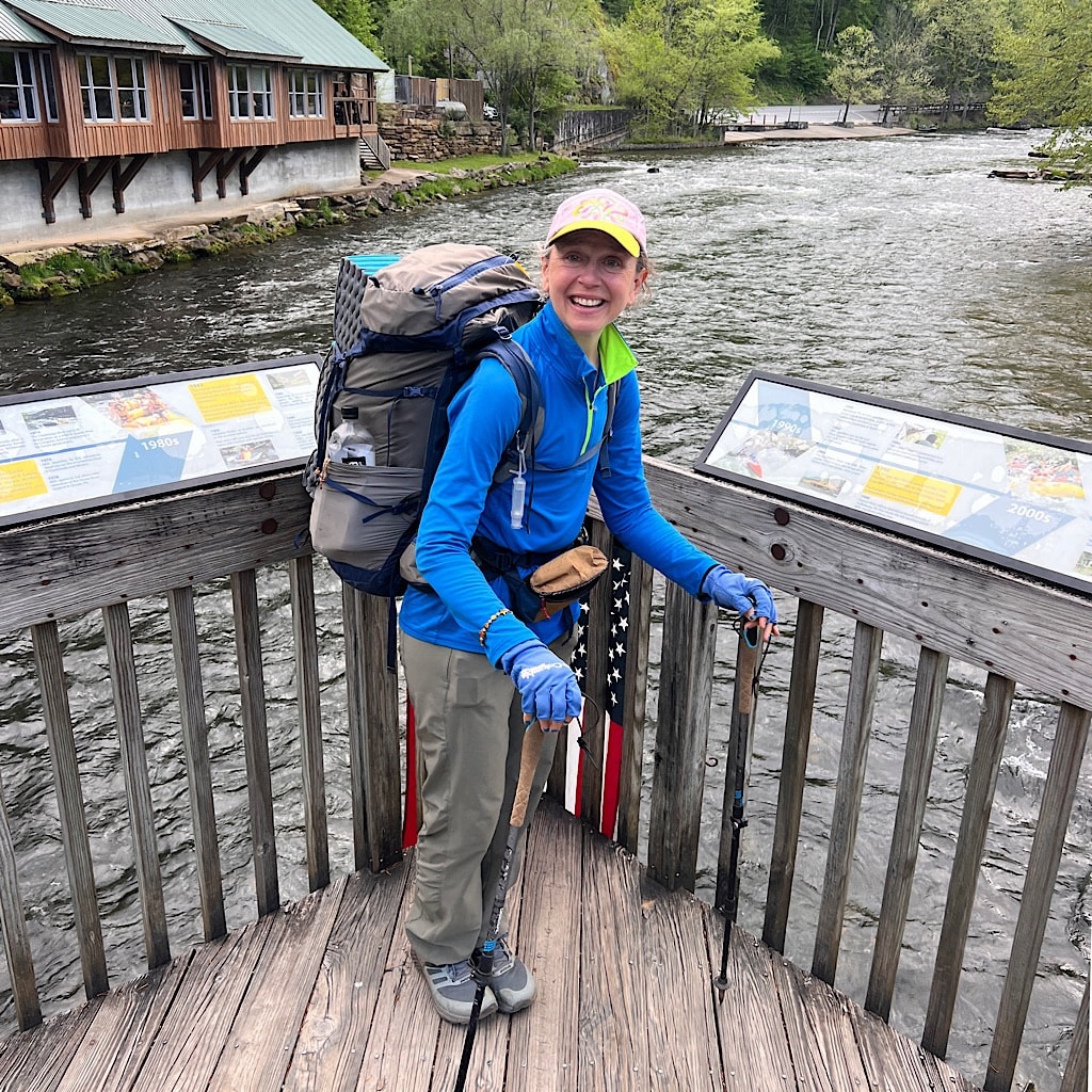


I buy something to drink, then sit by the water. The AT officially crosses the river on a cool pedestrian bridge. Yoshi and I play one round of Jenga with giant blocks before we head up to what should be a close site.
Somehow this day is just too much and I am distracted, not quite understanding where I’m headed. I walk right past my last water source before realizing there is no camping near water.
So I schlep back and fill two bottles and haul it up, and up and up and up searching vainly for “the” campsite.
It’s getting dark and I need to find something, but I am seriously climbing – on switchbacks – on the side of a mountain. Nothing here.
I check the topo and see that eventually things level out a bit, so I make a beeline (again) for the somewhat leveled out bit and there it is, well there something is, a wide spot in the trail, a kind of pull out really, big enough for me.
I set the water to filtering and get the tent up, cook and eat dinner and am all settled just as it goes totally dark.
A whippoorwill begins his loopy song and fireflies begin a spooky dance in the trees. One wisp of pink remains when I zip myself in.
What a day – 20 miles! – I’m bushed but happy and ready to knock out.
Tomorrow, I’ll make sure I study the map a bit more carefully.
