
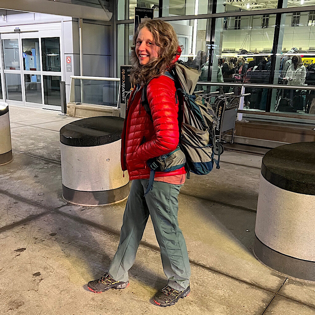
Alison asked me to post an update of her start on the AZT. There were some connectivity issues at the various airports where she hoped to post an update. She has no time upon arrival in Tucson with the hiker shuttle ready to whisk her away to a spot near the the start of the trail. The quick scheduling was necessary in order to put in some miles in before dark. Like the start of the PCT hikers have to walk to the international border to mark the ‘official’ start and then backtrack along the same route. She would only have half a day left if the flights and shuttle were on time. Luckily they were.
These travel plans started early Monday morning. We were both awake before the 4:30am alarm had a chance to sound. Nervous energy does that. All the gear was ready to go and had been placed by the back door in order to quickly load. We spent the previous evening scouring the checklist and assembling all the gear and dehydrated food. We were out the door fairly quickly that morning and by 5 am I was kissing her goodbye surrounded by a surprisingly large stream of young passengers jumping out of vehicles and running into the terminal. We thought it was spring break related and hoped that security lines would not be backed up.
Alison texted updates as she made her way to the gate. The post she had written describing the start of the trail will not upload. Neither would any of the images. I tried to trouble shoot the problem from home without any luck. She tried again while waiting in Dallas to change planes but nothing would go through. She texted the images to me hoping I could use them to make short update about her progress. (mission accomplished)
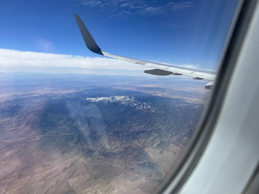
One of the images included a picturesque view of a small range of snow covered mountains. A rather sweet view imagining that those peaks had been dusted with a light coating of confectioners sugar. This detail was important to her because of other snow covered peaks she may need to traverse in coming days, It was a litmus test for her resolve to conquer the upcoming elements. Perhaps she was claiming that the challenge was accepted.
I would love to include the name of this range in this update. If only I knew where she took the picture, one taken randomly through the window as the plane bolted ahead. Could I find out? The map nerd in me took over.
I make highly detailed maps as a side hustle and I find the challenge of locating a place on earth from a few clues in a photo invigorating. It’s somewhat of an etude that keeps my perception of details sharp. I have a Facebook friend who travels the world and will randomly post vacation pics and ask if anyone can tell where he is. I always answer. Most recently when he posted a selfie over looking the Danube, I pinpointed his location in Budapest within a few dozen feet.
I was ready for another nerdy geo-location challenge. First, I checked to see if the picture contained any GPS data. Her iPhone should have recorded the location but it was not in the image she sent. It is clear that the only mountains she would have flown over were between the Dallas and Tucson so I needed to find the path the plane took. Websites that track flights also store that data for later playback. I was able to view the history of her entire flight. The best clue I have to go on can be seen near the bottom of the plane’s window. There is dirt road with a distinctive track. Google maps has a terrain view which clearly shows mountainous areas and the shape of this this road was easily spotted near one of them.
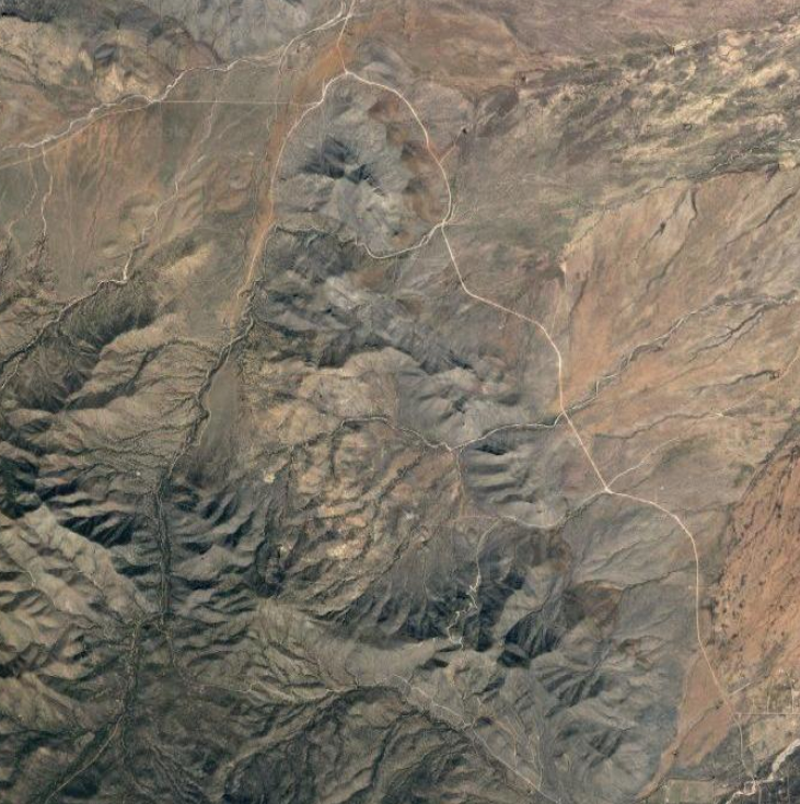
The road lies northwest of Chiricahua Peak a 9,763 feet peak located in the Chiricahua Mountains in southeastern Arizona. Mystery solved!
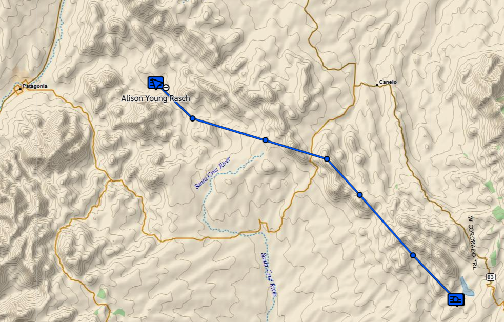
Alison always sends a message when she is starting the trail. After which I can watch as her GPS device pings her location. Her message arrived followed a few hours later by the expected message of where she is stopping. Tuesday the same start/stop messages came through and a third one with details about adjusting to the altitude and how beautiful the scenery is. Still no pings though and I message back that I miss her already. I enjoy tracking her progress as she makes her way along the trail. The GPS uses satellites for communication allowing us to converse from just about any place on earth she might be. The device also allows for an SOS if needed. The pings came through on Wednesday showing a long day of hiking. She has them set for two hour intervals. She should reach the town of Patagonia (to the west) on Thursday. Looking at the spacing of each ping she is about 3-4 hours away. Hopefully she will have the connectivity needed to get her posts uploaded.

16 Responses
This is all great information! Thank you for documenting this. Do you mind sharing which date you started on? I’ve seen everything from late February to mid-March. Just curious!
Thanks, Kelley! I hope you found the day-by-day blog of the journey. I started on March 7. It felt just right with the temperatures not too hot yet in the desert but snow melting in the sky islands. Are you planning a thru-hike? all best, alison
Amazing to see what you can do from home! I enjoyed learning how you “keep track” of your girl and all without talking or texting! Has to be comforting for both of you! Good luck with the rest of her trip!
Omg I am a map nerd, too, and I thrilled at your sleuthing! Good work! And good luck, Alison!
So good to know you’re following. Keeps me moving forward!
Wonderful update. Wish I had the knees to do that trip with her.
me too! taking it slow and steady. love the cowgirl camping!!