
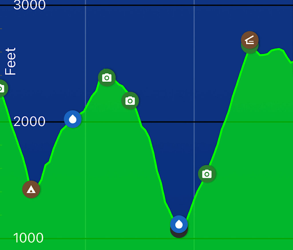
Day One, South Arm Road to West B Hill, 10 miles
At my talks – and in pretty much any chitchat about hiking – people ask me how many miles I walk in a day.
The question is nearly impossible to answer.
On the Pacific Crest Trail, the path was so gradual and clear, I got up into the upper twenties every day even as the days got shorter. I never really looked at my feet once.
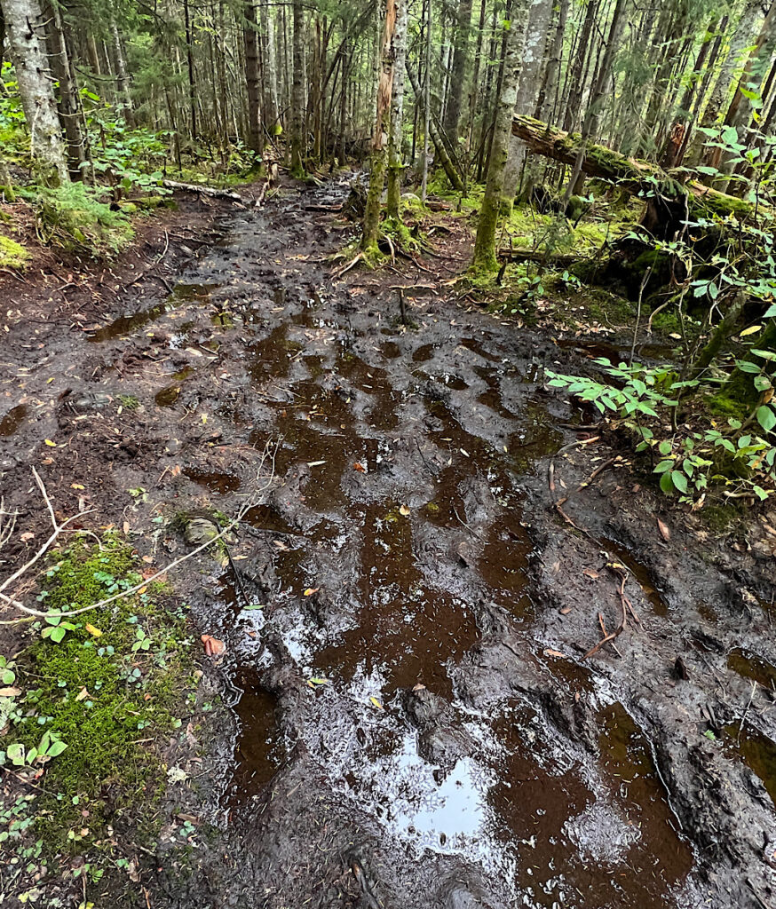
Maine on the AT is a whole different proposition. Mud, roots, rocks and the steepest climbs you can imagine slow the pace. I know people run this, but at 58 with aging joints, I am crazy careful on the descents. (note: my titanium hips are incredibly strong, the knees are being babied now)
It does give me a thrill that I still have big power going up, though. Cancer didn’t slow that piece of my hiker life.
Honey suggested I flip this section because of the wild up and down off Moody Mountain, and almost pointless grueling torture just to move the hiker along.
I wisely started with the hardest part first while still fresh, boldly up and down and up like an “N” before a more gradual descent.
One of the young men at the shelter warned me about the scary river crossing right away at Black Brook. Perhaps rain pushed its banks when he crossed, though I do recall he was petite.
I watch a SOBO rock hop and even I manage it (mostly) though my feet do get damp from the start. That south bounder tells me the trail ahead is like Virginia to which another hiker laughs.
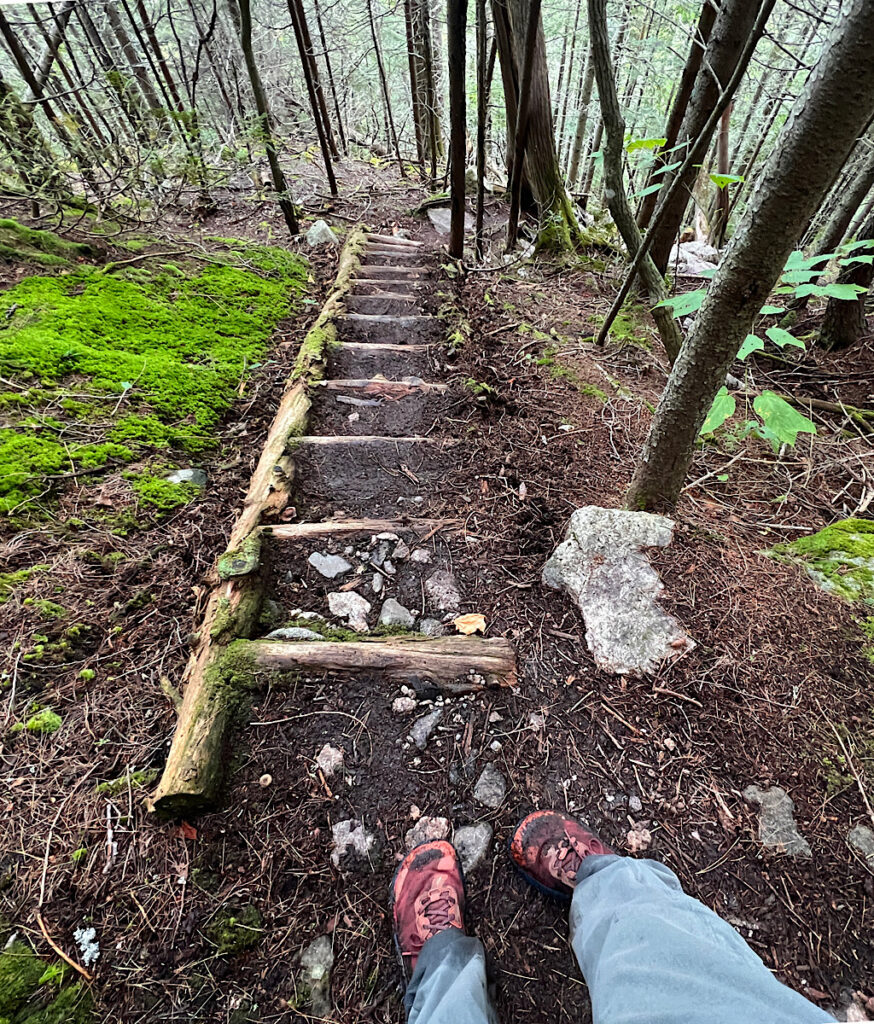
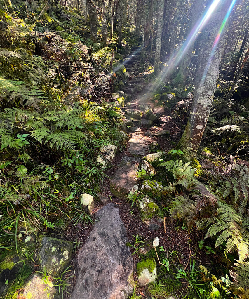
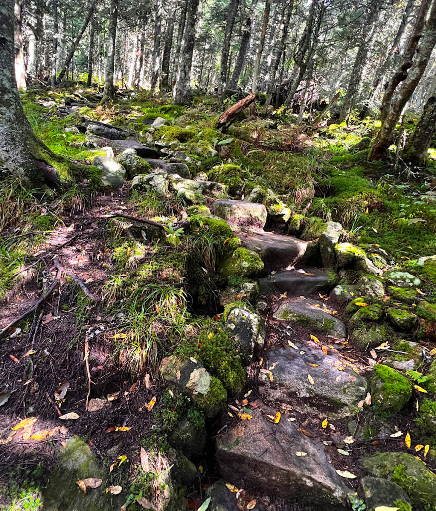
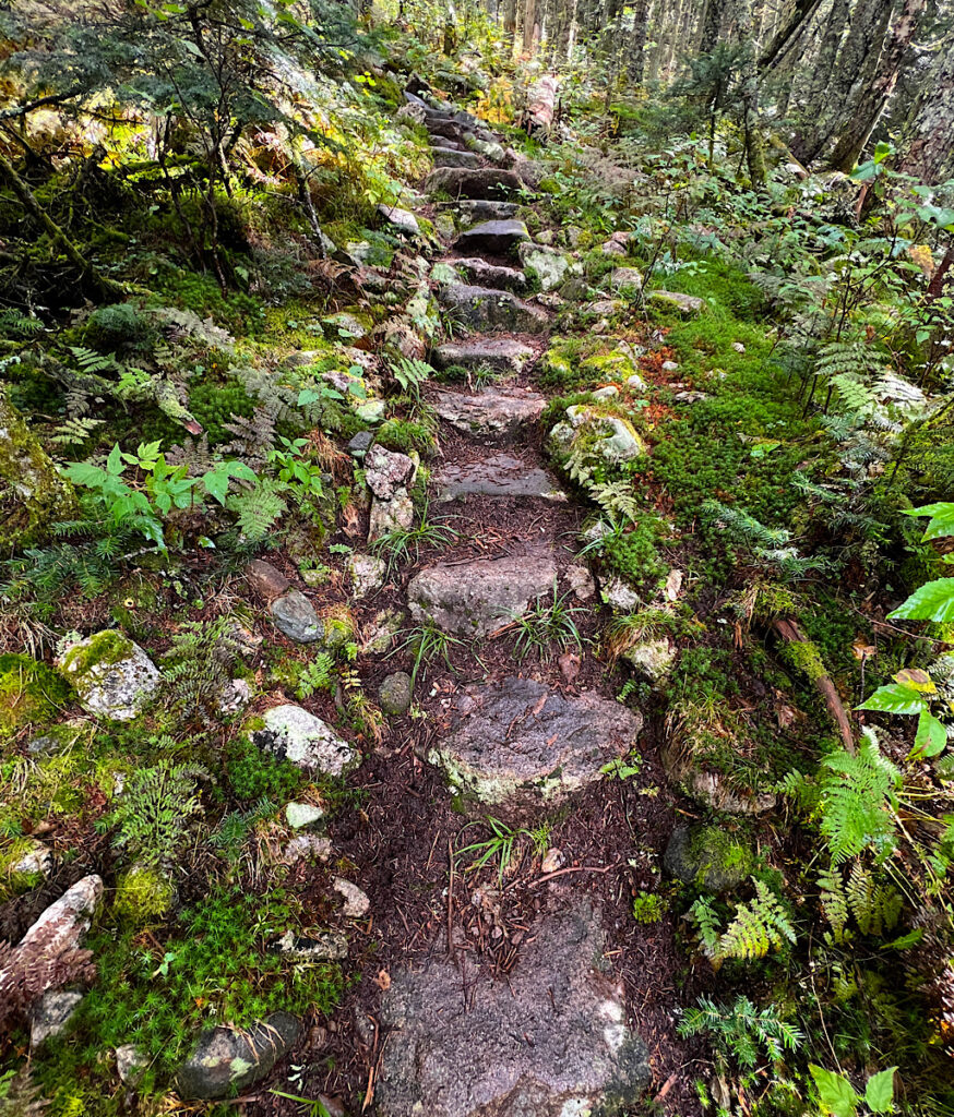
Perhaps not rolling countryside, but the good people from the Maine Appalachian Trail Club have set stairs most of the way.
How is this type of work possible?! I realize rocks are plentiful, so it’s not as if they need to haul materials up to place them for our tender feet to find.
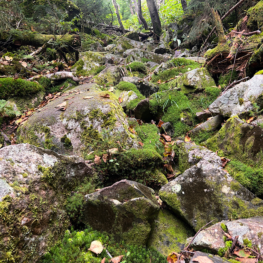
But please understand the value of an even and flat foot placement as opposed to a jumble of moss-covered sharp edges.
Sure, I breathe heavily, but I enjoy the ascent with plenty of time to think and even whistle a bit – to which a few cedar waxwings buzz back.
I may have mentioned Triple Crowner (walked Continental Divide Trail, PCT, and AT) Acuna hates it here. It begs the obvious question, “Then why are you back for a second dose?”
He explained before I left that he wanted to see if maybe he’d like it more walking south.
It makes me think of those relationships we get into with people who aren’t right for us. We wisely break up, then somehow make up in a rush of nostalgia thinking with the right attitude and energy, we can force it to be right.
I already know I’m not in love here, but as I rise feeling strong and happy I chose to check off the worst of this section first, I realize I came to do exactly what I’m doing – sate my curiosity.
That would be for this trail and for how I would be while on it. It is hard. It pushes my body and my expectations, though I find I like my company taking on the challenge.
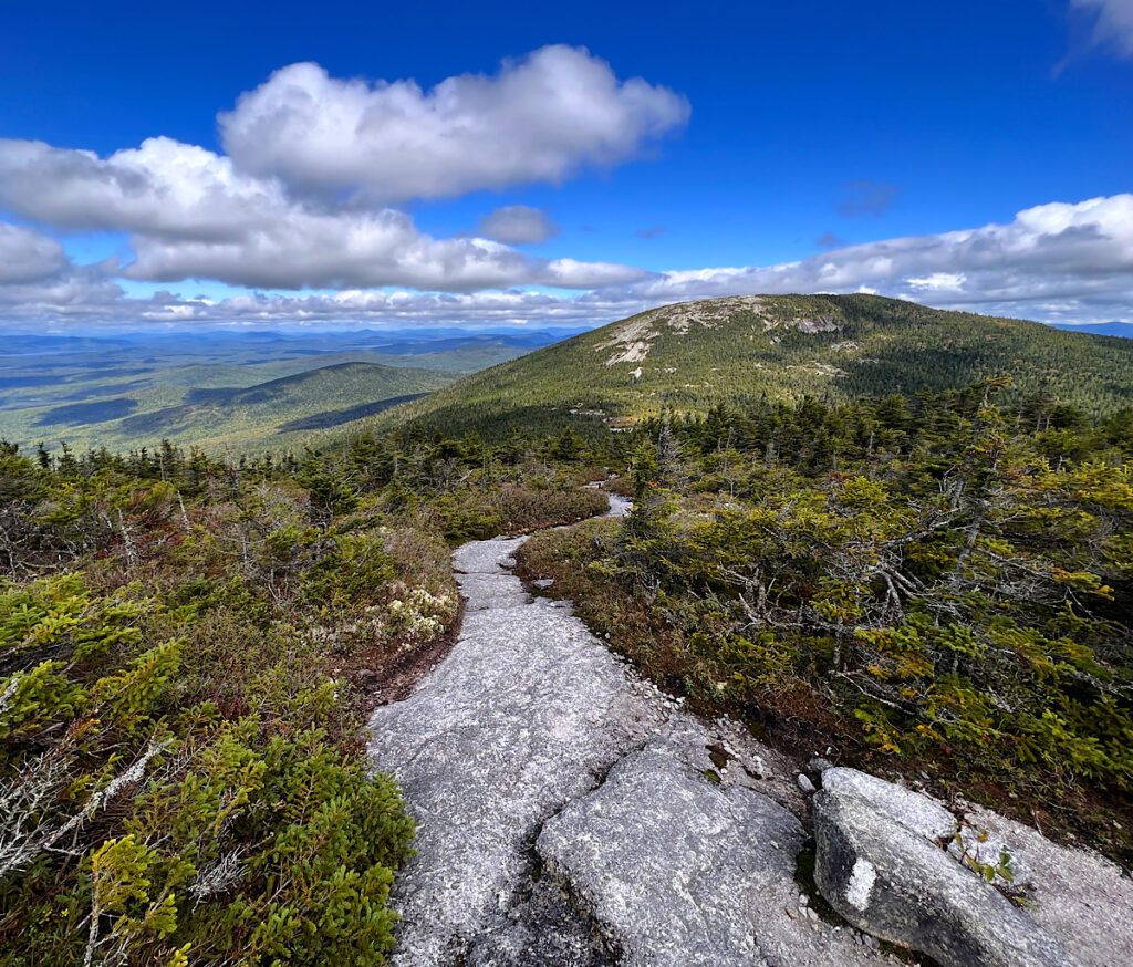
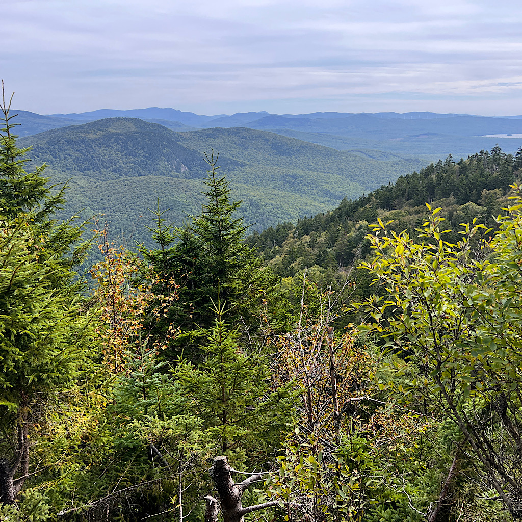
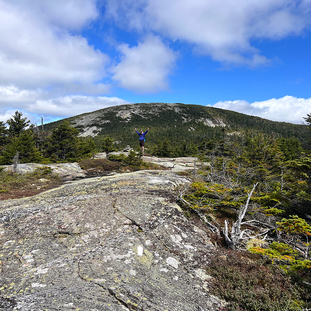
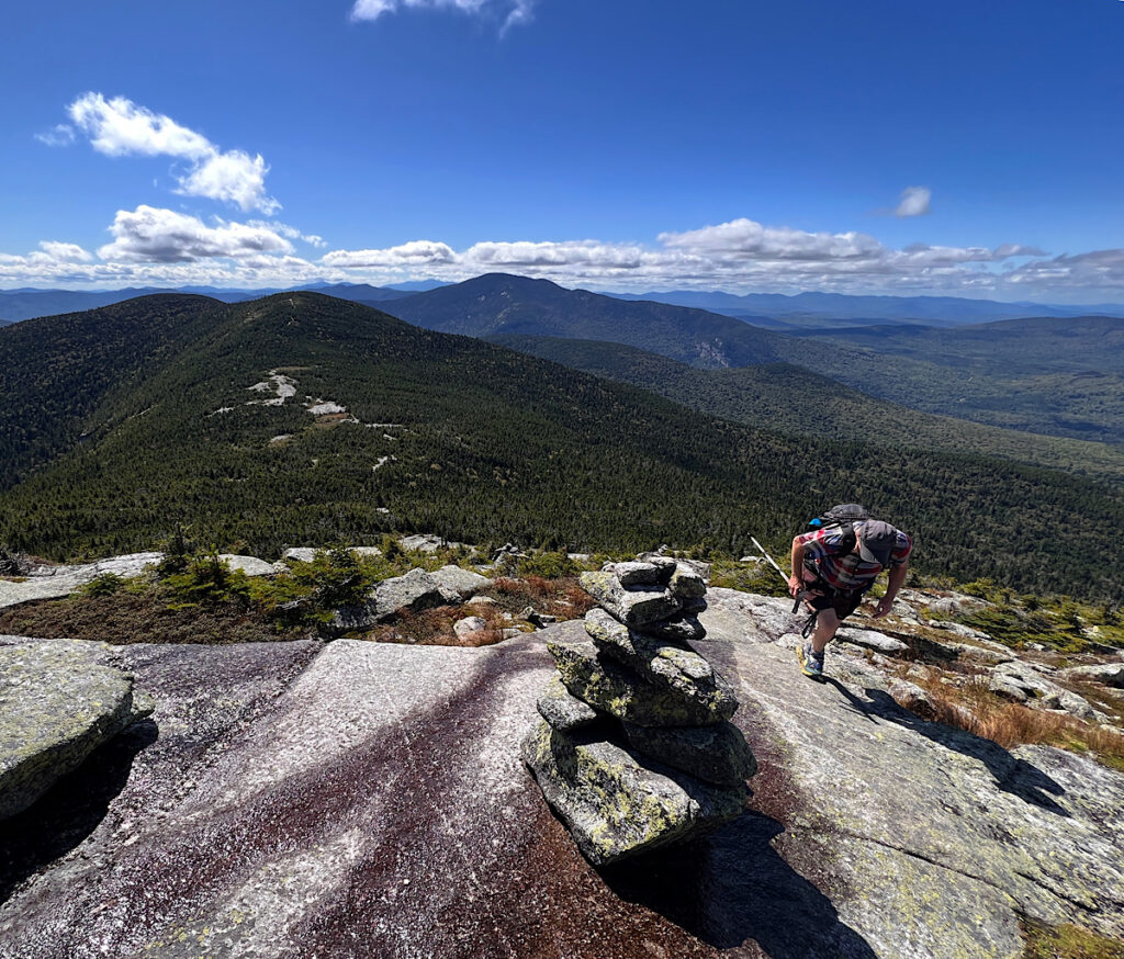
The sun is out, but it’s a flat and grayer light. I spy the massive hulk of Old Blue and Beamis through the trees, then more – and higher – mountains stretching into New Hampshire ahead.
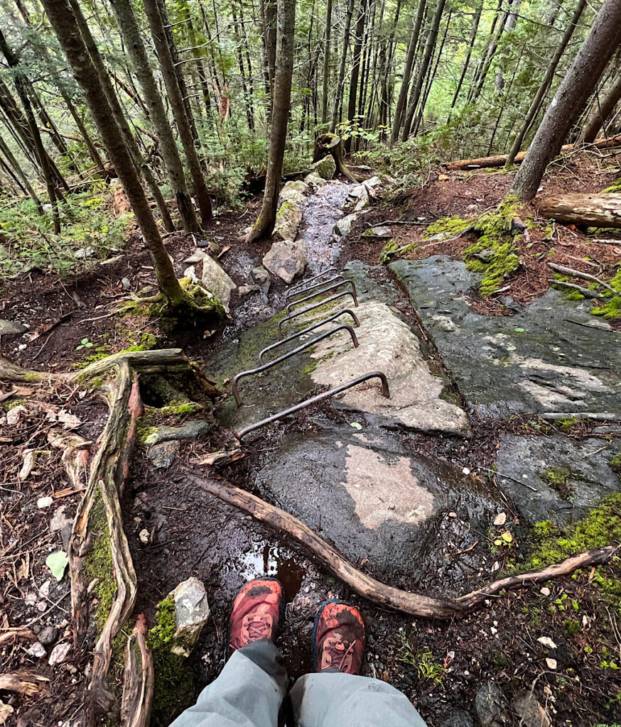
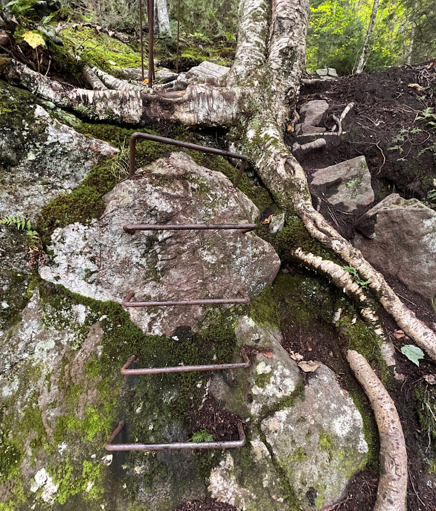
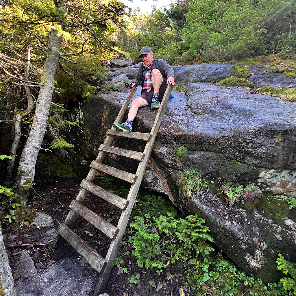
The wind makes the day extra special, cool and delicious. I crest the top and walk briefly on a ridge before heading straight down. Two hikers come up and one tells me ladders are ahead on the steepest bits.
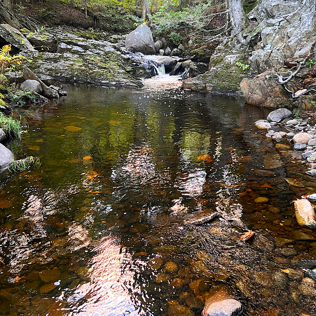
It’s not as soul-crushing as O’d imagined, just slow and careful, Sawyer Brook loud and melodious calling me down into my next notch.
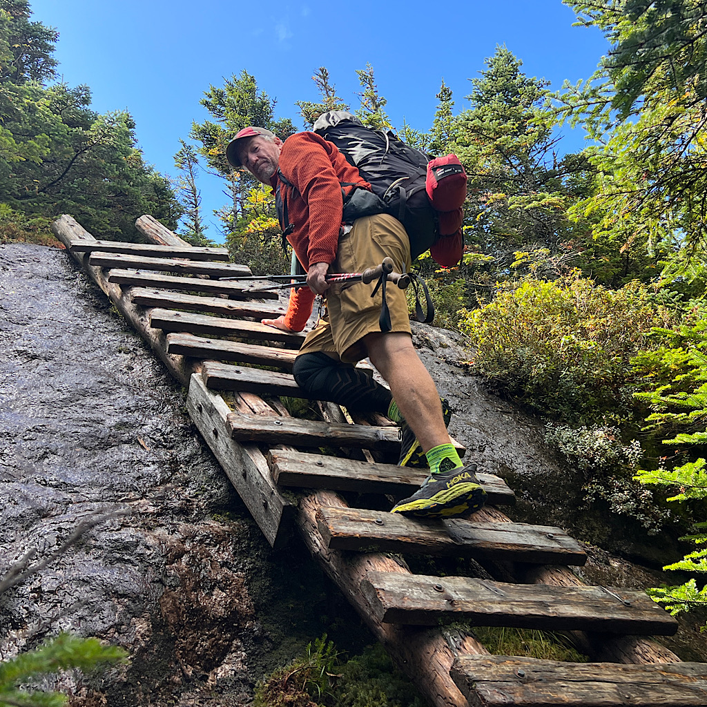
The ladders appear – wooden just leaning on the cliff as well as metal drilled in. Let’s not have this be the day they fail, shall we.
I toss my sticks to use both hands and carefully turn around for the descent. Not too bad at all. I slipped a few days ago and fell on one stick and it’s slightly bent. I hope I can adjust it for my tent.
I reach the brook and this time just walk through the ankle-high water. Keeping dry has its advantages as far as less rubbing for blisters, but flat and sure footing makes me feel safer.
Wyman Mountain looms above, huge with a rock face. I feel s bit of panic at the sheer girth I need to ascend, but am familiar now with the challenge.
It’s work to get up, but the wind keeps it cool and sun streams through the shaking leaves. A waterfall rushes down a rock face then into a tight flume.
A husky hiker descends and greets me. “Working your way up?”
Why can’t I resist being snotty to inane questions? I guess the polite response would be huffing and grunting with a choked, yeah.
Instead I laugh and respond, “I’m going up?!?”
He is not amused.
The next hiker cheers on my moving south into the teeth of trail and the hardest parts still to come. He’s sanguine on the weather forecast which keeps changing every day.
So that’s another hard lesson of trail life: it’s almost impossible to plan far in advance. Even the weather people can’t predict with 100% accuracy what each day will bring until we’re right on top of it.
Hurricane Lee is heading for the Gulf of Maine and some panic while others shrug their shoulders. Rain? Wind? All of the above?
Just keep walking.
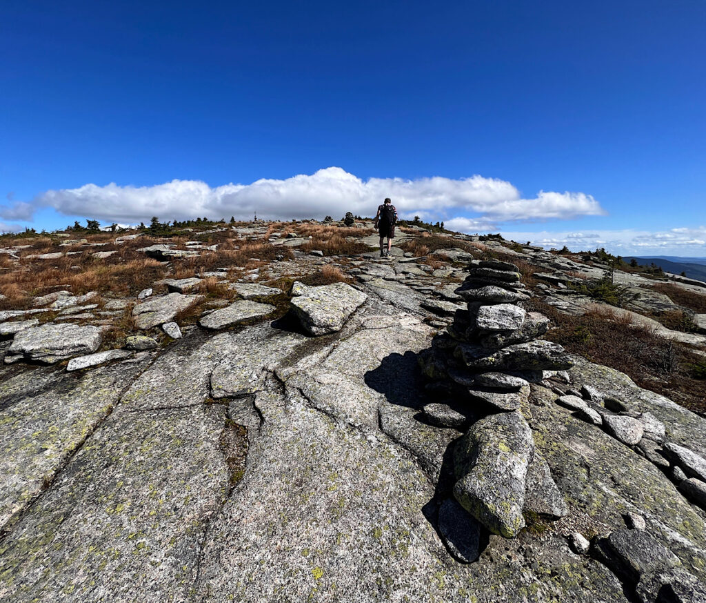
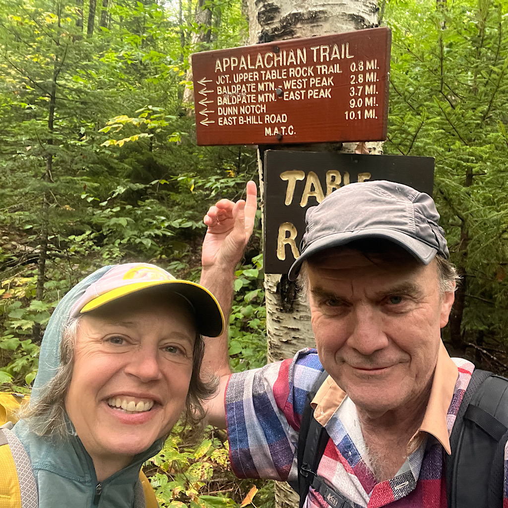
I reach a shelter and a short spur to the ‘Gunsight,’ a quartz ledge with spectacular views back to most of the mountains I crossed.
The PCT is mostly what are called ‘balcony walks,’ trail that sidles mountains with views all day. Here you settle for a wee peering through the trees before retreating into mud.
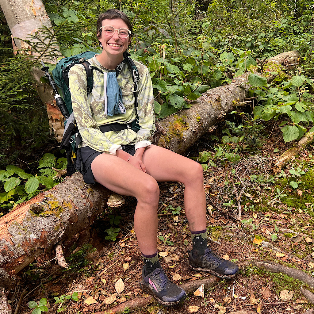
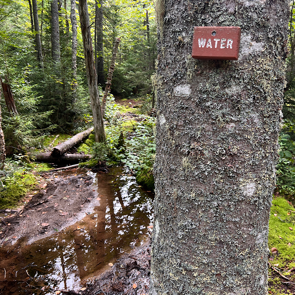
I stop for water and a sign that boasts water next to water. A lovely young hiker who calls herself Slug sits with me sharing her story in a soft southern accent.
I fear what’s ahead especially the “hardest mile on the AT” at Mahoosuc Notch, a jungle gym of talus to squeeze through that can take many hours.
She tells me she did it in rain and dark. Good lord! Her best advice is to decide to go slow and then it’s fun.
Slug gives me her number if I plan to keep walking in Virginia then takes off and I slowly do the same in the opposite direction.
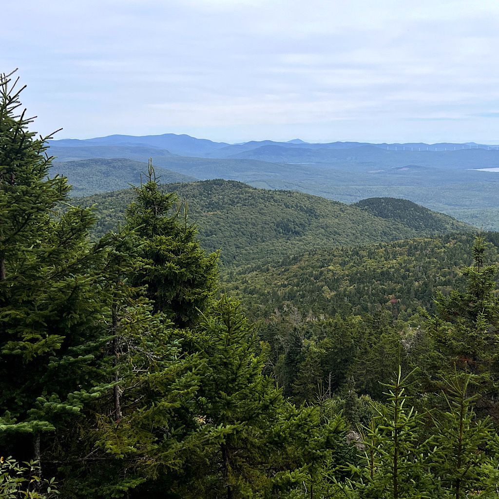
It’s another pull up through mud to the mountain with a view towards the White Mountains. They’re less white and more a raging sea of green waves disappearing to a blue horizon.
I’m humbled.
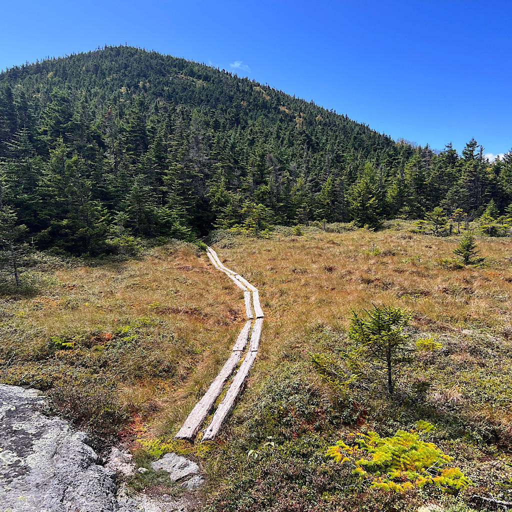
Now, it’s forest all the way down, with a few ups to keep me on my toes. Mile after mile after mile. Finally a lovely pond where a moose famously appears daily, though at dusk so empty now.
It’s one more drop on rock right before the road where Kevin awaits me with a local orange soda and a stunning drive to the lovely ski town of Bethel where I’ll hunker down for the hurricane.
Such hard work for my wee views. Such humbling country for my view of myself. Soon, Maine will be only part of my dreams.
Day Two, Grafton Notch to East B Hill Road, 10 miles
Finally a day arrives boasting full sun.
When I finished the tough and terrifying descent off Old Blue, Malcolm awaited me at the road to take me to The Cabin.
With full sun for views, made the wonderful suggestion I slackpack the Baldpates in the gorgeous weather, another section of exposed granite on a long alpine walk.
And he wanted to come along.
We get a late start. I sleep poorly because the couch is designed for little people and I need to resort to setting up on the gritty floor.
Kitchen Sink, the cook, begins crashing around at 5 am but has to cook for so many of us, things get more and more backed up. Plus there’s shuttling and motivating tired, angsty hikers.
We finally get started and enter spectacular Grafton Notch with towering mountains, exposed rock at sharp angles.
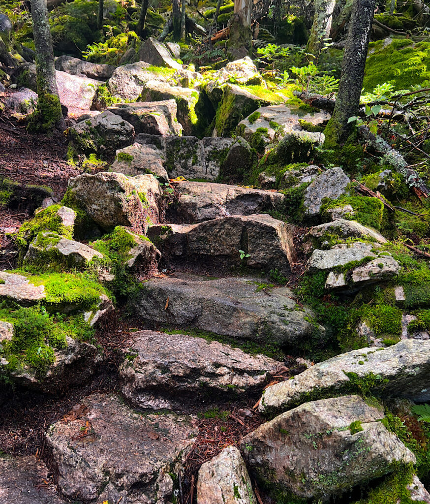
The morning is misty adding to the tension and mystery, but within moments, the sun peeks out on perfectly built stairs. These boulder stairs must have been placed here some time ago because electric green moss covers them.
It’s magical in here and I must admit, sunshine gives a hobbit feel to the place.
It can be fun to have a companion to see this beauty with, but Malcolm takes long breaks at seemingly silly places, like the lean-to .2 miles off trail. I would have just powered to the top, but am feeling so giddy by the sunshine, I compromise.
Why power to the top? Because the views, when we finally get there, are astounding. This is what makes all that grueling forest walking worth it.
I hadn’t mentioned that we had flipped the direction of this trail, walking north so as to not only reach the exposed section sooner, but to experience it in the most spectacular fashion.
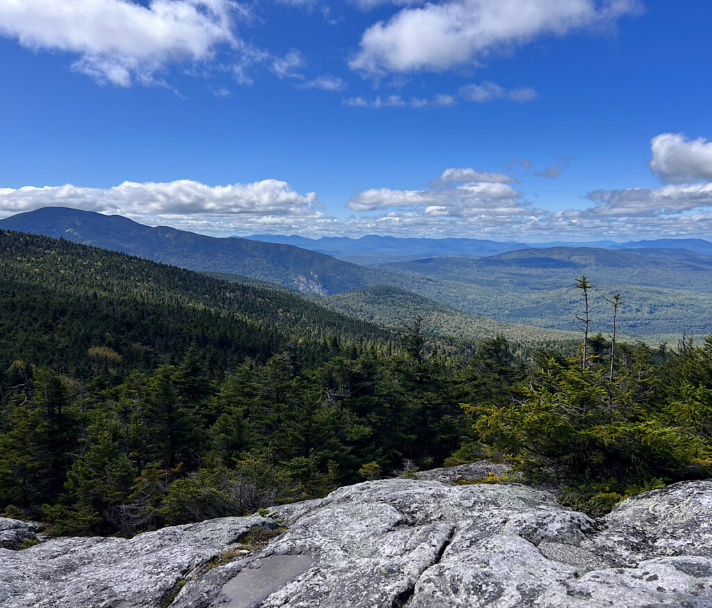
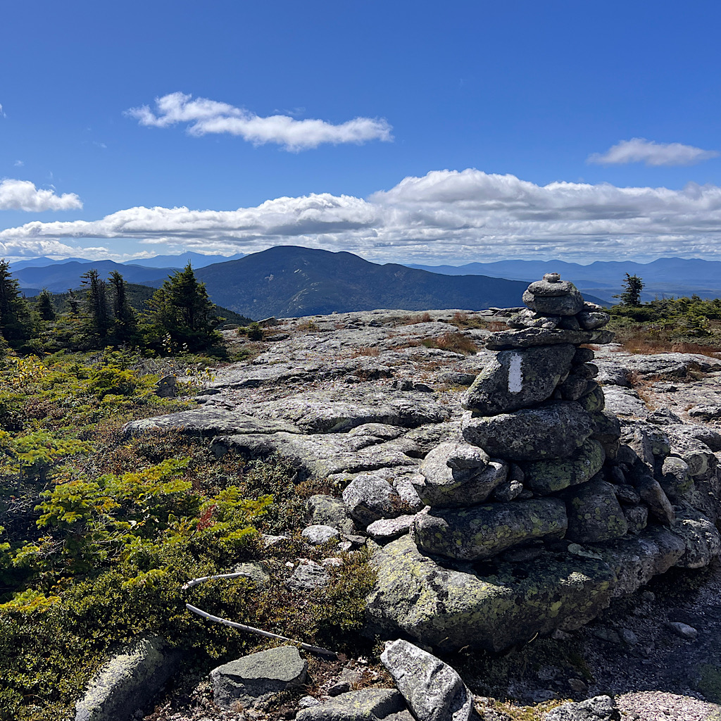
Baldpate West Peak is slightly lower and provides a perch to take in the larger East Peak. Each is gently rounded like smooth white domes. Perfectly puffed-up clouds reach in rows towards a bluebird horizon making dark blue shadows on huge mountains that surround us on all sides.
Malcolm informs me he wants to take a nap at the next peak. Mmmkay. We take many pictures and tumble our way forward. What a contrast to the cold white-out of Saddleback several days ago – or Beamis and Old Blue.
Golly, no wonder this trail is such a challenge! The weather makes what’s already an endurance test that much more difficult.
Here and now I squeal with delight at not just the astounding view but the feel of my feet on this grippy rock rollercoaster.
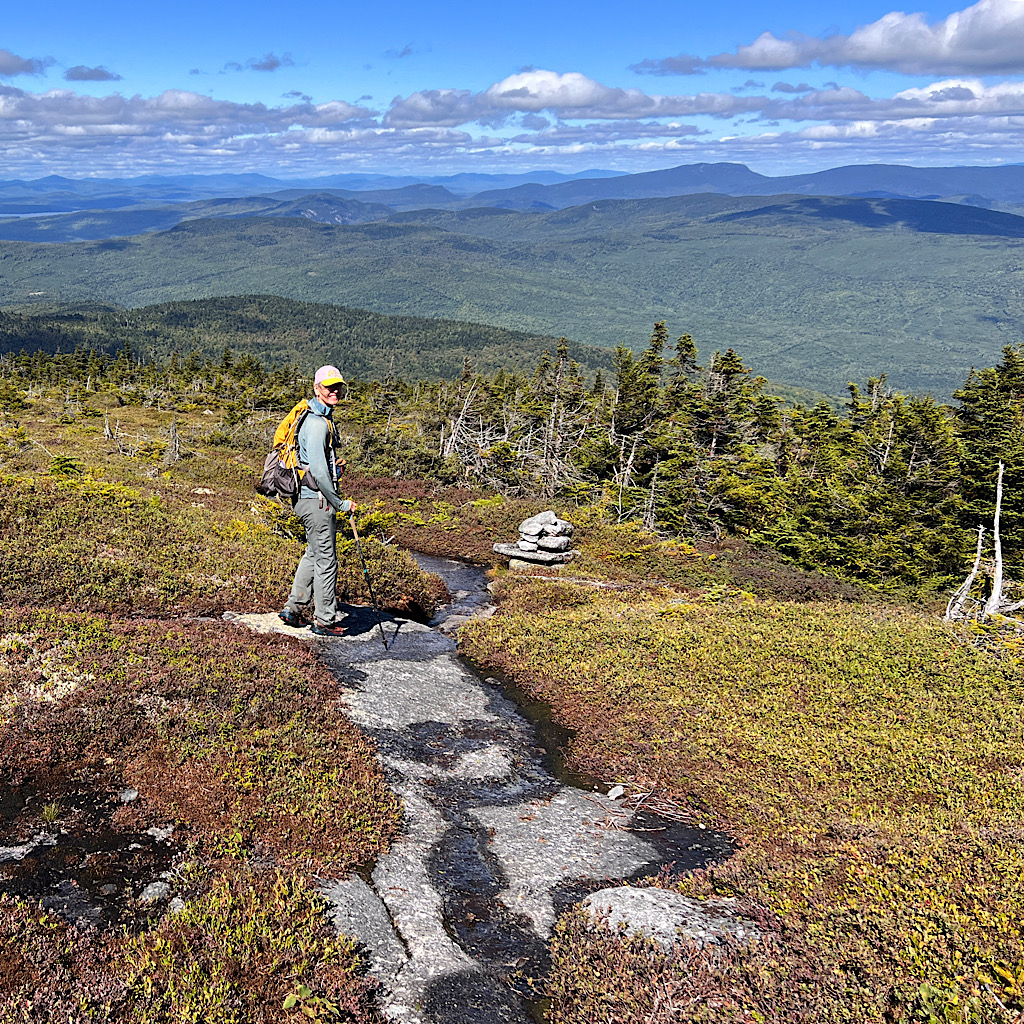
There’s a ladder at a big drop that takes us to the alpine bog. Bright red moss mixes with green and a boardwalk encourages us to avoid what appears to be just grass.
Malcolm presses his pole into the muck and it goes all the way to the handle before it hits bottom. Such a fragile area with life designed to live at extremes. Even in sunshine, though, the air begins to feel chilly.
The climb up to the East Peak is on rock slab. It’s quite steep and Malcolm loses a water-bottle which thankfully rolls to a stop near my feet. Giant rock cairns show the way and I remember the chilly crossing of Saddleback.
Oh, this day is glorious! Stops for pictures and ooing and ahing along the way. The determined hiker who has to ‘get there’ is gone for now and I simply revel in this spectacular moment.
How funny all our striving and hoping and needing and grasping is. And I am its worst culprit. When the rain falls and the view is obscured in mist, all I see is more of the same. I can’t imagine a faith steadfast enough to know deeply that sunny days will return.
The flipside, of course, is enjoying fully the moment as it’s presented. What a lark even tired and sore to jump at today’s chance. I suggested to the men they join me, but they had no interest.
I put on sunglasses for the first time in two weeks as I reach the top.
Vernal pools thick with microscopic life rest in bowls, red and blue algae creeping onto rock. We look north now towards the mountains I climbed as we take some snacks.
Oh dear, too much enjoyment and over six miles to the road at 1:00. I know from experience this will be a tough slog.
I underscore to Malcolm that I cannot walk this in the dark. I truly don’t feel capable of navigating. He’s been here before and says he’s not worried but I know it will be walking without a break.
What a way to take in joy! It’s glorious and hypnotizing but has to be left behind with only pictures and memories kept. We can’t stay in it forever.
We have a few more chances of views as we hit the scariest descent on smoothed slabs at sharp angles. Malcolm falls once but seems to have caught it before a disaster.
Water courses down the slabs but doesn’t make them any more slippery. It’s the mud and roots that can’t be trusted.
This is what makes progress slow and time tick by as maybe I move one mile in an hour. But we talk the whole way about Stephen King (Maine native) and scenes from movies.
The going begins to improve as we approach a shelter, but it’s a wild and long uphill out of the notch and back to deep mud. Is the price of entry worth it?
I’m tired and hungry and begin to move faster. Malcolm stops for a bit and gets behind me and I grumble we left so late in the morning.
Down and down, always watching my feet, the beauty of the top a dim memory now in a race to get out before dark.
Thoreau spoke of the darkness in Maine’s forests. Likely it’s all the pine that gives it a brooding and closed in feel. My eyes can’t see as well in the dim and I slip in mud, then crash on mossy rock.
Steady, now. Slow and steady.
I hear rapids and descend steeply to a set of falls, one squeezed into a tight rock slot. I leave my pack to signal to Malcolm I’m exploring the upper falls.
It’s another mile up and out and not yet dark. A car slows to check me out, the occupants concerned. I almost hitch but feel that would bd unkind and so I wait at the car.
Can Malcolm make it? Will there still be dinner?
I’m not there long when he appears. Slow, tired, and like me, somewhat chastised by the relentlessness of Maine wilderness.
We did it. Out before dark and on the glorious peaks during one of the most beautiful days of my journey.
I assume I’ll sleep on the floor again hungry this time, but instead, Honey anticipates out arrival and sets two places.
She’s 93 and has developed a hunchback but hustles about with pans of potatoes and squash, hamburgers and even brownies. I’m astounded.
But it’s late now and my body aches so time for bed. And this time, I get an actual bed next to my friends.
