
Day One, Hiker Hut to Bemis Mountain, 18 miles
So much rain – followed by clearing and then heavy rain. Nothing is more intense than rain pounding on a metal roof.
It’s relaxing at first, but then deafening. And as the rain lets up, the drops ping pong in high pitched tones like little hammers dropped from the heavens.
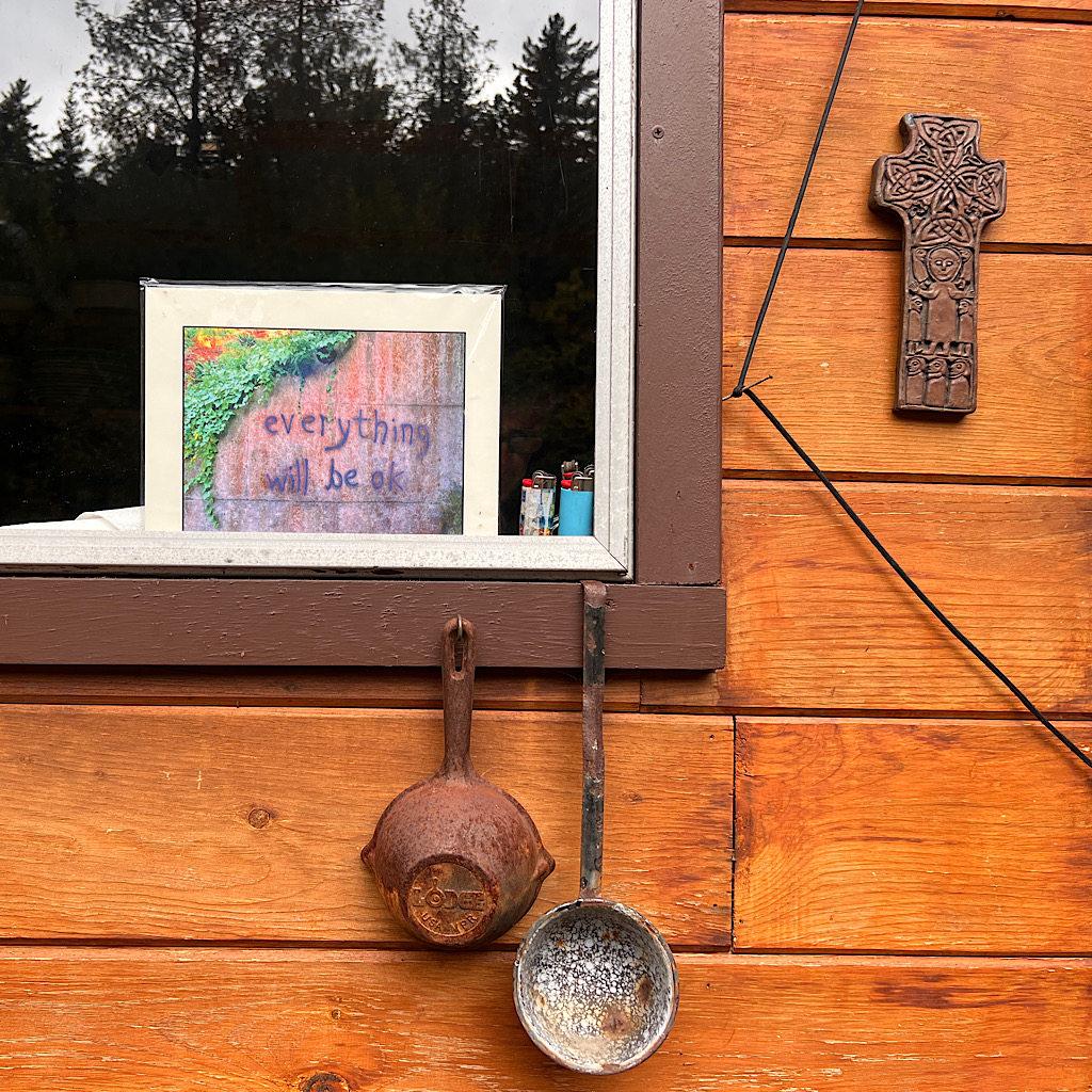
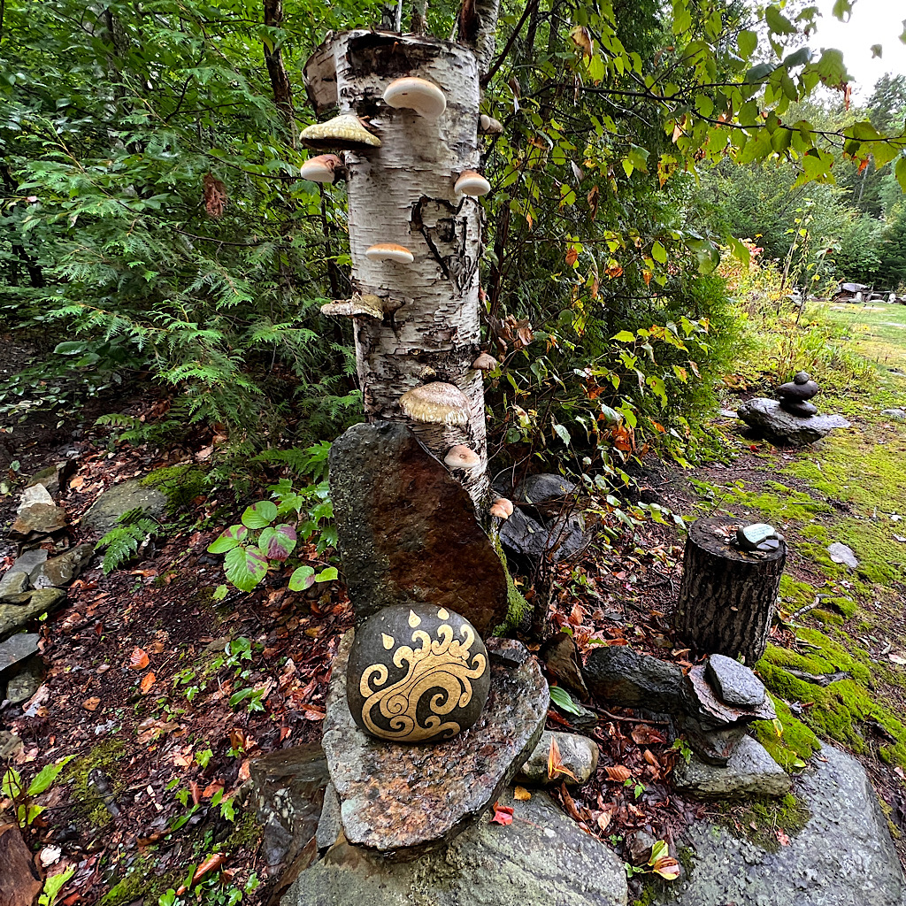
I do love my stay, though, at Hiker Hut. Flowers everywhere and thoughtfully placed painted stones and sayings.
Steve spends his summers here and winters in India. He dispenses wisdom and I need some after such a long day.
Don’t get me wrong, I love long days, but Maine is brutal – and the downs leave me a whimpering puddle of vulnerability.
Steve set up a chair and cooked up a bean burger for me, holding his spatula aloft as he tells me, “Breakdowns lead to breakthroughs.”
I’m not so much broken as beat up, but he goes on to ensure I know I’m walking in the hardest state on trail in the worst season in twenty years and five days of rain are ahead of me.
It scares me for sure until other hikers arrive and tell me the next 20 miles are the easiest in Maine, at least as compared to the nightmare I’ll hit after them, right before New Hampshire.
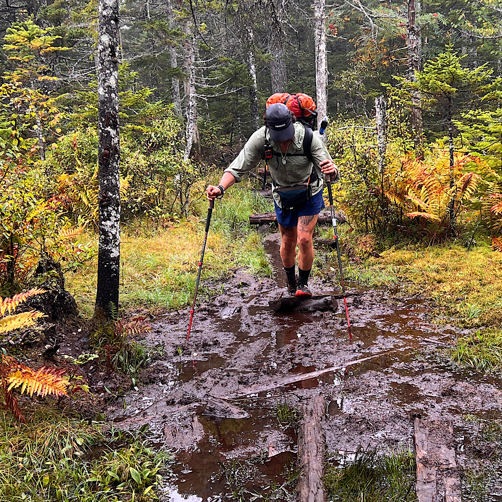
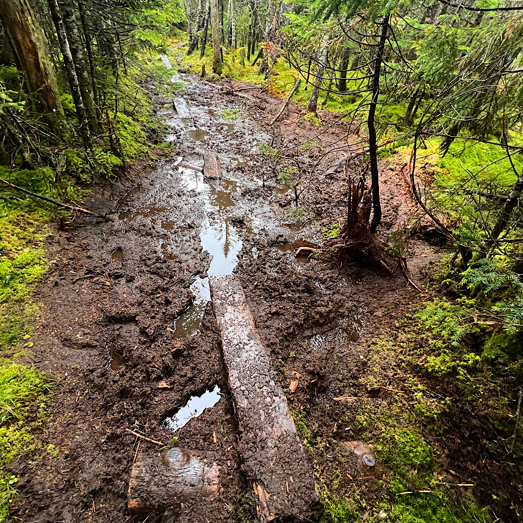
Except for the bogs.
Apparently the bogs have nearly fully consumed the boards set just so to allow hikers to cross deep mud safely. We’re talking mud up to the handle of your walking pole.
Some are just slick. Others slant into slick. Many are loose and threaten to seesaw you off if you take them too fast. And others rot just below the surface.
The hikers tell me they slow your pace while Steve ensures I’m aware he’s taken in hikers who sunk up to their eyeballs in muck or broke both wrists catching a fall.
Needless-to-say, I start this next section slowly and carefully, the rain steady but the air still warm.
I feel slightly panicky of what’s ahead, but surprise myself with my progress on what truly is straightforward terrain, at least for Maine.
There are rooty ups and downs and a few rock climbs using hands, but it truly is a deep dark Maine forest that rolls along.
I meet many hikers coming my way, some who laugh at the crappy weather and others wanting to know how much farther to the road.
It’s funny the contrast from “the hardest state in the worst year in a solid week of non-stop heavy rain” and the many hikers moving through taking it as it comes.
I pass beautiful swamps, moose habitat, just as a young man approaches wondering if I’d spotted any.
Just as the rain lets up, I come to a lake with campsites and two canoes for anyone’s use. I have a banana and think of my friends camping here last night with pounding rain. Maybe they got here early enough to paddle.
It’s dry now, so I take off my rain coat. A loon yodels in the distance and a pileated woodpecker laughs. There’s something magical in rain’s conclusion bringing out all the animals from their hiding places.
It’s not long before I reach beautiful Sabbath Day Pond, circled by perfect cones of Christmas trees. I had made this shelter my goal today to keep the mileage manageable, but it’s only 1:00 and the air is perfect for hiking.
I take a snack at the shelter with two NOBO’s who laugh at my jokes and are pleased with the dry conditions too. One came from the next shelter and urges me to go for it since the tread is easy by Maine standards. The out is I can always camp halfway if need be by a stream.
And just like that, my plans to go more slowly are dropped and I head on, eight more miles with a big climb.
Even though I’m eventually heading steeply down to a road, I crack straight up on rock to circle Long Lake.
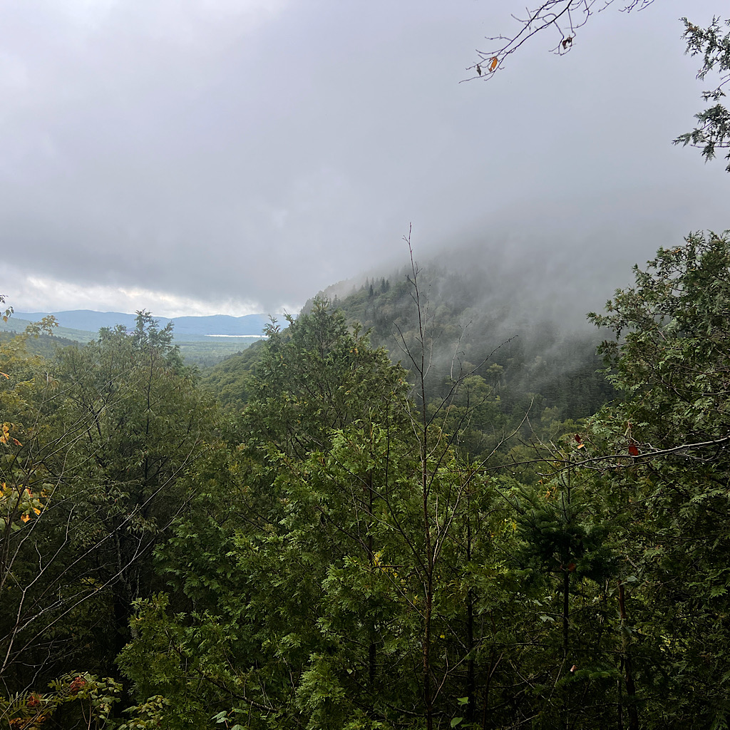
The terrain reminds me of the 100-mile wilderness, sidling a hill for a spectacular view which is a bit of a white out just now.
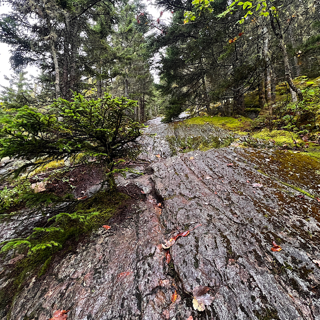
Then it’s down and down, never on anything too dangerous though I always watch my step in the wet. I reach a few more bog boards and eventually drop down and down to a road, major enough traffic is loud.
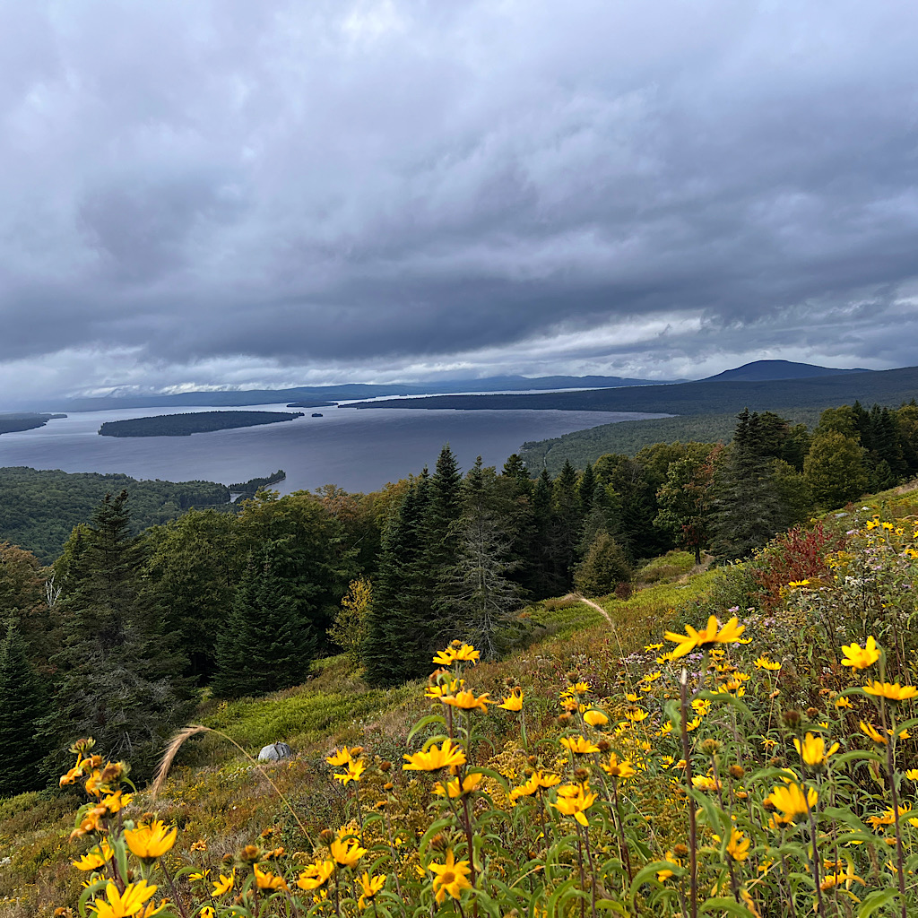
Just as I cross, the view clears to spectacular lower Richardson and Rangely Lakes. Islands about and mountains ring these phantom bodies of water stretching out to a vanishing point in mist.
I walk to the car pullout for the best look and am offered some water awhich I chug before the big climb.
But first, it’s steeply down to Bemis Stream, where a few inviting campsites await my tent. It’s 4:00 now and a big climb awaits. This time of year, the sky is dark by 7:00.
I keep moving.
I’m on steep rock requiring handholds through a thick carpet of moss. More hikers come down unbothered by the steepness or deep mist.
The rock changes to long ramps, still steep but easy to grip even wet. It’s a long way. A mile straight up on Maine rock is slow traveling. But I feel good and happy, laughing with a couple of girls who chat the whole way down and sport my same yellow backpack.
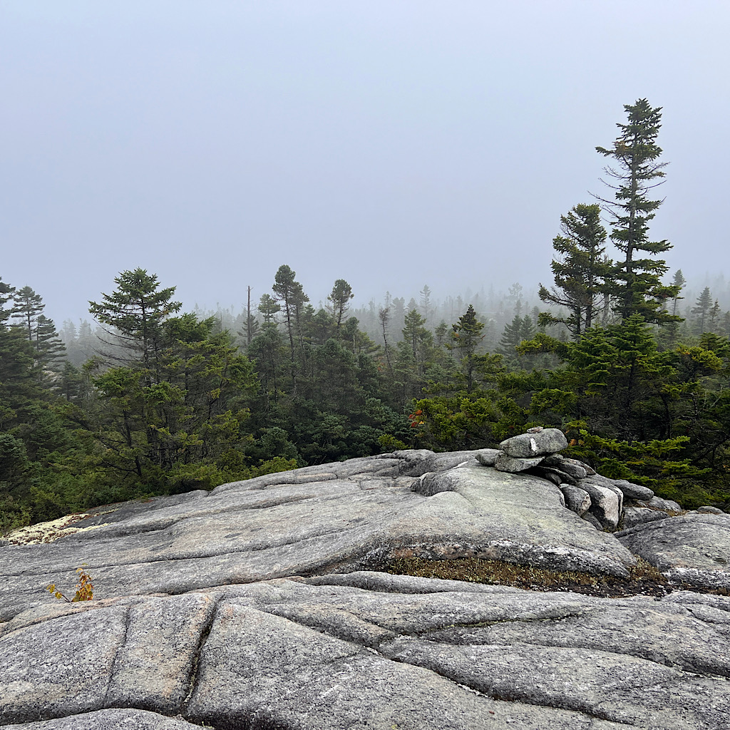
I meet a flatter section, some up and down, then more ramps to a wide open and mysterious summit. Stunted trees and plenty of mud are shrouded in mist but it’s lovely up here and has not begun to rain again.
I pass a sign for Bemis Second Mountain which on a clear day offers a view to the stairsteps of Saddleback Mountain.
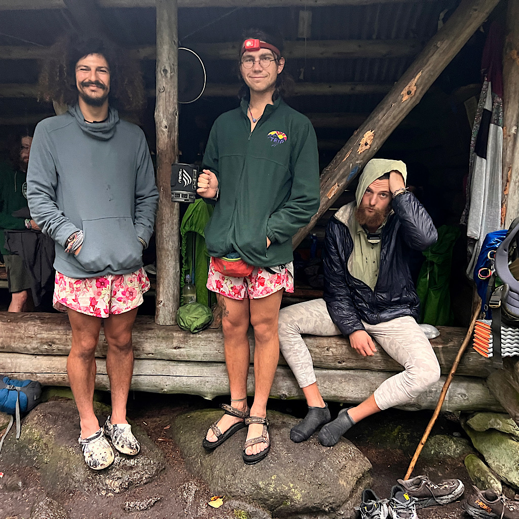
Then I dive back into trees and eventually find the shelter. The boys are surprised to see me – I knew they would be since I walked a big day. But it felt right and there’s not much time to filter water and make dinner.
Many more hikers show up – lovely, polite ones and a one loud entitled ass. Fortunately he spokes his dope with his hammocking pals and sleeps at the other end of the shelter.
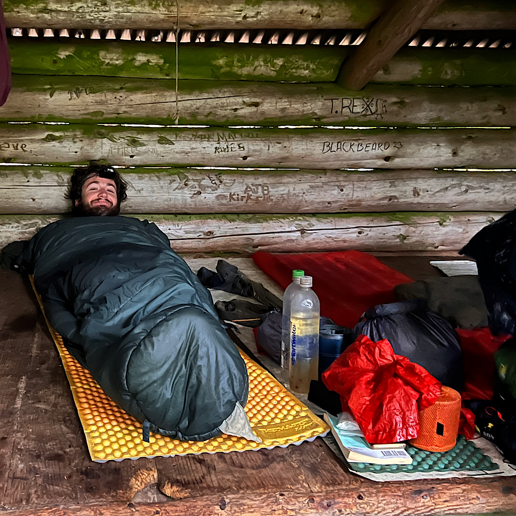
I would tent tonight but the rain will start again in earnest later and I like being dry and warm in here.
Funny, it’s been so long since I crowded in like sardines laying side-by-side on wooden planks, our feet all facing towards the open side and our smelly packs and clothes hanging from the rafters.
I got an end spot so hopefully feel a little privacy. Old jackass the loud hiker is still blaring his voice over the gentle quietness of the stream.
Sadly, it’s an earplugs night for Blissful.
Day Two, Beamis Mountain to East Andover, 8 miles
It was a full lean-to and hardly rained, but I enjoyed being snuggled in with the young men.
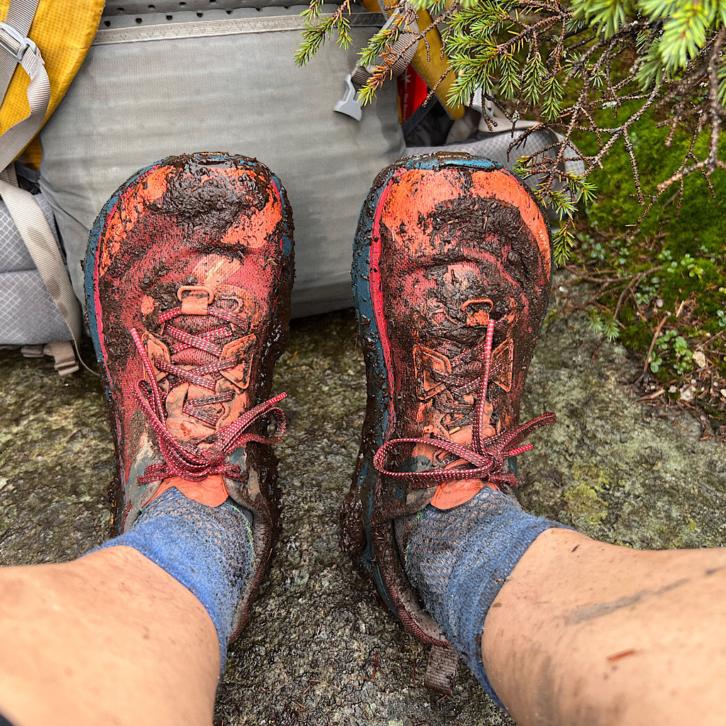
The man next to me had a horrible time the night before in a bivy bag. Nothing really ever gets dry here in not only rain but humidity.
When he arrived in pitch dark I offered him a free slot and he said, “I love you!” If I so much as brushed up against his bag I received a bit of wet, smelly slime.
Everyone stirs at first light but I’m the first to the mouldering privy. It’s warm and dry enough, just a mist cloud enveloping us.
I set off heading straight up for a few miles to Beamis Mountain. The trail still feels ‘cruisey’ even if I’m out of breath. For a small moment, I feel as if I’m in the Sierras walking on pine needles then exposed slabs of rock.
I’m not falling in love with the AT. It’s a tremendous amount of work for few and far between views. Of course that’s not completely fair since this awful weather has made some of the most sensational views non-existent.
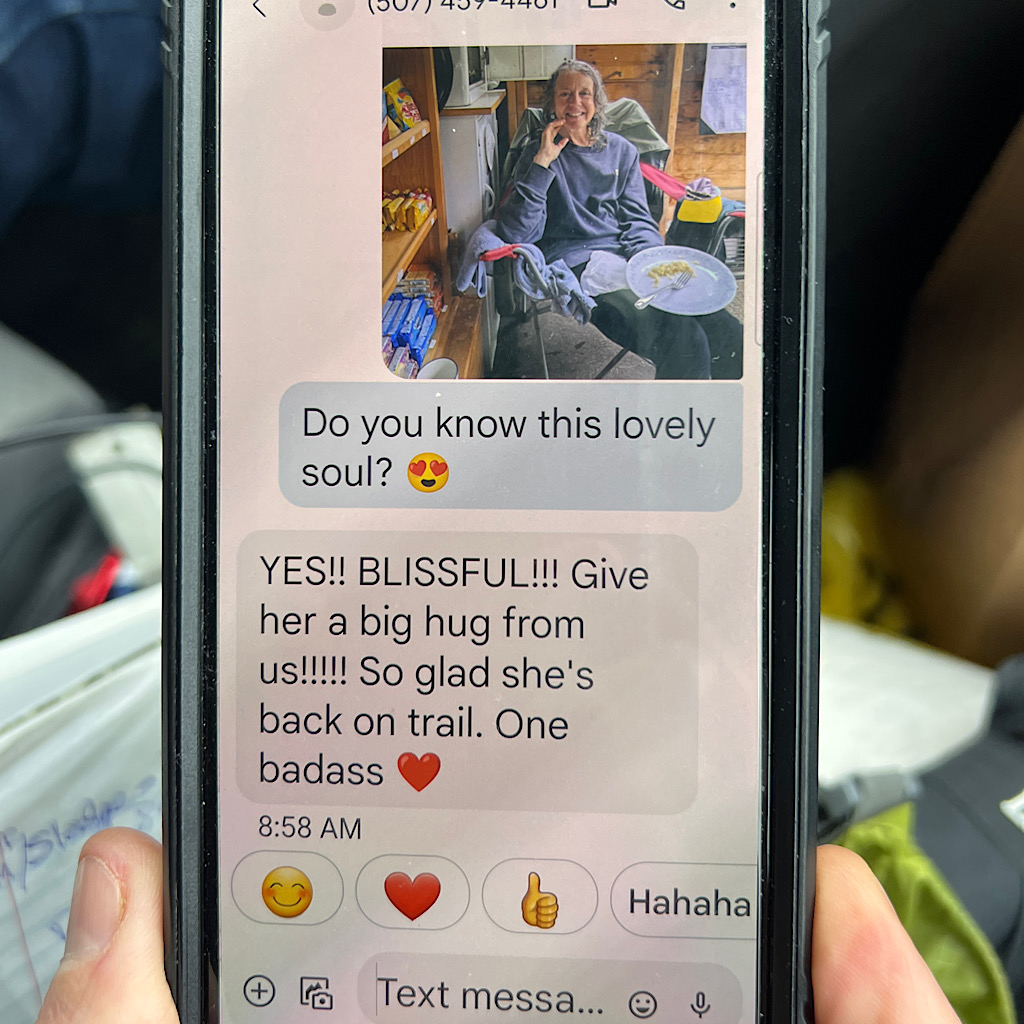
From the top I call “Honey.” She’s the 93-year-old owner of The Cabin in East Andover and a legend on trail. I tell her I moved faster and ask to stay the night rather than tomorrow.
She laughs that the rain has brought everyone inside but she’ll give me her couch, just call from the final mountain.
The rain has been horrendous flooding rivers and closing the trail in Vermont for a few weeks. Now, a hurricane is working its way up the Atlantic seaboard.
Of course it is.
Within moments, the trail gets hard. Really hard. It’s not anything I haven’t experienced yet, but as though all things have been joined in a potluck of hiker hell.
Steep climbs on mossy and now sodden boulders, streams emptying off in picturesque cascades where I search for roots and sturdy branches to steady myself.
But this is not just an uphill push, which for me is easy. Oftentimes the trail heads steeply down and that just plays with my head, forcing me to begin chatting up the goddess to keep me protected.
I read something recently about prayer and how powerful it is even if the person praying is an unbeliever. It focuses the mind on what one needs and wraps it within gratitude and praise.
I feel strong and so fortunate to be back here, pushing myself on a trail the likes I have never walked. Nothing feels wrong with my body at all – and my chest strap fits even better!
Of course my body is older and my knees are not as spongy as they once were, hence prayers for safe passage. Though being safe is up to me taking my time and assuring good footing.
I slip only a few times, but my hands are gripping a tree or a handle-shaped root.
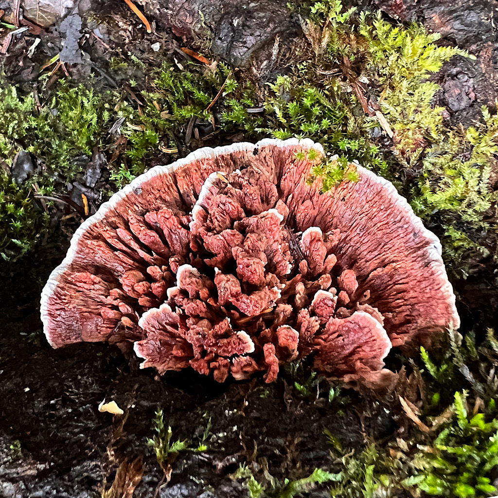
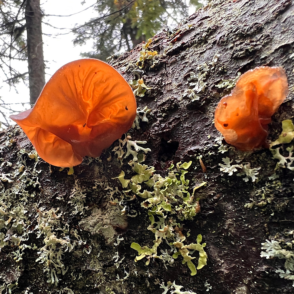
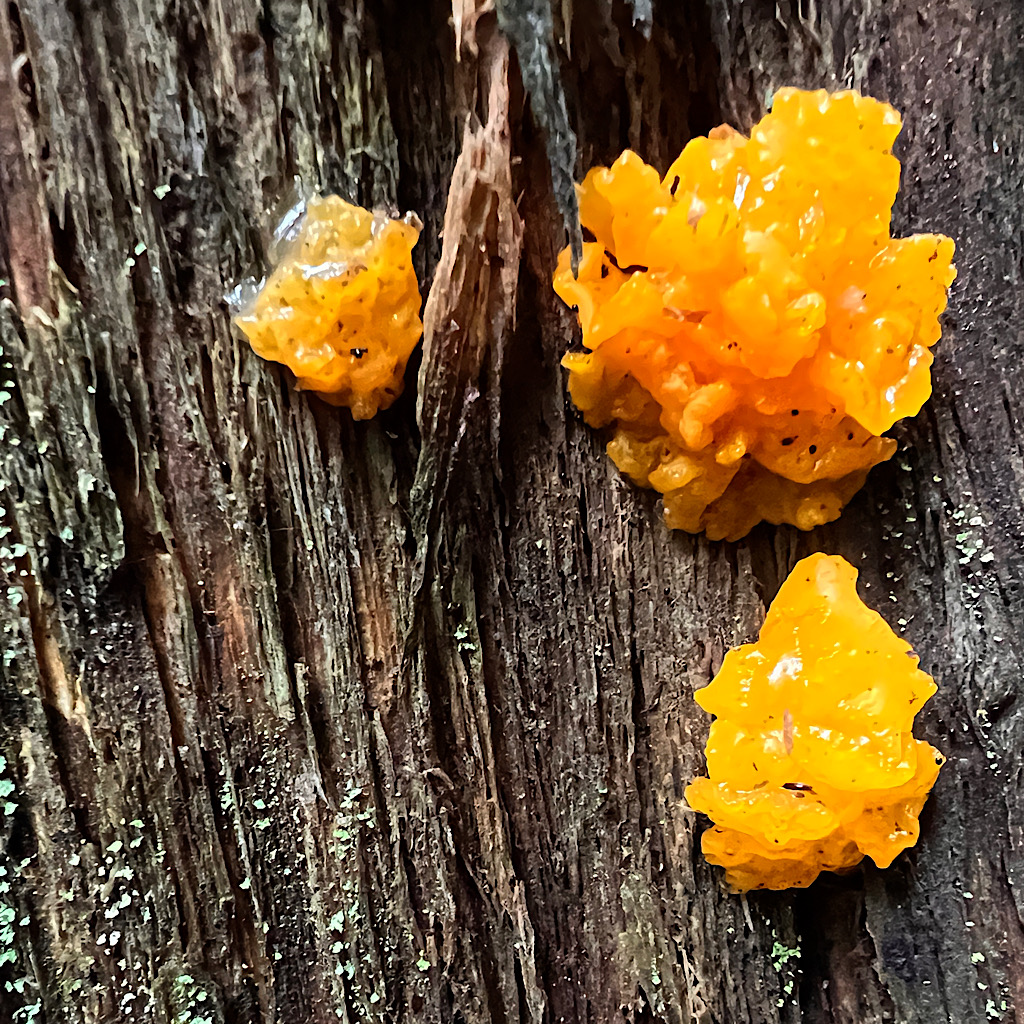
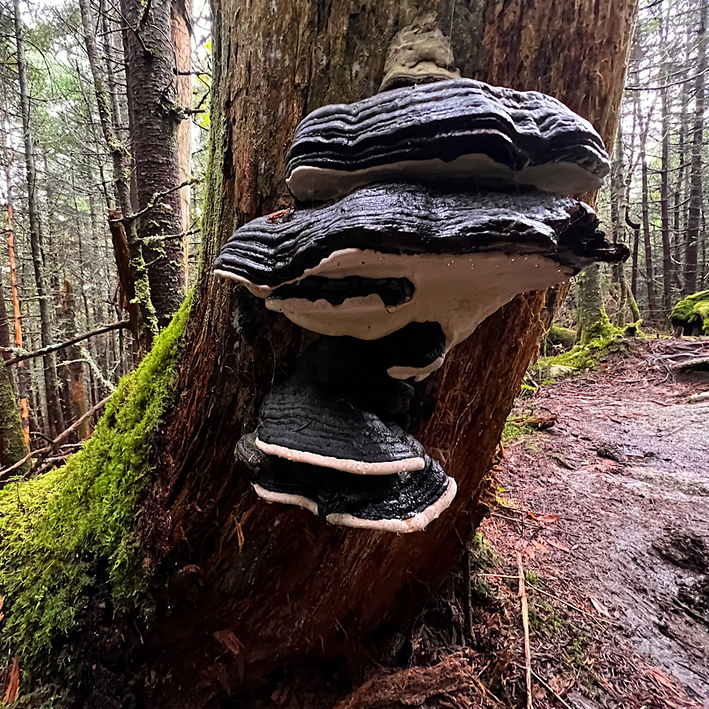
Fungus abounds, some bright white glowing in this gloom. Fluorescent yellow and orange too. I wonder what their color means besides adding interest to the monochrome of the day?
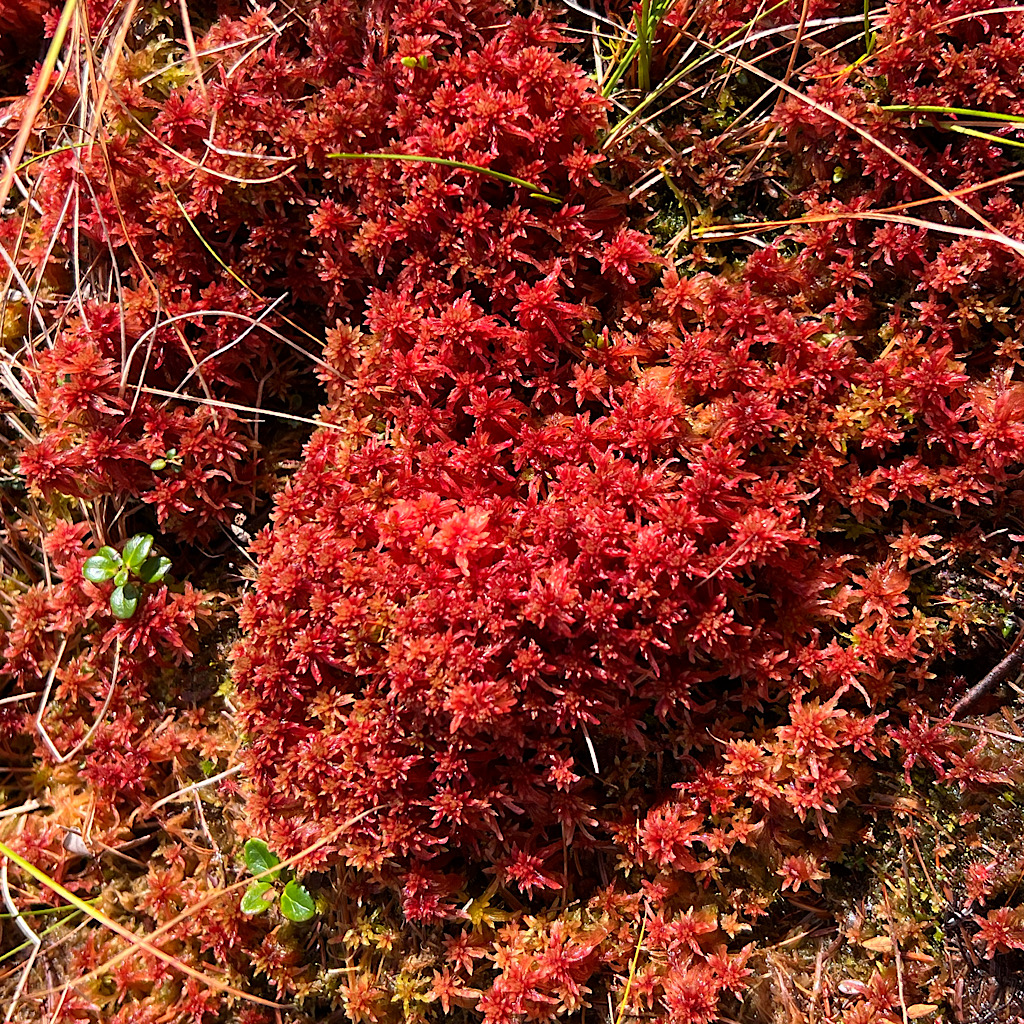
I was warned to watch out for the bog boards assuming all that happened below the mountains.
Never assume.
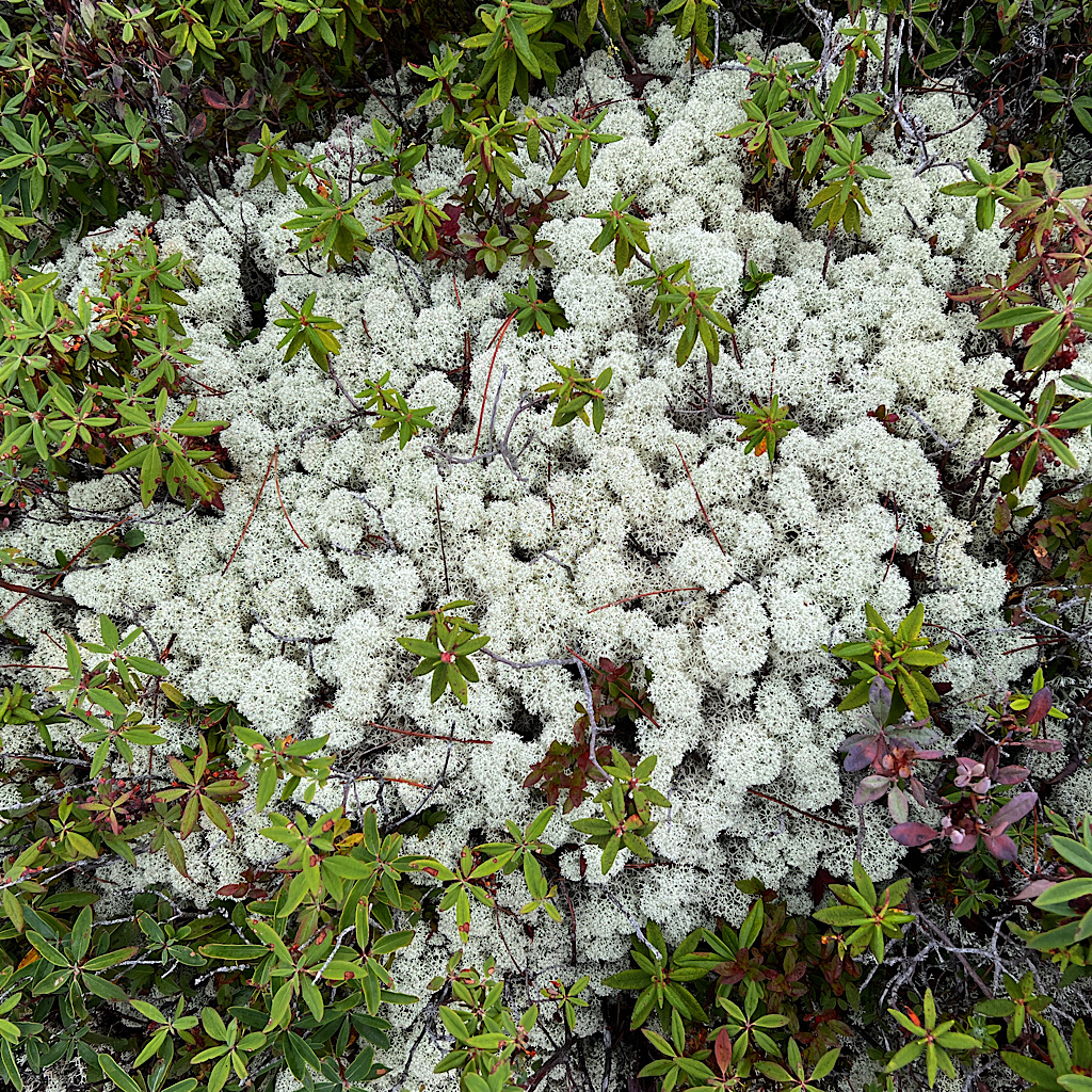
There are plenty of flat spots way up here in the clouds for bogs. The moss is green and a deep red reaching out several feet from the path.
I put in my walking stick and it sinks deep in ooze. I suppose a hiker could slosh through, but they might lose a shoe – or worse.
So I carefully step on the rotting boards or look for something solid like stones. It’s slow going but I’m not out of breath.
When I asked the boys about collecting water ahead, they looked at me funny. “The trail’s a stream right now!”
It’s sad how awful the rain has been. The last two years were drought, but a deluge doesn’t balance things, just damages everything – including hiker’s spirits.
Up and down the trail goes, passing ‘view points’ looking out to nothingness. But I still enjoy the rough walking, its challenge and having the time to process where I am in my life now.
I don’t have a precise return date though I hope to get through the hardest sections still ahead of me and check Maine off my list.
It’s not long before I begin to climb again and head to Old Blue. I’ll call for a pickup from the top and have a snack.
There’s something gratifying in a trail that just ascends without diving straight down just because it can – and to keep you on your toes. This one climbs to a clearing and just like that, I’m there.
It’s just a wide spot covered with wind-sculpted trees. Below the sign, I eat and it’s not long before it feels chilly. This is no place to hang around – or get injured.
And besides, it’s a long way down with a seriously steep finale. Right away, I hit slabs of rock with water running down it. The water itself isn’t making things slick, just the sharp angle.
I use trees, but if not available, I sit right in the water and slide down. I’m wet anyway so it makes no difference to get wetter – and it’s safer.
I meet a few people coming up and they look clean and happy. How is that possible?
It fascinates me that no one seems all that bothered by the weather. Time is of essence for them, though, since they’ll need to get to Katahdin before it snows and they close the trails.
Things level off a bit and I meet a woman in just a light poncho. She promises it’s cruisey until it’s not.
And she’s right. I head down on easy trail then shoot steeply back up using handholds. Has Maine never heard of switchbacks?
The trees change to deciduous, mostly maple, that will be fiery soon. It’s up and down when the rain returns, pouring heavily now.
I can hear Black Brook roaring far below and come to the edge of a sheer drop.
I’m here. This is where the real steepness starts. No longer do I have a river as trail, and some stones have been helpfully set as stairs, but the angle is so sharp, I truly am controlling a fall.
I often toss the sticks and carefully pick my way using both hands. Bit by bit I make progress, slipping in mud and wet roots but always having a firm grip.
Finally it’s so steep, a set of bars have been drilled into the bare rock. I guess out west where they used dynamite to produce some of the best-known trails is comparable. You work with what you have.
I toss my sticks below me, then carefully turn around to descend as if on a ladder. It’s exhilarating to make it in one piece.
The river is louder and I see the road below now walking on rock stairs to meet Malcolm who takes me to The Cabin, a hot shower, hot meal and the sofa to sleep on.
My friends are waiting and I’m happy to be inside as the rain starts bucketing.
Is this trail worth the beating my body is taking? Acuna, who’s already walked the AT tells me he actually hates it and has only returned to see if maybe hiking the opposite direction (south) he’ll appreciate it better.
At any rate, I’m seeing first hand what all the fuss is all about.
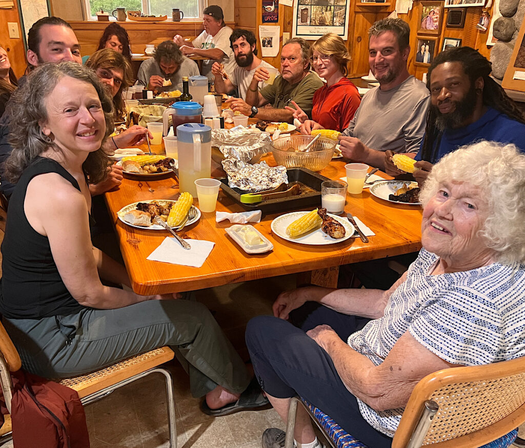
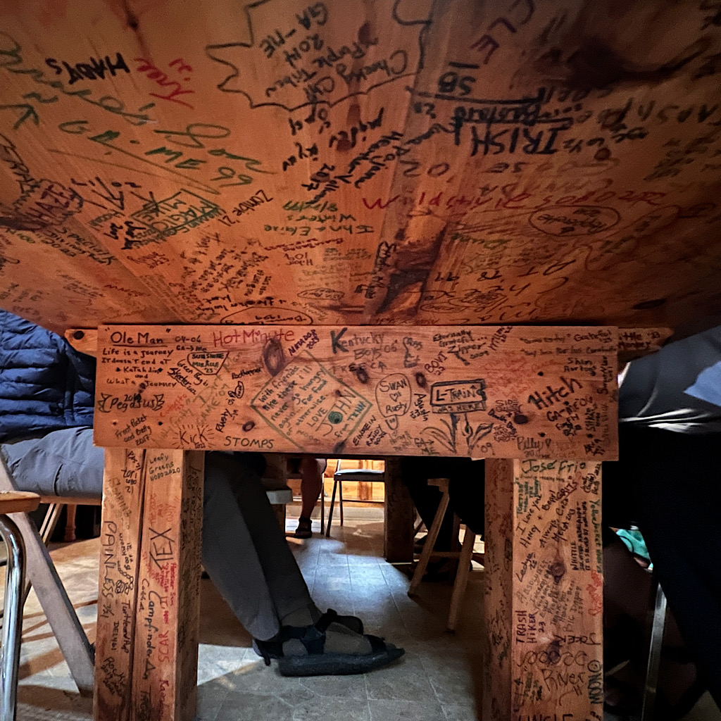
The legendary Honey sits down with us for dinner at a long table made by hikers from wood on her property. We’re all handed sharpies to sign underneath along with luminaries like Earl Shaffer (first thru-hiker) and Nimblewill Nomad (oldest thru hiker)
It’s hard to imagine that tomorrow calls for sunny skies. I plan to slackpack a high, beautiful section then return here.
Let’s see if they got the forecast correct.
